Quantcast
Channel: The Ranty Highwayman
Viewing all 512 articles
Browse latest View live

Because Buses Cause Congestion*

$
0
0

(*no they don't) First, a massive Hat Tip to Alistair Coleman who runs the angry people in local newspapers blog where he trawls the local newspaper websites for the big stories of the day which are making local people very angry.

I must admit, that this website appeals to me, as working for an organisation which is often on the receiving end of local "journalism" where (in common with many local rags) we are presented with an issue that some local people don't like and then through the written form of talking heads, various people give opinions and that is it. No facts, no background and so much digital fish'n'chips wrapping. Yes, I am indulging in armchair-punditry again, but there is more to this story than meets the eye.

Station Road, Didcot. Image from Google Streetview.
There are some excellent local newspapers which undertake extensive extensive investigative journalism, but it appears that a story in a recent Oxford Mail was of the former variety. The issue is about plans for a bus route along Station Road in Didcot which is linked to the redevelopment and extension of the Orchard Centre. According to John Cotton, Leader of South Oxfordshire District Council;

“It’s great news that Hammerson is now able to progress with the next phase of the Orchard Centre. People living in Didcot and the surrounding area want more shops and amenities in the town centre and I am confident that what Hammerson is proposing will add to the growing reputation of Didcot as a great place to live.”
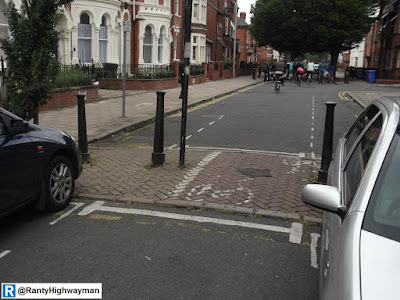
A bus (plus taxis and bicycle) only road is to be built on which
means shifting the buses (and taxis and bicycles) somewhere else.
Image from Google Streetview.
To enable the redevelopment to take place, an existing bus-only link road will be closed (to build on) and so (according to the article) the developers want to send up to 7 buses an hour along Station Road to access the shopping centre, much to the residents' disgust. They are concerned that the road is too narrow and that buses will end up going through the pedestrianised area at one end of the street. They also claim the buses will cause congestion.

The developers want to reroute the buses so they can avoid the congested Jubilee Way roundabout which sits to the west of Didcot Town Centre and presumably, the natural route to take when the link road through the extension of the shopping centre is to be built on. In other words (mine, from the armchair), the closure of the link road will force buses to use a roundabout which is currently stuffed and so the operators are not happy, so using Station Road will keep them happy.

Station Road ends at a modern, pedestrianised retail park.
Image from Google Streetview.
I admit that I was cynical (!) when I first read the article as after all, who wants buses rumbling past their homes? I chuckled at the residents for suggesting that buses cause congestion as that is clearly nonsense, but I thought I would dig deeper and I think there is a story in here that the paper simply didn't pick up on. 

From what I have read, it seems that the Orchard Centre is in fact Didcot's town centre which opened in 2005. The town is also a growth area and the expansion of the Orchard Centre is an aim of the local authority and it has a supplementary planning document to support this. Actually, I think the residents have a point. Their road does look too narrow to run two-way bus services along, although I think they might be as concerned about the potential to lose parking on the street.

The residents should be asking why the expansion is closing a purpose-built link road when buses could stop right in the shopping centre. They should be asking why their town centre is owned by a private developer. They should be asking why their town centre is essentially a retail park. They should also be asking South Oxfordshire District Council why their town centre is being made the main centre for the sub-region;

South Oxfordshire District Council intends that, by 2026, the town centre will have grown significantly to provide a vibrant, dynamic and living heart at the centre of the town -competing effectively in the sub-region as the principal town centre within the district.

No, it is not buses that cause congestion, it is the policies of the local authority which cause congestion and that is the real story here as it is up and down the country.

Sign Make It Better

$
0
0

I do occasionally tag traffic sign-related tweets as #signmakebetter and as we approach election season, it does make me smile that politicians seem to love them so much, despite pushing us to declutter our streets.

Yes, I have covered clutter before and I am not going to repeat myself, this is about the elections. In London, we are "only" voting for our MPs and actually, it has been a lot quieter than usual on the correspondence front and so I am hopeful that the current and potential MPs in my area had more important issues to campaign on than getting new signs put in!

Transport never features highly in elections at any level, unless it is a shiny big-ticket scheme like HS2 which will often divide opinion and so the stuff that gets people about on a daily basis is all but forgotten. This is sad, because it is the funding decisions, the national and local policies and indeed the views of elected people which make or break the small interventions which can often make all the difference or at least set the foundations for greater and more equitable things. Our transport policies have direct impacts on health, poverty, access to employment, pollution, personal safety; the list goes on - but then you all knew this anyway! 

No, as we move to the elections I will be voting for those who know that there are signs which can make things better such as those bearing the number "20", pictures of little green men and little green bicycles, the words "except cycles" and "bus stop", the "no through road sign" and lots and lots of little blue signs showing people safe and direct routes for walking and cycling where motorised traffic plays second fiddle.

Stealth Cameras

$
0
0

It seems that Labour was getting all hot under the collar about "stealth" speed cameras on the motorway network over the weekend, although it was old news recycled to have a pop at the Conservatives who had allowed all of these hidden cameras to be installed.

The outrage was reported by many newspapers, including the Daily Mail (naturally!) - if you would rather not click on the link, the thrust of the news report was related to the enforcement of variable speed limits on the motorway network;

  • 112,000 drivers given penalty notices in 12 months because of the cameras
  • Increase due to 'grey cameras' on motorways with variable speed limits
  • Critics say the measures are used to catch out drivers and make money
  • Numbers of drivers fined will rise as system is extended across the country
Well, let's have a look at those four points before I return to the politics. First, 112,000 drivers received fines because they were driving too fast and yes, if it wasn't for those pesky cameras keeping everyone safe they would have gotten away with it.

Yes, many of the cameras in use are grey, but as this image of a gantry on the M6 shows, the cameras sit behind the variable speed signs over each traffic lane and yellow cameras wouldn't be much help to drivers not wishing to pick up fines. (Images from Google Streetview). There are plenty other systems running, some with yellow cameras, some grey.

I guess that people getting fines and those who purport to be representing them might be called "critics", but as for catching out motorists, I simply cannot accept it. Presumably, people know what the speed limit is on the motorways and when the variable speed limit is in operation, there are some big signs on the gantries above the road and as one enters a variable limit section from a slip road; so how are people being "caught out"? Perhaps people feel ashamed and their representatives feel the group shame!

As for the numbers of people fined going up as "smart motorways" are rolled out, that may well be true, but as it becomes normal to stick to the speed limit, then I am certain that the numbers will drop and as a percentage of annual trips on the motorway, the numbers being fined are already supremely tiny to the point where this isn't really a story and me commenting is a waste of time!

Back to the politics. Labour issued a press release at the beginning of February where it quoted Michael Dughar MP, Shadow Transport Secretary;

This camera on a Transport for London road is new
and yellow!
“The previous Labour Government issued strict guidelines that speed cameras should be in accident blackspots and that they should be painted yellow. At the same time, we worked to deliver the best road safety record in the EU.

“Under this Conservative Government we have seen a proliferation of grey, hidden 'stealth’ cameras, and at the same time road safety has deteriorated.

“This Government’s belated and half hearted review is insufficient. We should have one universal standard whereby all fixed speed cameras are in accident blackspots and are painted yellow. Ministers should issue guidelines to the Highways Agency today to stop treating motorists like a cash cow.”

The first paragraph is true, although they were guidelines and so not following them never would have invalidated enforcement activity; although most camera operating authorities and partnerships did as they were told. The point about having the best road safety record in the EU is highly questionable, although in 2010, the Conservative/ Liberal Democrat coalition introduced swingeing cuts to road safety work, including the removal of revenue from camera fines being reinvested in safety camera partnerships.

The whole issue about treating motorists as cash cows was, is and always will be nonsense when it comes to law enforcement and to say otherwise is populist nonsense. At the simplistic level, one could say that if you stick to the speed limit, then you have nothing to fear and that is OK to some extent. The wider issue is that people should drive according to the conditions and for sure, automatic cameras cannot police this and this brings the gradual cuts to traffic policing in the UK into sharp relief.

If our politicians (all of them) were more serious about speeding, they would be calling for changes in the law to tighten up on penelities, stopping serial offenders from driving whilst banned and ending the nonsense that allows people to carry on driving with more than 12 points. Of course, this is all about motorways and I think far more is needed in enforcing speed limits on local roads. Cameras will have their place, but they cannot be a substitute for roads policing.

If you want to find out the detail of how safety cameras (speed and red signal) have been funded and kicked around as a political football, then the House of Commons Library Standard Note 350 will be of interest.

A Trip To Traffex

$
0
0

I spent part of today at the Traffex 2015 trade fair, held Birmingham's NEC. The rest of the day was taken up with getting there and back (but that's not very interesting). Traffex 2015 closes tomorrow, so get you skates on if you want to go!

OK, I know what you are thinking, highway engineer goes to a trade fair and all we get is a post about bollards, well, there were some I cannot deny it (thanks Glasdon)! The event is held every two years and as I haven't been or a while I was looking forward to going. Actually, there was something I was really looking forward to see, but more on that later.

Traffex had the usual mix of exhibitors with an emphasis on traffic - designing and providing for (and remember, traffic includes pedestrians and those riding bikes too), but there were some contractors and that meant plenty of big bits of kit parked up for a look around.

An interesting area was set up with dimmed lights to show off kit which lights up such as traffic signs, zebra crossing beacons and the like which was a great idea, even though it was a little surreal. 

I have to mention bicycles of course and two stands caught my eye. First was Cycle-Works who supply all sorts of cycle parking arrangements (secure and open us), but they have an integrated bicycle pump and tool kit in a housing about the size of a bollard - one I will be following up for the day job. There was also Bikes-on-Buses who were there promoting cycle carriers on buses with a couple of case studies in the UK. There was a bit of bike-wash going on, but I won't bother writing about it.

For hi-viz enthusiasts (and I mean when being used on site, not for utility cycling!) Viz Reflectives were showing off clothing which as well as being bright for day use and retroreflective for night use, it also had photo-luminescent stripes which "charge" in UV light giving added visibility in low light or darkness.

I had an interesting discussion with the rep from Charles Endirect about street lighting technology. In the age of austerity and street lighting being turned off or dimmed, it was nice to see some practical ideas and Charles Endirect has a system which detects traffic flow and adjusts lighting accordingly (aimed at motorways on the whole) - when the road is busy, the lighting brightens and vice versa - the system also has an override to provide more illumination if there is an incident. The street lighting can also "talk" to base stations on the network which allows remote monitoring of faults which reduces the need to send people out to physically check things.

There were lots and lots of traffic signals, detectors, speed cameras and more traffic signals which is to be expected and to be honest, much was a variation on a theme. What did stand out was the number of hire companies with temporary traffic signals available with pedestrian and cyclist stages built in - SRL had pretty much every layout on show!. This kit is so easily available, there is no longer an excuse to exclude people walking and riding bicycles when temporary signal control is needed.

Speaking of signals, to my personal highlight of the event and before I go on, remember where you read this first as I really hope this is a success. Neatebox is a small company run by Gavin and Steve which has (among other things) developed a smart phone app which uses bluetooth to control the pedestrian demand on signalised crossings.

It sounds like such a simple idea and it is in a way, but the challenge has been to get the industry and the traffic authorities interested - it does seem some big players are interested and in fact, a full trial site (on-street) is due to come forward in Edinburgh in the next few months (surely an excuse for me to venture north of the border).

Steve (l) and Gavin (r) with the app in action.
The app works by the user activating it as they start their journey and as they get within a pre-set distance of a crossing, the app will tell them that they are near. A touch of the screen presses the button on the crossing for you and shows a red man. When the green man comes in, the app shows the same green man and you are away.

Why is this such a revolutionary idea? There are many people in our society who struggle with the push button on crossings. For example, someone using a wheelchair might find it awkward to get close to the push button or the ramp to the carriageway is steep and it is hard to get into the right position - the app allows the person to stop and wait where they feel happy. Gavin showed me a video of someone walking with her guide dog across a staggered pelican crossing (and, yes, I learned something today).

Green man on the puffin push button, green man on the app.
As the woman approached the crossing with her dog, she instructed him to sit while she found the push button. She holds her dog on her left and so pushes the button with her right hand. The green man came in and she started walking, but almost immediately, her dog stopped at the kerb (as they are trained) and so vital seconds of crossing time where lost.

On the island, the push button was on the woman's left which was no good for her when walking with her dog and so she crossed by putting her arm out and waiting for drivers to stop - pretty scary and hardly inclusive. The app would have mean the woman could have stopped with the dog without having to reach the push button. With a green showing on the app (with an audible signal) she could have crossed over the the centre and instructed the dog to keep going. On the island, the button in an unhelpful place would not have mattered. You might be interested in this video giving some more examples of who could benefit.

Tap the screen and press that button!
Of course, I had to see the cycling angle and I mused on the application with Gavin whereby toucan crossings would no longer be the reach-over-your-handle-bars-to-reach-the-button pain that they can be (I have to deal with one every day which gets me half off the bike). You could have your phone on your handlebars and activate the crossing from where you wish. Or how about, automatic demand as you reach the crossing!

This is a great application of technology and I sincerely wish Gavin and Steve well with this project. I look forward to Neatebox being a standard component in our crossings and those engineers and campaigners reading this, please spread the word. For me, this is another one of the little things which we can do which can help make our streets accessible for all and proves once again, we don't always need huge projects to make a difference to everyday journeys. Three cheers for Neatebox!


On The Level

$
0
0

This week's post is inspired by a tweet by Brenda Puech about the difficulties faced by wheelchair users in negotiating footways which have poorly arranged and steeply sloping vehicle crossings to private property.

Twitter is great at feeding me ideas for posts and in this case, I think Brenda has raised an excellent point which is (mostly) easy to deal with, so a big thank you her.

So, to the basics. We are dealing with "vehicle crossings" which is dealt with under S184 of the Highways Act 1980. It is a power that the local highway authority has where someone needs to (or already is) taking a mechanically propelled vehicle over a kerbed footway or verge. (don't worry, I am not going to describe the detail of S184!) I would add, that we can also be dealing with private roads meeting the highway and a vehicle crossing could even be the norm for side roads meeting other roads, the so-called continuous footway or "blended junction".

The provision of a vehicle crossings is a power rather than a duty and there is no automatic right for someone to have one installed. For example, if we have an accessible bus stop, putting a vehicle crossing through the middle of the waiting area will remove accessibility and so the highway authority has every right to decline a request for a vehicle crossing. It is quite useful to have a policy in place to help deal with applications though.

So, to the point. What makes a good vehicle crossing? In fact, what makes a good footway in the first place? For the detail, you can refer to "Designing for Walking" which is free to download guidance from the Chartered Institution of Highways & Transportation (CIHT); Section 6.3.1 covers vehicle crossings and Section 4 some more general matters on footway design. For this post, we are mainly interested in the crossfall of the footway and what happens with levels along the line of travel, as well as footway width.

The basic point of a vehicle crossing is to allow people to drive between the carriageway and private property and so most of the time, this involves dropping the kerb from a "full height" to a "dropped" kerb. There are lots of different kerbs out there, but in most situations we will have kerbs with a "face" (height about the carriageway surface) of around 100mm to 125mm (yes it varies). We will then have a pair of transition (ramped) kerbs which take us down to the dropped kerbs which will have a face of about 15mm to 25mm. The face on the dropped kerbs is useful as it helped visually impaired people know that they are at the edge of the footway (as well as "feeling" the slop to the dropped kerb).

In usual circumstances, footways will have a crossfall of around 1 in 50 (2%) from the back to the kerb. This is needed to make sure water drains off the footway into the carriageway as standing water would be an ice risk in the winter and not very nice to walk through at other times. If the footway is laid in asphalt, the skill of those installing the surfacing will be telling in terms of water still getting trapped if the surface isn't laid flat enough - I am starting to think we should machine-lay asphalt footways and strengthen them to enable machine lay (structural design of footways is a subject for another day).

When it comes to dropping the footway for the vehicle crossing, many people will just increase the gradient to cope with the lower kerb. For example, a 2m footway with a full-height kerb face of 125mm which drops to 25mm could go from a 1 in 50 crossfall to 1 in 14. For many people, this change in gradient is difficult to cope with and for everyone else, it is like trying to be a mountain goat!

Imagine if there are vehicle crossings like this for each house you pass, each going from a 1 in 50 to a 1 in 14 crossfall and back each time - how very tiring to walk along and of course a much greater problem for those using wheelchairs, pushing buggies and so on. The other thing with this arrangement is that at the rear of the footway, the level along the direction of travel stays the same, but at the kerb, there is also the slope down to the dropped kerb to think about. The stock ramp kerb is 914m long (3 feet) and the transition provided is 100mm, which gives slope of 1 in 9. When we consider the usual pedestrian dropped kerb gradient is 1 in 20 (1 in 12 maximum), then 1 in 9 is also significant. The narrower the footway, the greater the problem too.

So, how can we make things easier? CIHT recommend that a level "landing" of at least 1m is required. In practice, this means keeping the rear 1m of the footway at 1 in 50 and then only sloping the front part down. With our 2m footway example, this means that the front part of the footway (1m) would have a gradient of 1 in 8 which is steep for pedestrians to use, but no effort to drive over (at a suitable speed). 

The reason for the 1 metre platform is that it is seen as the minimum unobstructed width needed to walk along, use a wheelchair or push a buggy. This might be fine with the odd vehicle crossing, but where there are lots, then we quickly end up with an effective footway width of only one metre by default and it is no good if people want to walk side by side.

There are other options available to us. Where there are multiple vehicle accesses to property, it might be better to drop a complete length of footway with gentle slopes at each end (which will need thought with laying the kerbs right at each end - remember a transition kerb is a 1 in 9 gradient). It does mean the levels at the rear of the footway need to be looked at as these will need to be dropped too which can mean doing work on the "private" side to get it working right.

CIHT also suggest using one of my favourite kerbs, known as the quadrant kerb. To be honest, nobody on site calls it a quadrant, it is affectionately known as a "cheese" because of the passing resemblance to a lump of Edam! The kerbs are available in two stock sizes (the 455mm one being more robust) and is compatible with standard UK kerbs. It is possible to get much larger ones made in natural stone - I have used 1m radius ones to form dropped kerbs at pedestrian crossings in the past.

The quadrant kerb used in our 2m wide footway example gives another half a metre of usable footway and the other advantage is that people need to be really careful driving over them - moving slowly which is a good thing as far as I am concerned.

The quadrants are installed as in the diagram to the right and they allow most of the footway to stay at he same gradient. The area between the quadrants is then ramped down to the dropped kerb level. The use of quadrants is not always something people like because of the risk of someone tripping over them, but I would argue that people tend to walk in from the kerb because of traffic and a wider usable footway is the bigger concern.

There is a variation on using quadrants with a little slope and that is using special ramped kerb units. The photo to the left show a unit about 300mm wide which with the special transition kerb go to form the ramp wholly within the kerb line. The normal kerb in the photo onto has a kerb face of about 50mm and so the slope on the kerb is gentle for drivers to negotiate. This arrangement is often seen elsewhere in Europe, although kerb faces are also often lower than in the UK which makes the transitions easier - perhaps we should lower out standard kerb units? Of course, we don't have to lay kerbs with a 125mm kerb face, we can use standard units to lay them a little lower, but it is an issue which people don't seem to think about.

A nice way to accommodate vehicle crossings is by using a grass verge. The main part of the footway can be left with the gentle crossfall and the front of the vehicle crossing can be ramped within the line of the verge. The use of verges is also nice because we can plant trees and install lighting columns and signs without creating clutter for those walking.

I suppose for some people, the ultimate in providing level surfaces is the establishment of a shared space scheme. I will be blogging about the concept later this year, but it is worthy of a mention here. My caveat is that I only think the idea works in very specific circumstances of vehicle access and low speed (I mean walking pace), but that will be covered another day. 

The photo on the left is a little one-way street which is under construction at the moment. The reddish area is the "carriageway" and the grey area the "footway". I state in quotes because the whole thing is a level surface. While not a boundary to boundary treatment in the same materials, this is a form of shared space and its success will be known in time. From a vehicle crossing point of view, there were no levels to accommodate and so for the "footway" area is really flat and easy to use (this would be a similar case with access taken from a speed table, although a small kerb upstand would normally be used).

The entire area is built to carriageway standards and so the "footway" can be overrun. The important point here is that the parking is designed into the scheme so that anyone parked on the "carriageway" will block the street to vehicles and anyone parked on the "footway" is at risk of a parking ticket as this is a London site - time will tell on this (developer designed) site. 

Whatever type of vehicle crossing is used, it should be constructed to take vehicle loading. It doesn't necessarily need to be designed to take a 40 tonne lorry, but it should be substantial enough to take regular use by light vehicles. I don't think we construct our footways that well in the UK (at least outside city centres) and would advocate building them to a better structural standard anyway.

To get things really right I want to describe the tricky issue of "accommodation works". When I was a junior engineer doing mainly maintenance works, I was fortunate to work for a really good principal engineer who considered maintenance work as something rightly needing the same care and attention as new build. When it came to a footway reconstruction scheme, he was always eager to get the levels right to best serve pedestrian comfort and this has stayed with me over the years. 

Accommodation work is the practice of entering private property and (with agreement) adjusting levels. This means that footway levels can be gotten spot-on for maximum improvement those walking. So fanatical were we all about accommodation works, that around 10% of a footway renewal budget was given over to the work. The image from Google Streetview above is a footway scheme I did about 15 years ago. The "joined" on strip of concrete is actually on the private side of the highway boundary and allowed the rear of the footway to be laid level. In the most extreme case, we relaid about a third depth of someone's driveway to get the levels to work properly. Getting this right takes time and effort, but it is worth it.

And finally (hooray I hear you scream) I have to mention cycling. In thinking about situations where people need access over a cycle track, much of what I have written applies because we want to keep the riding conditions comfortable.

The photo on the left shows Old Shoreham Road in Hove which has a stepped cycle track for each direction; that is the cycle track is lower than the footway and the carriageway is lower than than the cycle track; with kerbs doing the stepping down.

What this has meant for those walking is the kerb height between the track and the footway is quite low and so the vehicle crossings don't need much ramping down to the track which gives good levels of comfort for walking. The cycle track kerb height is also low, so the creation of vehicle crossings over it are not obvious as one cycles along. A good example of cycling infrastructure assist those walking and cycling.

Beyond the Bicycle

$
0
0

This week (Wednesday 6th May) I attended a seminar on inclusive cycling which was being jointly held by the London branch of the Chartered Institution of Highways & Transportation (CIHT) and the London Cycling Campaign (LCC).

I don't know if these to groups have ever met like this before, but it was a cracking idea and I really hope it happens again. Of the 40 (my guess) or so people who attended I think the split was about 50/50 campaigners and engineers, although there were quite a few of us there who belong to both organisations!

Rachel Aldred shows us that we need to be designing for everyone
Perhaps it is a sign of change in London when a meeting like this; perhaps the silo mentality is gradually breaking down. I certainly hope so. Chair for the evening was fellow CIHT and LCC member, Philip Loy who introduced three speakers who I am sure many of you know (at least on Twitter!); Dr Rachel Aldred of the University of Westminster (yes another CIHT and LCC member), Isabelle Clement of Wheels for Wellbeing (self-confessed fair-weather hand-cyclist) and Phil Jones of Phil Jones Associates (another CIHT member, and as he spends so much time in London on a bicycle, I am hoping a potential LCC member!).

Now, I was there to learn and although I attempted a bit of live tweeting, I did get absorbed into the discussions and so this post I guess is a summary of the highlights or interesting points (for me at least).

Rachel Aldred's theme was essentially why inclusivity matters and how it should be central to good design (in its widest sense). Something which is designed to assist and enable specific people will also help the wider population. She went on to explain that cycling is a way to enable people move independently, even when walking might be difficult, and so we should be concentrating our efforts on designing for under represented groups as after all, we get the people cycling who we design for. 

The next good point made by Rachel was that the Equality Act 2010 gives local authorities additional duties, including the important "equality of opportunity" which extends to being a transport provider (i.e. highway authority). When put in cycling terms, it means that designs which are not usable by all will deny the opportunity of use to some, and so the "old" way of designing may arguably be indirectly discriminatory. My observation was that highway authorities need to up their game as a challenge under the Act is bound to happen. 

Isabelle Clement spoke next and started with a personal history on how she came to hand-cycling, starting in parks and then gradually moving up to using the roads, but as a way of getting from A to B; although she admitted that she was rather fair-weather! She did explain that she had been going through a steep learning curve on the technical side of things, but at least knew what a splay kerb was - nice!

The serious part of her talk was that "we" have been designing for people who can walk their bicycle, lift it up steps, cope with kerbs, can stop and stay on the saddle and so on - in essence a narrow group of people. She explained how traffic calming of various types presented significant disadvantages to many people such as those using tricycles and hand-cycles. Speed cushions, for example, were cited as a particular problem for cyclists on more than 2 wheels. She also suggested that we had forgotten about those using trailers, cargo bikes and we really need to be designing "beyond the bicycle" which is a great way to put it.

Phil Jones then spoke about some of the design standards and engineering which needs to go into inclusive cycling. He reiterated the narrow nature of the target cycle user so far which was telling given the front cover of the official government guidance in Local Transport Note 2/08 (see left). He said that regular cyclists are most likely to be male, white, in work and non-disabled.

He went on to say that LTN 2/08 does recognise children and disabled people, but it all gets rather vague and is out of date. In terms of the Equality Act, it is referenced in the new London Cycling Design Standards which also sets out a range of different types of bicycles which need to be designed for. Beyond that, he said that the Wales Active Travel Design Guidance has looked at inclusive cycling and on that aspect was ahead of the Dutch and the Danes!

At the discussion/ debate at the end of the session, there were some good points made and questions asked. Isabelle said "cycling cannot be survival of the fittest" which was a double-pointed issue in my mind in terms of how people often have to cope now, and how the conditions put so many people off.

A question was asked about what might happen after Boris if we had a less interested Mayor. It prompted comments about the Mayor perhaps not being that interested (half-jokingly), but the panel felt that despite a lack of National guidance, London seemed to be doing well at officer level within TfL which would give continuity as after all, politicians always come and go.

L-R; Philip Loy, Rachel Aldred, Phil Jones & Isabelle Clement
There was a point made about needing standards to take us beyond guidance as engineers want to be able to refer to numbers and parameters and in turn they would be pushed to do better. The panel was warm to the idea, but standards would have to cater for all users. Phil made the point that Highways England would be releasing an Interim Advice Note on inclusive cycling and while aimed at trunk road schemes, it would provide a "design vehicle" which if used to design a scheme, would cater for all.

We had a question about the gap between design standards/ advice and what we can afford to build with the gap getting greater as new standards get better. Rachel said that there were always underspends in London (so money is not necessarily the issue), but it would be better to go for the highest standards and spend properly on fewer schemes. This led to a point about campaigners using the new LCDS to measure the quality of current TfL and borough consultations. On the subject of boroughs, a good point was made about staffing cuts being a huge issue with volunteers often being expected to take up the slack.

The final point of interest for me was raised by Isabelle on how some protected infrastructure can create access problems for non-cycling disabled people and how this can create tensions. She felt it really important that both cycling and non-cycling disabled groups engage with each other to find common ground and compromises.

Yes, an excellent session which leaves me with this thought ; for engineers "beyond the bicycle" should mean that we are designing for inclusive active travel with high levels of experienced safety. As well as applying to those riding bicycles, it equally applies to those walking.

PTALs, Parking and Power

$
0
0

I'm sorry, but this is another London-centric post, but three things of interest caught my attention this week which have some linkages.

First up was the launch of WebCAT by Transport for London which is a transport planning tool which can be used to look at public transport connectivity across the Capital. Three systems are available on a map-type interface; PTAL (Public Transport Access Level) which scores locations based on their proximity to public transport and its frequency, TIM (Travel Time Mapping) which shows how far one can travel within a defined time and Catchment Analysis which shows how many work places or different types of services exist within a certain travel time of a place. The system replaces the TfL Planning Information Database which was also web-based, but showing its age.

The graphic above an example of a PTAL output for a location in the centre of Stratford and unsurprisingly, it is the highest at 6b. The graphic to the right is a TIM output centred on Abbey Wood Station and is a series of isochrones of travel times from that location.

I have only just started looking at the tool and there is much more to it than I have set out. For the day job, I will use it to double check PTALs for development sites which will have a link back to local planning policy on the parking provision that one would expect to be provided for a site. Where PTAL is at the highest end, the provision will be less than one parking space per unit and where the score is at the lowest end, it will be 1.5-2 spaces per unit. There are variations for density and unit type, but I shan't go into detail here (the parking standard relates to off-street parking).

This brings me onto the next thing and that is parking standards for developments and a "minor alterations" consultation on parking standards which is running now. The consultation has come as a result of the Government agreeing with the Mayor that parking standards in Outer-London need reviewing. The Minister of State for Housing & Planning wrote to Boris in early 2015 stating;

This Government is firmly of the view that more parking spaces should be provided alongside new homes that families want and need. This is especially the case in areas where access to public transport remains low. But even in urban areas, an insufficient number of parking spaces - which may be caused by maximum parking standards amongst other reasons - risks creating a 'vicious cycle' where clogged up streets leave motorists to run the gauntlet of congestion, unfair fines and parking restrictions."

Well, I suppose this unified approach from the Mayor and the DCLG doesn't come as any surprise given the politics (in general) of Outer-London. The issue they are attempting to address is that in Outer-London, many areas have low PTAL scores and so people will rely on private cars to get around. We have had maximum parking standards for years now (if a developer proposes more than 2 spaces in a low PTAL area, it is technically a material reason for refusal) and the perception is that lack of off-street parking has and is clogging up our streets with over-spill. 

I have some sympathy with the issue, especially where people work beyond the boundary of London and let's be honest, public transport is pretty sketchy and cars are used (the PTALs are low of course). The Mayor could of course look to influence Outer-London policy and improve public transport and I suppose he is in places (Crossrail for example), but unless you are travelling to a town centre, moving around the outer boroughs can be a problem by public transport. I also agree that over-spill parking is an issue, but there is only so much kerb-space and boroughs can control use themselves to deal with the issues.

Thinking about my own area, for parts of the borough with a low PTAL (2 and under), the parking standard is 1.5-2 parking spaces per dwelling for houses and 1-1.5 spaces per unit for flats (as a generalisation) and this is repeated across many outer boroughs (with local variations). The proposals in the amendment actually reflect what is policy in Outer-London boroughs anyway and so I cannot see much changing in approach, although it is telling that for PTALs of 0-1, boroughs should be considering higher levels of provision - executive homes anyone? The London Plan was always for lower standards and this is something which has caused political tensions. It is also worthy of note how we have provision for electric vehicles (EVs) woven into the policy which brings me on to the third thing of interest this week.

I had a pop at how the Government was pushing EVs a couple of years ago and they show no signs of stopping. Using public subsidy to help people purchase EVs, the motor manufacturers clear know that the writing on the wall is there for petrol and diesel and so there is heavy investment in clean alternatives (so long as the electricity is renewable of course). I have no issue with the technology if it is applied to buses, vans and taxis and perhaps car clubs, but replacing one fuel for another won't deal with the parking issues and poor PTALs discussed above. 

One of the biggest issues for EVs is so-called "range anxiety" which is the worry that one will run out of juice and get stuck. Those of us who use public transport can empathise when we miss the last train or bus home! The way to deal with range anxiety is to establish a network of recharging points so that people can stop to top up their power or trickle charge overnight. In London, things have not gone well with lots of different systems (some public on-street, some in private car parks), sporadic maintenance, charging points often out of action, no proper network and a lack of a unified system - as a result of planning policy I would add. TfL took the lead and set up Source London to try and run the system on a city-wide basis, but this was sold on last year to French industrial, Bolloré Group's sunsidiary, IER for £1 million. Bolloré has fingers in world-wide pies including transport and electricity storage systems.

IER has been negotiating with London Boroughs and private operators to take over existing charging kit and to roll our a proper pan-London charging network. Where on-street charging points are concerned, they are also seeking to get dedicated EV parking bays provided (with revenue for the local authority) and the whole thing bundled up to be simple for members of the system to find and book charging places. There is ambition here and IER is taking on huge risks to make this work beyond what TfL could ever have done.

Of course, this all means that for private car journeys, the policy and investment in London will conspire to keep those Outer-London PTALs low and allow the free movement of private motor cars across the Capital with all of the the safety, heath and societal problems it brings. EVs are also exempt from the Congestion Charge and so there is an obvious attraction for the Outer-London executive in their multi-parking space home to ditch the train in favour of taking the Tesla S to the office. Me? I'll stick to my bicycle.

What Would Sir Joseph Make Of It All?

$
0
0

Sadly, I don't think people could name a living civil engineer, although they might be able to name a dead one. 

Thorley Lane Bridge on the M56 - yes, bridges don't magically
appear at the click of the fingers. Image from Highways Magazine.
A regular topic of conversation in the dusty halls of the engineering institutions is how can we raise the profile of engineers in the collective mind of the public as well as how we might go about engaging with the decision makers who ultimately decide what is going to be built. I think our problem is that most of the time, we are too busy with the day job to think about promoting what we do and when something does become newsworthy, it is often because it has gone wrong. Think about the chaos earlier at the start of the year when overrunning works brought London Bridge to a standstill, or a whole 90 minutes of delays on the M5 at Bromsgrove due to a weekend closure for bridge works.

This week, we have had the Twitterati laying to CityConnect about the Leeds-Bradford Cycle Superhighway which has now made the front cover of the local paper, the Telegraph & Argus. Now of course, I have made some of my armchair pontifications about the scheme, but I am not blogging about the scheme, just that people have only become interested because of a problem and of course, the engineers are the scapegoats - not the sort of profile we want and no way for us to try and show the public what we can do.

One of the big problems we face is that we are rarely fully in control of the schemes we deliver with politicians and accountants calling the shots and our vision getting watered down by the corporate system and with guidance being applied as standards by those who don't understand what they are doing. Whether it is stupidly raising public expectations that we will be able to complete that railway work in 48 hour line closure at Christmas when we need a week, or where we make contractors keep traffic lanes open as not to inconvenience drivers when we could do a quicker and better job with a road closure or where a pure vision for a cycling scheme has us designing with one arm up our back because we cannot possible shift capacity from motors to active transport.

When I expand my question to allow people to name dead civil engineers, Isambard Kingdom Brunel will often spring to mind, although the fact that he was a workaholic who had many people killed on his projects seems to have faded from rose-tinted view of history. He was a great man of course, but the success of his projects did vary over his relatively short career and yes, he was often criticised in the press at the time. Of course, the projects he built were very much his projects and this is why he is remembered.

Sir Joseph Bazalgette. Image by Lock & Whitfield,
National Portrait Gallery (Creative Commons Licence)
My own civil engineering hero is the lesser know Sir Joseph Bazalgette, another workaholic and contemporary of Brunel, ended up building The Embankment in London. The project was actually a grand scale sewer scheme designed to intercept the sewers of London where they tipped into the Thames, instead sending the waste further downstream to be discharged in an area with no people at the time. Bazalgette had vision on what the scheme should do and it took him a few attempts to convince the powers that be that it should be built (it was horredously expensive). Actually, the Great Stink on 1858 finally convinced Parliament that something should be done as much as anything Bazalgette did.

I wonder what Sir Joseph would make of life in 2015, after all, we are still using the sewers under The Embankment and Transport for London will be repurposing some of the space he created for cycling with the East-West Cycle Superhighway and I wonder what he would make of how decisions are made? I am not in my business to be rich or famous, but I want to improve our built environment and I think that most of my peers have exactly the same motivation. But I do think we need to come out of our shells more and tell the public what we do and why we do it. 

For the continued slating of railway engineering works, I think the engineers need to be telling people how complex the work is, how we are trying to gear up a whole supply chain to operate when everything is closed on a bank holiday and yes, expose the unrealistic deadlines they are given. For the highway maintenance people, when the Lead Member publicly criticises you on how long it takes to get a damaged road opened after a multiple pile up, politely explain that if he his administration had properly funded you, then you could have provided a better service. Designers, when your cycling scheme is systematically dissected on Twitter, perhaps it is time to become transparent and explain the parameters within which you have been forced to work.

Actually, the advice in the last paragraph probably doesn't do much for one's current or future career prospects and this is why it is vital that our engineering institutions pick up on some of this criticism and give the counter arguments. Of course, we should also admit when we have got it wrong and I know this is difficult, especially if it is unpalatable to those we are working for. It is also important to keep our vision and to record it because when we have our own Great Stink, we need to justify our position. Perhaps then, the public will realise that they undervalue us and actually, all the great people are civil engineers and well as civil engineers being great people. But, I am bound to say that aren't I?

We Need To Move This Tired Old Discussion On

$
0
0

Last week, there were various news reports flying around about a cyclist who hit a toddler as he cycled along a footway in Blackpool (he has turned himself in to the police).

I am not going to link to the story, you can find it yourself. I am not going to defend the behaviour of the person who hit the child with his bicycle, it cannot be defended. We all know how rare it is for someone riding a bicycle to hit someone walking - the toll from motor vehicles is the real issue. Of course, a news story involving a child and a "cyclist" has some of the media foaming at the mouth - Nick Ferrari on his LBC radio show certainly did last week as he tried (and failed) to bait Carlton Reid who attempted to "de-generalise" the popular canard that all cyclists ride on the footway and are dangerous.

As usual, for me, the story is much deeper. On the surface we have the #bloodycyclists rage for a few days and then we are all on to the next controversy. I have been thinking about why this chap was on the footway in the first place and so let's look at the street where it happened, Collingwood Avenue in Blackpool. I do need to sound the armchair pundit alarm at this stage as I am going by what I can see using Google - I don't know the area myself.

Collingwood Avenue, image from Google Streetview.
The street itself is to the east of the town, with a wide carriageway (perhaps around 9 metres) and footways around 2 metres in width. There is little off-street parking because of the small front gardens the houses have, and so cars are parked on both sides. 

The street hits a signalised crossroads at its southern end (with advanced stop lines for bicycles) and turns into Layton Road at its north end (which soon connects to the A586). About a third of the distance down from the northern end of the street, there is another signalised cross roads with ASLs. It looks like a pretty normal residential street, like we have all over the UK, although the northern section becomes wider and I bet faster on account of the speed cameras.

Speeding traffic? Image via Lancashire Partnership for Road Safety
On closer look, the signalised junctions at each end have Advanced Stop Lines (ALS), there is a sign on the street which indicates "route recommended for pedal cycles on the main carriageway of the road" (yes, I see the irony) and a couple of cycle route direction signs to local destinations. I have also found on Open Cycle Map that this street is a "local cycle route". 

OK, I will come out with it. I reckon this street is awful for cycling - the incident was captured on CCTV (on the house where the toddler lives) and in the 5 second snippet, 3 cars pass the scene at 3.15pm (the incident took place on Monday 18th May). Yes, this is massive (and utterly unscientific) extrapolation, but 3 cars in 5 seconds is busy and I would love to know the truth - with signals in the street, it is likely that groups of vehicles come down as a "platoon" rather than being a constant flow. I will go further, my gut tells me that it is a rat run. The other bit of armchair evidence can be found on Crashmap. Between 2009 and 2013 (the data currently on Crashmap), there were 8 injury collisions, 2 involved those cycling (both at the signalised crossroads about a third of the distance from the northern end of the street). 

Yes, lots of theories and opinions there (and very shaky evidence I accept), so perhaps Collingwood Avenue is a quiet street and people can cycle on the carriageway in perfect safety, but I doubt it. The real story here is why this person was riding his bicycle on the footway in the first place. Was he there because conditions are normally awful and so he rides of the footway as a matter of routine or does he ride on the road elsewhere where it is quiet, it is just that this street is too scary?

It took me about 2 hours to write this post, including research (as much as it was), so why has the reporting been so superficial? Sadly, the shock of the incident is the story for most here, whereas the much wider story which should be reported is how our streets have become so hostile that we get people behaving like this. All very well for an armchair pundit like me and of course talk is cheap. So, what could be done to make this street feel safe? 

We know what the answers are, don't we?
The wider area is surrounded by some pretty large (and classified) roads - these need to be developed for cycling by providing tracks (continued over side roads of course) with time and space at the junctions. The residential streets need to have traffic filtered out of them and returned to the people that live there, along with their visitors and the odd delivery. Collingwood Avenue is not a bus route or a main artery, so it can be returned to access only for motors. 

The speed limit should be dropped to 20mph within the filtered streets (the main roads could stay at 30mph if protection for those walking and cycling is provided). It is a pattern which comes up time and again and should be discussed every time that someone walking or riding their bicycle is hurt on our roads. We need to move this tired old discussion on, it is boring and not changing anything.

Holidays On Foot

$
0
0

Well, I am back from my week off and thanks to the patience of my family, I was able to capture a few snaps of some interesting street-type stuff for future posts. But this week, some thoughts on using one's feet when on holiday.

A level surface shared space which works for people. The road goes
nowhere for vehicles (which is only accessed by those needing to
get to their caravans) and it feels very safe for all.
Like thousands of others at half term, we upped sticks and headed for the seaside for a week away. As we have done the last few years, we stayed at a nice little caravan park near Great Yarmouth and like so many people, the attraction of the site for us is there is a good swimming pool and the children get to go a bit more free-range than they are allowed to at home. By free-range, I mean that our 6 year old (nearly 7) is allowed to go to the playground and on-site shop with her 11 year old brother and he can go to the swimming pool on his own.

Why do the conditions permit such free-ranging? Well, one big plus is that the children don't need to go anywhere near any busy roads to get to amenities which are all within a 5 minute walk. This is a similar selling point for other holiday destinations such as Center Parcs and Butlins (hell, even all in leisure resorts!) - cars are seldom being used and the people on foot are in charge of the space. 


A network of well maintained and direct pathways means that it is
easier and quicker to get around this mini-neighbourhood on foot.
Caravan parks still have roads with parking either being next to the caravan or in groups in parking courts. Aside from the odd service vehicle and people going off site for the day, there are few vehicles to be seen; these places are subjectively safe with high levels of experienced safety. Of course, roads in holiday parks don't go anywhere (so no through traffic) and throw in some nice pathways to create extra permeability for pedestrians, we get something quite good for people in my view.

Perhaps not a "pretty" street, but cars are stored conveniently and
out of the way and they are there by invitation into the pedestrian's
world.
The experience of children being able to walk around on their own (perhaps with an older sibling) and parents not having to worry is much rarer when we get back home to our neighbourhoods which are full of rat-running and speeding traffic, footway parking and busy roads which adults find difficult to cross, let alone unaccompanied children! Why more people aren't clamouring for the same at home is beyond me.

Inspiration can come from the most unlikely of places, but our stay in the caravan proves that we don't need showman designers and expensive materials to make something which has a high sense of place and works for people; this makes me happy!

OK, I have probably over-analysed this (after all I did read Jan Gehl's "Cities for People" last week), but there are countless little examples of how things can be done right and I guess the challenge is to distill this into decent guidance, supported by data - more than holiday anecdotes, I'm sure!

#Quaxing Lyrical : Part 1

$
0
0

For those who don't know, I have invested £60 in a trailer for my bicycle and as usual, I have been able to turn the mundane (come on, it is) into a learning experience.

This is the first of two posts about my trailer experiences - I will write the next one when I have used it for a while and when I have had time to look at some of the physical details in terms of the space needed to move around with a trailer. First, what is "quaxing"? Well, the word came into being as a result of comments made by councillor Dick Quax from Auckland, New Zealand who suggested that nobody would lug their shopping home on the train.

As is with these things and the Internet, they gain a life of their own and so was coined the definition;

Quax, [verb; past: quaxed, present: quaxing] — to shop, in the western world, by means of walking, cycling or public transit. 

My new trailer - articulating at the seat stem.
OK, a bit of fun and it gives a name to the mundane act of people getting around while carrying stuff with them. As it happens, I had been toying with the idea of getting a trailer for my bicycle, ostensibly to get Ranty Junior to cricket without having to take the car as our local park is a pain to, well park at (although for some away matches, it will still have to be by car). I didn't want to spend much money and so I plumped for a trailer by Veelar.  


The trailer consists of a metal frame which carries a 70 litre plastic box (which apparently can take 50kg) and is attached by an arm to a ball and socket arrangement via a tow-bar attached to the seat stem of the bicycle. The trailer has a folding stand, a cover and a pair of sturdy 16" wheels. I got mine from Amazon and it is sadly out of stock at the moment, but there are plenty of comparable products out there. 

I first took the trailer out a couple of weeks ago (my first every ride with a trailer) and it was immediately obvious that I had to change my riding style and the limitations of the local cycling infrastructure were thrown into sharper relief. Despite being attached at the seat stem, the trailer turned the bicycle into a mini-articulated vehicle and although I could still manage fairly tight turns, the trailer doesn't quite follow the same line. By that I mean that the rear of the trailer swings out ever so slightly more than the wheels (overhang) and the trailer tracks inside the path of the bicycle (cut-in) - an identical dynamic to that of an articulated lorry. The immediate issue is therefore tight turns where there are also posts to avoid - classic UK cycle track territory! In fact, why have we got tight turns on cycle tracks at all, they are awful for towing a trailer on and that must mean that mobility scooter users have a crap time too,

Ride quality shows up too. The difference between a hand-laid cycle track and machine-laid carriageway is all too apparent with the trailer bouncing along the former. Further evidence (if any where needed) that all cycle tracks should be machine-laid for the comfort of all users. Ramps are another problem. Giving way to each side road is a pain in terms of bumping down and up ramps and this is made so much worse by wretched kerb upstands which are also a nightmare for mobility scooter and wheelchair users as well as those pushing buggies. All together now - "may your kerbs be flush and ramps gentle".

On one of my trailer journeys, I have had to negotiate a staggered Toucan crossing. It is on my usual commute and at the best of times, I do try and time things so I can go around the island (only safe in one direction) to avoid the stagger. I can do the same with the trailer, but when going the other way (where one needs to use the island), I found that having to turn right and then left on the island to the second crossing, I couldn't actually reach the push-button without getting off. Again, a lesson in access for all.


The combination is of course longer than the bike itself!

One other piece of "infrastructure" I have encountered with my trailer is a series of "priority pinch points" along the next street to mine. There are islands in pairs where only one vehicle can pass through the middle and with alternating priority indicated by signs. The idea is that traffic flow along the street is calmed by the priorities. The ones near me have cycle bypasses which I can cope with normally, but the trailer is a different matter. The trailer is slightly narrower than my handlebars, but you don't want to get too close to the kerb and certainly, if your handlebars track over the kerb, you are in trouble with a trailer. The trouble is, some drivers didn't expect me to take the lane to come through, although I think they were more worried than me. For a hand-cyclist, these bypasses would be a no go area.


Door to door service with a biycle and trailer!
My final experience to cover in this post is parking. With many cycle hoops plopped on the footway, those at 90 degrees to the kerb are no good for a bicycle and trailer combo, unless you want to block the footway! Parking hoops parallel to the kerb were best, although one had to get onto the footway to park (again, a major issue for those who cannot do so). Where cycle parking is to be placed on the carriageway, anything at 90 degrees to the kerb is going to be useless (unless really deep) - something for the cycle parking designer to think about. I guess than in any run, put the first hoop in parallel so that the trailer-cyclist can pull left and park and leave plenty of space for the trailer - my set up is 2.8m long and 750mm wide! One other thing, you definitely need a stand when using a trailer, fortunately, my double leg type was a timely purchase a few months ago!

I have enjoyed my first few weeks of advanced quaxing and when looking at it financially, I have so far made 8 trips (i.e. in a single direction). This is 8 trips of under 2 miles avoided by car, but which would not be possible on foot. I could have used the bus (at £1.50 per journey - £12 so far), but I would be subject to a timetable and the bicycle is proper door to door stuff, including being able to park next to the cricket pitch! So, the point to leave you with this week is had the places I cycled with the trailer been properly designed for all, then my trailer exploits would have been second nature and this is another great example of the "beyond the bicycle" concept of inclusivity.

For further insights into cargo cycling, then this blog by Krister Isaksson is well worth a read. Thanks to Dmitri Fedortchenko of Move By Bike for the link.

Great(ish) Yarmouth

$
0
0

As you may know, I was on my hols the other week and during our time away we went to Great Yarmouth a couple of times. 

The first time was to take the kids to the Pleasure Beach and we enjoyed a glorious day of rides, sun and junk food. On the way back to pick up the car (yes I know, but I have a patient family), I couldn't resist taking a photo of the street outside.

South Beach Parade has been designed as a pay-and-display car park, pure and simple, but even at the end of the day during the school half term it was pretty much deserted. I did scoff and I did tweet my contempt for the layout. The thing is, the Pleasure Beach has a car park which is free to those getting a day ticket to the theme park and just behind where I took the photo, there is plenty of roads without parking controls.

A couple of days later, we decided to go further north to the main beach and town as the Pleasure Beach is some way from the heart of the action. We parked on the outskirts, perhaps 10 minutes walk from the beach. At this stage its stating that Great Yarmouth suffers from awful traffic congestion, a proportion of which must be caused by people like me driving in as a tourist - perhaps park-and-ride is part of the answer for getting people in?

The building and covered area beyond is to rest the horses pulling
carts along the sea front and to pick up fares - very much like a taxi
rank.
For those living within a reasonable distance of a town, there is of course another way to get around. I don't know what the network is otherwise like, but there was a surprise to be had. There is a road set back from the main carriageway of Marine Parade and it is marked with a curious sign - shared use by bicycle, horse & cart and trains? I didn't have my bicycle with me, but I did pop off for twenty minutes for a wander while the kids went on some more rides! 

Essentially, this road is about 4.5 metres in width (I didn't have a tape measure with me!), it is two-way, machine laid and contains many of the feature I think makes a good cycle track. I would state that I am looking at this in isolation and being on the beach, it means that there are no side roads to worry about which is an issue for two-way tracks. A series of photos follow which I think give the feel of the layout and I will offer some thoughts at the end.


 First, the general layout. On the left, the main carriageway for traffic (with the odd parking bay and bus stop), a planted buffer zone, the shared-use road, a contrasting footway strip which contains things such as street lighting and benches and then a very wide promenade. Kerbs are low on the buffer side (chamfered would be perfection) and flush on the promenade side - this might be an issue for some visually impaired people, although the strip has colour and texture contrast which helps.


 Most of the pedestrian crossings over the shared-use road and the main carriageway are uncontrolled, but there are some Puffin crossings in key places which will suit some pedestrians. I am not sure that the stagger helps too much and it means pedestrians have to wait twice - perhaps Zebra crossings would be better and humped on the main road.


 Not only do we have a buffer between the main road and the shared-use road, parking is on the outside of the buffer and the planting gives way to a surfaced area so those leaving cars don't affect the shared-use road. You can just see the bicycle-friendly gully.


 An entrance/ exit to the shared-use road which heads over the the closed road beyond. The turn into and out of this access is really tight and with not much waiting space. The crossing of the main road is awful too - no protection and difficult when the traffic is busy.


 An uncontrolled (courtesy, informal) crossing of the shared-use road and the main road (which has a pedestrian refuge). People seems to cope fine with this. The strip between the shared-use road and promenade put to good use to place street furniture and to give pedestrians a buffer from the shared-use road (a bit of experienced safety perhaps?) The crossing point has tactile paving for visually impaired people.


 There are a couple of car parks on the seaward side of the shared-use track and some access to businesses. The accesses are laid out to require drivers to give way to the shared-use road in both directions, although I would like to have seen the first give way set back behind the footway. In the buffer area, the depth is about 4 metres which is too small to store a car - 6 metres would have been a minimum, but there is compromise to be had. Note the grey strip of cobbles between the shared-use road and promenade helps reinforce the visual priority of the shared-use road over drivers leaving the car park. There are also bollards which carry the shared-use signs and also mark the shared-use road for drivers - a good use of bollards in my view.


The "train" running on the shared-use road is a small road train. It doesn't go fast, although might still be intimidating to some cycling - plus at the "stations", one would have to overtake. The "stations" are also floating bus stops for the main road bus stops, although it means people have to cross the shared-use road to get to them if they are using the seating in the shelter. The main road bus stops were in laybys which could so easily be filled in with duplicate shelters and seating. Cycle parking is also provided, although I can't see it being linked to parking up to ride the bus, unless one is going a long way.


As with anything half-decent in the UK, it comes to an end all too soon, although getting back into traffic is with traffic signals and at least one is protected for a few seconds. I don't know how this scheme was developed, but it could have continued, there is loads of space. I didn't really see how things went on from here, but I suspect there wasn't much of a dense cycle network in the town.


Looking back from the other end just shows the space. This could have had the cycle lane to the left with a buffer created by the taxi rank. The cycle lane is provided with flush kerbs which could so easily have been stepped as a track. Oh, and the road train parked in the lane doesn't help.

I don't know why this scheme was built, although I suspect it was perhaps more to do with the tourist draws of the horse & cart rides and land train than cycling, but the layout actually ticks quite a number of boxes for cycling. I could easily imagine this layout picked up and stuck by the Embankment in London for example and indeed, the principles would hold for single-direction tracks on both sides of a road. Someone seems to know what they were doing, but I have yet to track down when this scheme was opened and who designed it.

People often say that we need to learn best practice from overseas and perhaps import Dutch and Danish engineers. I say that schemes like this show that we can do things well in the UK, it is just we are so bad and building networks. Imagine a grid made of cycle routes designed to the principles of Great Yarmouth on main roads, with filtered permeability elsewhere - it would be a pretty fine start!

A Lazy Post

$
0
0

Look, I will level you, I have run out of steam this week and so this week's post is a lazy bit of navel-gazing.

It's been a bitter-sweet few weeks in London with more people being killed riding their bicycles, but some big schemes starting on site in Central London. There is also something very interesting being proposed for the Whipps Cross Roundabout in Waltham Forest. In London (well some parts at least) it does feel that things might be happening now - certainly far more interesting things than the splurges of blue paint which were passed off as cycling infrastructure when I started this blog.

Normal service will be resumed next week as I will be attending the reinvigorating weekend (tomorrow and Sunday) which is the Cycling Embassy of Great's Britain's AGM and Infrastructure Summit, being held in Leicester. I am looking forward to seeing more interesting UK infrastructure and I am hoping to show that perhaps we do know what we are doing only if we have money and political will. Of course, meeting people will be equally as interesting as will the kerb-nerdery which will take place (yes, my tape measure and spirit level are packed).

So, in the meantime, have a wonderful weekend, whether it riding bicycles or wandering about!

Looking forward to bicycles and cricket being the new definition of
Englishness (sorry rest of the UK!)

Liveable Leicester Part 1 : Extreme Kerb Nerdery

$
0
0

Last weekend (27th & 28th June) saw the annual general meeting and infrastructure summit of the Cycling Embassy of Great Britain held in my current favourite place which is the City of Leicester.

First, a huge shout to the Leicester Cycling Campaign Group for looking after us so well. Elizabeth Barner and Grant Denkinson were our guides and this extended to making sure I was on the right (cycle) track to get back to my hotel on the edge of the city on Saturday evening! Extra thanks to Elizabeth who emailed me a description of the routes we took around the city and provided a Strava map of our route on Saturday.

This post will concentrate on some of the larger interventions we saw and next week's post will look at some of the smaller (but equally effective) stuff. Of course, a weekend isn't the same as living somewhere and so there may be a little of the rose-tinted holiday spirit involved, but I will try and keep it objective and if I get anything wrong, feel free to correct me!


Yours truly involved in some spirit level/ tape measure kerb face
height checking action. Photo, Mark Treasure.
The format for the weekend was a mixture of serious on-site tape-measure kerb action, more relaxed exploration and discussion sessions at the Leicester Secular Hall. Oh, and we managed a pub or two and a curry (well it is Leicester).

I also want to thank one of the City Council highway engineers, Idris, for giving up his Saturday to ride and chat with us; plus Deputy Mayor, Cllr Adam Clarke, who has been part of the political drive to make the Leicester more liveable and who joined us for a while. I also thank the CEoGB for being inclusive and allowing us evil engineers to attend, including the irrepressible Brian Deegan who gave a presentation of engineering tips for cycling infrastructure design which promoted a great deal of debate. OK, gushing over, you want kerbs and tarmac!


I stayed on the southwestern edge of the city which was within easy reach of the M1 (yes, it was the folding bicycle in the car). I had done some research for a car-based trip and I picked my hotel knowing that there was a greenway which I could ride into the city. National Route 6, "The Great Central Way", runs from outside of the city limits broadly in a north-south direction. 

Following the old Great Central Railway route, there are surfaced paths (of fair to good quality) of varying widths which did feel tight in places. The route was lit which was great on the way back to the hotel late on Saturday evening and there seems to be a good amount of direction signage.


There are other routes like this from other parts of the City and they certainly take one from the outskirts to the centre pretty rapidly. Of course, the criticism is that being shared, one does have to slow down for other people (including people with dogs on long extending leads). The Great Central Way is largely a wide corridor and one can see (subject to loads of cash) a true cycle superhighway is possible.

As I left National Route 6, I did get a bit lost as the signage gave up and I had to resort to the map app on my phone, but I got to the Secular Hall eventually. Being an hour early, I invested in a fry up where I bumped into representatives of Cycle Sheffield who had the same idea! As the small crowd gathered, it was pointed out that my rear tyre was going down and I had to repair a puncture from a piece of sharp grit - so much for National Route 6! Still, a repair took me 10 minutes which wasn't too embarrassing. We then went of for a ride.


The first place we visited on Saturday was the St Matthew's area to the north of the city where we passed though an small industrial area into residential streets of terraced houses with yards laid out on a grid, mainly with traffic calmed 20mph Zones and some one way streets before cutting through Cossington Recreation Ground. It was all very relaxed until we headed south onto Belgrave Road which was a typical British High Street which attempted to stuff all uses into one street with the outcome that it is hostile to walking and cycling and not at all fitting as its status as Leicester's "Golden Mile". 


We then reached Belgrave Circus which is a large roundabout which has had a flyover removed (as part of a deal with Sainsbury's which was moving out of town) and is being remodelled to reconnect the Belgrave area back to the city. The roundabout being signalised allowed Toucan crossings on the northern and southern side of the roundabout which pushes a wide path through the middle shared by those walking and riding cycles. 

To be honest, I didn't care for the surface. Although flat, it was covered in 3 - 6mm stone surface dressing which was still losing material (it takes time to bed in). The colour is attractive and a lift compared to black asphalt, but it won't be as hard wearing as bound materials which would have given a better ride quality. The shared path was wide by UK standards, but given the fairly blank slate, a separate cycle track could have been provided. We crossed back towards the city in the centre of the street which had been changed to continue the walking and cycling link.


A wide view of the centre of the roundabout
We headed back to the city, passing under the Burley Flyover and awful roundabout and with the roads being generally awful until we reached the clock tower in the pedestrianised core of the city centre - more on that next week, but suffice to say, cycling is allowed!

We quickly arrived at the western side of the city core (inside the ring road) at Jubilee Square which until recently, was a car park. The square had a level surface shared space area to one side which was relatively traffic free when we were there, providing some access to this part of the city and somewhere for taxis to wait. The "carriageway" area was demarced with tactile paving to assist visually impaired people, although I don't know what the views of local access groups are.


Jubilee Square in October 2012 (image from Google)


Jubilee Square now!

An interesting little point to note is that the square is a restricted parking zone with some loading and access provision, but with minimum signage and no yellow lines (which are not needed in an RPZ). It is a masterclass in how to do RPZs well!


RPZ repeater sign showing no parking or loading - nice!


Loading bay at the edge of the square, the loading area is marked
out by the small element paving and you can see one of two signs
mounted to the wall of the building showing the end of the bay.


Southgates.
We looped around the city edge passing the Richard III Visitor Centre, itself in a very handsome street before heading out to Southgates to look at a new bidirectional cycle track hewn from a paved area next to the ring road.

There were harrowing scenes as kerb nerds started to measure the width of the track (3 metres) and the upstand of the kerb as it was stepped down from the footway. The step down was 40mm and the kerb was a 45 degree splay. This has a splay which is 75mm high and so the surfacing had been laid higher to take the kerb face face down. 


Even on my small wheels, I easily popped up and down the kerb without coming off, but I will admit, it wasn't completely what we would call "forgiving". The track carried on for a bit and we skirted Jubilee Square reaching St. Nicholas Circle (part of the A47).


We continued west on a cycle track taken from a lane of the main road, crossing the River Soar before turning off the main road using a bollard separated cycle lane into Duns Lane and beyond through the edge of De Montford University where we rode a section of the National Route 6 which I first came into the city on.


We looped around some derelict areas on the edge of Bede Park before heading back to the city, stopping to admire the kerbs and tarmac of Newarke Street which had another bidirectional cycle track won from a traffic lane of the ring road. The track was on the north side of the street by intervention of the Mayor because it was the sunny side - serious political interest in my view!

The recently constructed cycle track is 3.4 metres in width (excluding kerbs), it is machine-laid, smooth and induces a grin when one uses it. Sadly it is all too short (although more is planned) and it is let down by toucan crossings which are a bit of a fudge for crossing the roads at junctions. I do recall one 2 stage non-staggered crossing going green on both sides which was enough to cycle across both roads (although I assume pedestrians won't be able to make it across both sides. It does mean lots of tactile paving where separated facilities become shared at the crossings which is a clumsy, but I can only think, pragmatic solution for now. 

The cycle rack is stepped down from the footway and this is ingeniously achieved by laying a standard half-battered kerb on its side with the batter creating a forgiving splay of about 15 degrees. 

The kerb nerds were soon bumping up and down with no fear of being thrown off. Even though there is a rounded edge where the kerb meets the surface of the cycle track, it is negligible and won't catch a wheel. I will stick my neck out and suggest that this is one of the UK's best. Pedestrians have no trouble crossing the kerb, the step up is low and people using wheelchairs or pushing buggies will have no issues with this kerb in my view.

There are a couple of issues with using the half-battered kerb on its back though. First, it can only be laid is straight lines or radii of over 12 metres (no curved units are available). In addition, the kerb will need to be properly bedded on concrete and in turn the bedding founded on a decent base otherwise any overrunning by the odd van (we saw one) or a mechanical sweeper will "pop" them out.

The machine-laid surface (I think) is AC10 (10mm asphaltic concrete), although the stone was a little duller than I expected - it may be a dark stone with a red binder which is being polished off, but I am not entirely sure.

There is a side road (Marble Street) which is a one-way into Newarke Street. The cycle track is continuous across the side road (although the dip down to the road might have been done better). The footway kind of carried on across, but blister tactile paving was provided - I assume because vision from the side road was limited by building lines.

As it turns out, there have been a couple of cycle vs car crashes (drivers are perhaps more interested in looking right for traffic as they enter the one-way road), although we were informed that the road is being planned for closure as access could be taken elsewhere. There are more plans for the area and so time will tell.

I'm not sure about that bollard!
After we had finished admiring Leicester City's handiwork, we cruised back to the Secular Hall where we were well fed with Falafel (a first for me) before getting into the serious business of discussing infrastructure which was kicked off by Brian Deegan's talk on 22 little things and 1 big thing he had picked up designing for cycling - the debate on the interpretation of S65 of the Highways Act 1980 may have been a little too much for some of the campaigners to bear (although I maintain that I was right!)

So, that was Day 1 - there will be a post next week looking at some of the less engineered features we saw, together with some personal views on the weekend. Finally, for this post, I do need to claim some Build a Better World Bingo points (#BaBWBingo):


 I claim a point for volunteering to write this blog post (and next week's!), a rode with a politician and I was in "normal" clothes (hat optional). I have also used my photos as a talking point with some of the people in my team too, so I claim the teaching point, plus followers of this blog might learn something too!

Liveable Leicester Part 2 : Kerb Crawling & The Small Stuff

$
0
0

In last week's post, I reported on some of the bigger projects we saw during our first day riding around Leicester as part of the Cycling Embassy of Great Britain's AGM and Infrastructure summit. This week, I will look at some of the smaller (but no less important) things we saw, with a round up of thoughts at the end.

Our second day saw more relaxed riding with more stopping to discuss what we have seen. Starting at the Secular Hall again, in Humberstone Gate we headed west towards the city core. At this point, I will mention Humberstone Gate as it is pretty hostile to cycling being bus-central and the right hand side advisory cycle lane was not much fun to get into in order to proceed ahead into the core.

Typical Medieval street layout. No space at all for cycling here.

The city centre (which is apparently the largest pedestrianised area in the UK) allows cycling pretty much throughout, and it allows loading in the morning so that shops and businesses can be serviced (or by cycle any time!) In some locations, access is by rising bollards. There are also areas which allow more general motor vehicle access, but they don't go anywhere and so one cannot gain any advantage driving through the core.

The access arrangements for vehicles generally follow one-way loops, with cycles allowed in both directions. In short, one can cycle mostly anywhere and in any direction. It is lovely being able to cycle through the core and cycle parking is provided everywhere so highly convenient for activities and city visits.

One issue which has been the subject of debate is the impact large number of people cycling can have on pedestrians, especially those with visual impairment. In other words, some of the (valid in my view) arguments against sharing space* are presented as some people can feel intimidated. The routes we followed tended to be arterial to the centre rather than radial skirting the centre and there is merit in the suggestion that access to the centre is desirable as well as decent routes skirting the centre for people not stopping. The same argument for motorised traffic.

Personally, I liked the layout of Market Street which used parallel (but flush) channel blocks to mark out a "road" which was easy to cycle along. As with many towns and cities, there were too many adverting boards and many of the cafes along the street had their tables and chairs too far out. We were looking at Market Street reasonably early on a Sunday and so one can guess that it would soon fill up with pedestrians, making it less suitable as a through route for cycles.

Some of the older areas of the city had various little bypasses and contraflow cycle lanes (which in places had been curiously paved to give a bit of visual priority). For cycling (and walking), the places felt less comfortable compared to the newer stuff because there were more vehicles around (many taxis). And we saw one feature which could be tidied up, mirrored over all arms of a junction and called "simultaneous green" (sort of!). Here are some photos;

Gallowtree Gate approaching Granby Street. The paving guides
people riding cycles towards a signalised junction which has hybrid
Toucan/ cycle signal.

Granby Street opposite, has a contraflow cycle lane which is
entered via a short cycle track. To cross, a green signal will appear
on the Toucan display to the left.

There is a pedestrian crossing (under signal) just out of shot on the
right which runs when traffic leaves Granby Street turning right.
You must made sure you are looking at the left signal and not the right!

The flush kerbs and paved contraflow cycle lane on Granby Street.

It all runs out of steam at the dual carriageway ahead.

Belvoir Street, with Market Street on the left. You can't use the left
turn bypass here until the signal goes green because of conflict
with pedestrians on the crossing.

But, on turning the corner, there is a bypass to give a floating
crossing area with the signalised crossing on the approaching road.
All very confusing and a bit old, but could be tidied up to give the
concept of the simultaneous green when applied to multiple junction arms.

OK, it's no pocket park, but people are raving about this at the
moment - sorry guys, Leicester was there first.
Outside of the core, we visited a neighbourhood to the southeast of the city which had been subjected to a series of road closures (to motor traffic) around 20 years ago apparently to push out kerb crawling (not our kind, the other kind). What has actually been created from the grid of streets as a layout which one can walk and cycle around in safety, while maintaining access and parking for residents. It was wonderful to move around (although a bit tatty in places) and shows how traffic can be tamed on an area-wide basis without resorting to traffic calming (which still permits the rat-running). Here are some photos;

Contraflow cycle access (no the "except cycles" is not needed).

The kerb should be flush, but little impact on parking spaces.

From the other side.

Checking the centre to centre measurements (1.35m in this case)
This one is too narrow, should be about 1.7m.


Trees planted 20 years ago make a nice little space.
(they may even be a little big).

A series of closures making a series of no through roads for motor
traffic. This photo shows how areas to turn service vehicles
around have been left.

OK, a little narrow, but kerbs used to prevent motors,
rather than bollards.

So, there you have it. We had the opportunity to see all sorts of road and street layouts in Leicester, some good, some bad, and yes, some ugly! In one of the discussion sessions, we talked a little about the Dutch concept of "Sustainable Safety" and more specifically, we looked at single-function roads. That is;

  • Access roads - access to homes, schools, shops & businesses,
  • Distributor roads - taking traffic locally from through roads to access roads,
  • Through roads - carrying large volumes of traffic between centres of population
Leicester certainly has plenty examples of access roads with modal filters in the city core and some of the residential areas to give access, but no specific cycling infrastructure. There are also distributor roads (such as the ring road) where it is recognised that protecting cycling infrastructure is required as would be the case across the North Sea. 

This has certainly got me thinking on the application in the UK as we seem to try and make everything work in the one street (like Leicester's Golden Mile I mentioned last week). Often, "shared space" rears its head in situations like this, rather than unpicking and simplifying streets from a network perspective. Leicester has come a long way, but it still has a long way to go, but the city does show what can be done with political support and drive at the highest level. Oh, and it is a great place to visit and cycle around!


*I have now decided to used the term "sharing space" because "shared space" is now too associated with a type of scheme which tries to mix everyone together, regardless of mode and flows, with the assumption that it will all be fine. This couldn't be further from the truth. Sharing space implies that it has to be under certain terms (and those terms need to be defined on a case by case basis). Market Street is an example of where pedestrians are "sharing space" with cycles and (at certain times) essential vehicles. The sharing is on the pedestrian's terms (although some users may disagree with me, such is the debate raging).

A Walk On The Wild Side

$
0
0

We are lucky in London, even if we don't know we are. I am talking about the often maligned Transport for London, which when not upsetting people by doing/ not doing something, undertakes an awful lot of research and data gathering.

Personally, London is better for having TfL trying to think strategically across the city and it is heartening to see other parts of the UK trying to go the same way. Perhaps if we could dismantle the borough structure and abolish The City, we might get somewhere (at least with cycling!). OK, I am digressing and being flippant again, this is a walking post! 

I was at CIHT HQ this week for a meeting of its "Walking and the Needs of Pedestrians Group" (the Walking Group for short) onto which I have been recently co-opted, where we received a presentation from the excellent Bruce McVean, who is working on updating TfL's walking strategy (which is for another day). He was giving us some background information from TfL's "Travel in London - Report 7, 2014" which looks at data for 2013/14.

One thing which struck me from the presentation was this map for the average time London residents spend walking each day. I don't think there is a single reason, but I don't think it is surprising that people in Outer-London are walking less than in Inner-London.

The core boroughs are compact and geographically, easy to walk around. It makes me smile to see that in pro-car Westminster more time is spent walking than in the supposed pedestrian-friendly Hackney. There is also the suggestion that with Inner-London, more people use public transport which itself is associated as being used by people who are more active as well. Of course, those walking in Outer-London could commuters traveling to their local station which would distort the averages against local walking as single-mode trip. 

Unlike cycling, walking generally has well-developed and mature networks, so lack of infrastructure is not a limiting factor. Of course, the quality of the infrastructure must play a big part in terms of the level of maintenance, safety (personal and threat from traffic) and opportunities to safety cross big roads. In Outer-London, there are many arterial roads and railways with limited crossing points which creates severance (as diversions are too far) and many town centres remain in thrall to motor traffic provision. There are also demographic considerations, Outer-London generally has an older population, especially in the suburbs which also have services provided in a low density way as the with the housing.

There is also a map for percentage of trips undertaken within the borough of residence. In Outer-London, it does perhaps reinforce the point that people may be commuters walking to the station! Newham does amazingly well for some reason, but Inner-London generally has less intra-borough walking trips which is suggested to be a consequence of good transport connections and smaller areas making trips outside of borough boundaries easier.

So how can we enable more people to walk further and walk more? I think we should start with our town centres and shopping parades - the areas councils fall over themselves trying to cram parking into, often cheaply and increasingly with free periods. Economically, pedestrians spend the most over time which is something which is always missed by businesses who have no idea who spends what and how they travel, but campaign for free parking. We also have councils who listen to the businesses and drivers who make the most noise and as usual, he car is seen as economic activity. Don't take my word for it, Living Streets has put the case far better than I ever could in this summary or full report

Of course, we also have the car-centric government pushing parking as a solution to the fall of the high street. This week's mouthpiece is so called High Streets Minister, Marcus Jones, who was reported to have suggested"that small town centres could become “parking meter-free zones” in an effort to save shops from closure". I think we need to start with these places because if they fail, there will be less reason to walk locally. Is your local town centre or shopping parade well maintained, or falling apart? Is is quiet and pleasant to walk around, or is it rammed full of through traffic going somewhere else? Would you happily sit on a bench watching the world go by, or have the benches been removed?

We also need to concentrate on the areas around our schools because walking is a habit to be learnt from a young age and covers so many areas such as independent travel, health and even just being sociable. All too often children walking to school have to run the gauntlet of other children being driven so that roads are hard to cross and footways are clogged with parked vehicles.

For our short trips of around a mile (about 20 minutes), walking has got to be the mode to prioritise and our politicians need to start waking up to it. When the free parking experiments at shops come and the shops go, when children no longer walk to school because it is not safe, where will we be? 

Command And Control

$
0
0

The London Cycling Campaign is running it's "end lorry danger" campaign which has three threads. Two I think are excellent and one, I think, is flawed.

As a member of LCC and a firm supporter of the #Space4Cycling campaign, I am definitely not here to bash them, but to perhaps encourage some wider thought and discussion. I do need to say that we are discussing an area where people are being killed and injured and so I understand the emotion, I just need to keep a little distance in what I write. So, the two threads of the campaign that I am happy with are;

Direct vision lorries - this essentially retrofitting, or prescribing through regulation, arrangements whereby lorry drivers can see what is going on next to them - think bus passenger doors, rather than normal lorry doors. This complements LCC's other idea for lorries cabs lower to the ground so the drivers have much better vision.

Stronger enforcement - this calls for a crack down on rogue operators, unlicenced and untrained drivers. Apart from dealing with these people, it means that responsible and professional operators aren't undercut by the cowboys. So far so good.

The other thread is a call for lorries over 7.5 tonnes to be banned between 8am and 9.30am on the basis that 40% of cycling fatalities occur during the morning peak and this would prevent the majority of people who cycle to work from sharing space with lorries (I assume a weekday ban).

The entirely selfish angle to my objection to the idea is that I am usually sitting at my desk by 8am, or at least making the tea. This idea would increase the risk to me on my cycle commute within which I do have to share the road with lorries. 

As it happens, in my corner of Outer-London, I have to mix with far more buses on my commute than I do lorries over 7.5 tonnes (and bus drivers are not always saints, even with direct vision to the nearside) and even more vans which are often driven poorly. Part of my commute is on a cycle track which isn't fantastic, but unless lorry drivers are going to all of a sudden bounce up and drive along it, means that I feel and am pretty safe. A lorry ban would make no difference to me on the cycle track (other than losing some fumes, but the cars pump out the most.

Mixing with lorries is no fun, but nor is mixing with
rush hour traffic generally
My commute is a snapshot and pure anecdote, but where the danger has been removed from "my" world (i.e., I have a cycle track), then I am safe. When I set off from home, the first 100 metres or so before I get to the track is on a pretty quiet street where lorries tend to be a refuse truck once a week and the odd delivery truck. 

My street has a 7.5 tonne weight limit (although there is little point for lorries to use it) and so this part of my journey is safe. I put up with the section which is on-road. While it doesn't feel "dangerous", the majority of other people I see cycling are on the footway which probably feels dangerous to those walking. My point is that the infrastructure is key.

An old "exempt vehicle" plate from the LLCS, which
was called LBTS at one point. From my shed!
The other issue I have with the idea is one of practicality and here is a bit of a history lesson. London has had its "Lorry Control Scheme" (LLCS) which the Greater London Council brought into force in 1985 using "The Greater London (Restriction of Goods Vehicles) Traffic Order 1985" which has been amended over the years and now managed by London Councils, it is a real geeky piece of London traffic history. Of course, it is controversial as it restricts lorry movements on most London roads at night and the weekends with the Freight Transport Association being particularly upset. Actually, it has been controversial for years, here is a report in the Guardian from 1994 from the dark years of fragmentation of transport in London. For everyone else, the scheme offers some respite to the noise of heavy traffic at night.

The LLCS is in force across the whole of London, including The City and parts of the TfL network, although only 29 boroughs are in the scheme - the LLCS website says "29 of the boroughs allow London Councils to enforce on their roads". Don't be fooled, this is a euphemism for the 3 boroughs who have withdrawn from the scheme to save paying annual fees to London Councils. The Order remains in force in these boroughs, it is just not enforced.

This trunk road is on the ERN. There is a cycle track
to the left, although some cycle on the road because it
is doesn't give way to side roads, there are no
pedestrians in the way and the surface is better.
Are the lorries the threat here or the traffic generally?
The LLCS bans vehicles of 18 tonnes and over from most streets in London overnight between 9pm and 7am during the week, with Saturday between 7am and 1pm unrestricted and Sunday restricted all day. Permit holders are excluded (for those who have a proper reason for travel at those times and have written prior permission which is essentially the permit). Those caught in the restricted times are fined, although there is only a small team of enforcement officers.

There is what is known as the Excluded Route Network (ERN) which comprises of major routes such as the big London Trunk roads (A12, A13, A1, A4 etc, but not into the core area) plus the North and South Circulars. In other words, freight can move through London (although not the centre) and can at least be on the road before the restricted time ends.

The sign on the left is the LLCS sign,
these are all over London just off the ERN.
The sign on the right is a local 7.5 tonne
weight limit.
So perhaps the proposed ban could be tacked onto the LLCS? Perhaps, the ERN comprises of roads which most people wouldn't dream of using anyway and so the ERN could apply as it does now. The LLCS has a hell of a lot of traffic signs - every side road off the ERN has them and they are huge and complicated now, plus many side roads have local 7.5 tonne weight limits now, so how is this going to work exactly? Perhaps a new sign is needed?

We also need to remember that 3 boroughs have jumped ship already because of costs and as the cuts continue to bite, how many more will also jump? How many are needed to keep the scheme viable? I suppose TfL could take over from London Council's, but this will probably need another piece of legislation to make the transfer.

The other problem is that the LLCS does have the ERN and so if the campaign is that all lorries over 7.5 tonne are banned between 8am and 9.30am, then the ERN still lets them in and so I doubt piggy backing on it will prove to be practical.

From the 1st September, TfL will be commencing its "Safer Lorry Scheme". This essentially creates a zone around London which requires all vehicles over 3.5 tonnes to be fitted with basic safety equipment such as better mirrors and side guards which reduce the risk of cyclists being dragged under wheels. Failure to comply will lead to fines. Have a look at the Traffic Management Order, it is rather complicated!

Current UK rules have many vehicles exempt from the rules and so London is effectively creating a higher requirement for the capital. The scheme has similar to the London Low Emission Zone (LEZ) which required better standards of vehicle emissions than the UK at large. Again, failure to comply leads to fines.

The Safer Lorry Scheme essentially covers the same area as the LEZ and it will come as no surprise that the signs for the new scheme are being mounted with those for the LEZ. This involves far fewer signs than the LLCS, although quite a few do coincide with LLCS signs - there are going to be some big signs soon!. There are little gaps in the scheme around the edges of London which give those driving non-compliant vehicles to "escape" back into the Home Counties.

The morning ban could, in theory, piggyback on the Safer Lorry Scheme, although the mind boggles at the signage. A 7.5 tonne weight limit can vary by time of day and day of week and could be the sign on the left, although I think the sign on the right may be more in keeping with the idea.

The Safer Lorry Scheme is a joint effort by TfL, London Councils and Heathrow Airport (yes more historic London traffic reasons there) and it is enforced by the Metropolitan Police, City of London Police and the Driver and Vehicle Standards Agency, so no worries for the boroughs about paying annual fees. In theory, if all agree, the Safer Lorry Scheme could include the morning peak ban and the legislative approach has been tested with the 3.5 tonne scheme.

A reminder of what a 7.5 tonne lorry looks like.
So, it brings me back to the practicality question. My industry is responsible for running a lot of lorries. Sadly, they are over-represented in collisions which kill pedestrians and cyclists (actually more pedestrians that cyclists). They are engaged all over London on construction sites doing all sorts of jobs and driving a lorry is hard work. The usual 8-wheeler lorry which is shifting muck or bringing in materials is rated at 32 tonnes. Many utilities run grab lorries which are pretty similar too - like any city, London needs its utilities to run. Of course, there is also all of the lorries of all different sizes delivering to shops, there are the firms who deliver TVs and sofas - the first drop is easily at 8am.

It is also worth touching on the planning system. It is pretty routine to impose conditions on developments to control the hours of work on site for the amenity of neighbours. A condition could read like this;

All building operations in connection with the construction of external walls, roof, and foundations; site excavation or other external site works; works involving the use of plant or machinery; the erection of scaffolding; the delivery of materials; the removal of materials and spoil from the site, and the playing of amplified music shall only take place between the hours of 8.00am and 6.00pm Monday to Friday, and between 8.00am and 1.00pm on Saturdays and not at all on Sundays and Bank Holidays/Public Holidays

The implication could be that lorries need to get to site before 8am (when the proposed ban would start), but after 7am when the LLCS overnight ban ends - a one hour slot to get lorries into site, concentrating movements. Alternatively, deliveries have to wait until after 9.30am, again creating a peak. These times are pretty common in this type of condition and don't forget, the highway restrictions trump planning conditions.

There will have to be exemptions for local authority vehicles and utilities who often need to react to emergencies or repairs to maintain services. Perhaps the Royal Mail would need an exemption for its lorries and of course, what about other mail companies? You can see the requests for exemptions!

Let's look at a supermarket as again, planning conditions often control deliver times;

No deliveries or servicing shall take place other than between the hours of 07:00 and 22:00 on Monday to Saturday and 08:00 and 22:00 on Sundays and Public Holidays without the prior consent in writing of the Local Planning Authority. 

Again, the same issues as for construction.

This proposed ban will do several things in my view;

  • Potentially create busier HGV periods before and after the ban which can potentially create additional risk to those walking and cycling outside of the banned period,
  • Put more pressure on lorry drivers trying to "beat the ban",
  • Lead to "stacking" of lorries outside of the ban boundary,
  • Create the potential (or at least pressure) for legislation to annul or amend (in a blanket way) local planning restrictions on construction and retail deliveries, so that life can continue outside of the lorry ban period,
  • Take focus away from safer lorry design,
  • Take focus away from changing our streets.
So, what would I do in reaction to the issue of people walking and cycling being killed by lorries, especially construction vehicles? Well, the Safer Lorry Scheme seems ripe for development and manipulation. In the same way the LEZ can be tightened with time. we could add all sorts of requirements in a planned and timetabled way to allow operators to catch up;
  • Physical changes to vehicles such as cameras, sensors, mirrors etc,
  • Leading from this, setting dates for the requirement of direction vision cabs for lorries operating in London,
  • Softer measures such as requiring registration of operators wishing to enter into London with registration forming the basis of regulation by training and inspection of operator procedures to a standard (FORS for example),
There are other things which could be done which are carrot rather than stick, such as working with businesses to create consolidation hubs to reduce the number of lorries delivering in the first place such as the Regent Street scheme which ran before the 2012 Olympics. We could have the boroughs collaborating to set up core, preferred lorry routes, so that where possible, certain routes have to be followed. Roads investment could then be aimed at these corridors to redesign the roads and junctions to make them safe for walking and cycling.

For me, the key principle has to be stopping the need for people and heavy machinery mixing and as I have explained, even with the peak time ban, there is still plenty of heavy machinery operating - being hit by a 3.5 tonne van and a 40 tonne lorry is not going to end well in either case. I understand the sentiment behind the campaign and I understand the urgency, but I think it is a red herring and one which could create safety risks for people travelling outside of 8am to 9.30am.

Big Blue Wobbly Thing*

$
0
0

I happened to be at Whitechapel in East London earlier this week which gave me the opportunity to have a quick look at the new layout for Cycle Superhighway 2 (the CS2 remix if you will).

I'll be honest, I am going to be critical and it pains me to be like this because the original CS2 was comprised of an awful lot of blue painted stripes in running lanes, with not even a cycle lane to provide any clear space. TfL is calling the work an upgrade, but the old layout did little other provide a wayfinding route and so an upgrade is not difficult.

Don't get me wrong, what is going in is starting to address the protection issue. It is very much a work in progress and there is a long way to go before the scheme is finished so I can only give the briefest of comments on the work so far.

Looking northeast with Greatorex Street on the left
I was on site for a while on Monday morning, but I didn't stop on the way home, so this post is only a little snapshot! I was wandering around on the northwest side of the A11 Whitechapel Road near Greatorex Street and before I go on, it is worth just reminding ourselves on the old non-infrastructure looked like - see the photos from Google above and right. 

The road layout was generally 2 lanes in each direction with the nearside lane being bus lanes. There were also inset parking bays and the odd little right turn pocket. Pedestrians were confined to dashing across the traffic lanes or using the staggered 2-stage Pelican crossings placed here and there.

The new layout is striking (it's not hard!) and is seeing a cycle track created from nicking bits here and there. The bus lane is not as continuous as it was, the parking and loading is on the outside of the track (nice!), but it does appear there some loss of footway width in places which is less helpful. Clearly, TfL wasn't going to reduce traffic capacity any further.

The first three issues which I noticed were the kerbs, the drainage and the surfacing. The good news is that the kerbs are of the 45 degree splay variety which are more forgiving than normal road kerbs (although already out of date when compared to what Leicester has been doing), but the bad news is that they have been laid too high meaning there is an upstand before the splay starts which is a wheel-catcher from the start. The kerb to the left is the most important as it allows one to stay close to the footway with the one on the right less important as in many places, you are still close to traffc and would want to fall over the kerb into the traffic lane, keeping left is the key!

At this location, there is about 15mm between the surface and the
splay - wheel catching territory.
I had a chat with one of the guys on site and he told me that the upstand on the kerb is the design, so this is a TfL design issue rather than a workmanship issue. It is a logical mistake because rather than made the footway crossfall steeper, the nearside cycle track kerb is going in at the same level as the old road kerb and the track is at the old carriageway level.

The splay has a 75mm height, the old kerb would have been laid between 100mm and 125mm, so the upstand was inevitable. I don't know what the excuse is on the offside as it is a brand new kerb line. Really TfL, needs to be resurfacing and lifting the levels to give a 75mm upstand of just the splay and changing its design detail before too much more is gotten wrong.

On the subject of the surfacing, it is awful. The usual blue paint has been applied (I am totally sick of the colour now) and being a hand-laid screed, it is uneven. Further towards mile end, there is a track at footway level and seriously, it rides like some chimps have surfaced it! 

Somebody has also either messed up the level design or the gradients are so slack that there is a fair bit of puddling. There was some drizzle that morning, but water shouldn't be ponding on a new scheme like this. Lessons from Stratford haven't been learned - the first rule of civil engineering hydraulics is that liquids flow downhill!

The van is in a loading bay which blocks the view of people cycling
through the junction.
While on site, I watched the traffic for a bit as the protection ends just before the junction. In the case of Greatorex Street, there is a loading bay just before the end of the protection and what happened was drivers were starting to turn left into the cycle lane which runs through the junction. The other problem was right turns are still allowed and so drivers seem to be looking for a gap in oncoming traffic and forgetting people are cycling.

The solution here would have been to look at the side road network and allow drivers into a loop of side roads via traffic signals (which would hold those cycling) and then only allow drivers to exit from the uncontrolled side roads. The track and the footway could then been continuous to give visual priority. Alternatively, the side roads could be broken down into smaller traffic cells and some turns banned. The issue here is (and please correct me if I am wrong) that access roads are connecting to a through road and missing out a middle class of distributor road (to step up and down between the other two).

I saw some other things on my brief visit. In the photo to the right, you can see a line of "wands" which provide some separation between the traffic and those cycling (towards The City in this case). Some had been clipped and they provide far less protection than kerbs. Sadly, this is the finished job and it is about maintaining motor traffic space.

There are bus stops which have the now familiar floating or bypass arrangement where TfL has decided to squeeze the track down to single file to reduce conflict with pedestrians. There is a hump at the end of the bypass to slow those cycling to help passengers cross, but as a bus pulled in, people crossed where they wanted and so it does still sit uncomfortably. I did see some loading bays which were pretty good as trolleys could be wheeled across the track with ease.

So, the new CS2 has flaws, but it at least shows that highway capacity can be reworked to provide protected space for cycling on major roads. There is still the issue of trying to accommodate everything and everyone and that is where the compromises are creeping in. But, TfL, please, please get a grip on the kerbs and the surfacing.


* Yes, the inspiration for the title of this post is from Blackadder;

E: Great. Baldrick, what have you done?

B: I've done `C' and `D'.


E: Right, let's have it, then.


B: Right. "Big blue wobbly thing that mermaids live in."


E: What's that?


B: `Sea'.

#RideLondon #FreeCycle

$
0
0

So, another year, another lot of Central London road closures for RideLondon and a lot of people who just want to enjoy cycling.

This is an additional post for this week, but as usual with RideLondon, I will let the photos do the talking. People want to ride their cycles, they want to ride with their kids, they want to ride with their grandparents, they want to ride with their friends. Give people safe space and they will ride.


The New Iconic View Of London

$
0
0

As a suburbanite, I am one of those people who will say that I am going into London or I am going up town. London is a huge and diverse city, but the action is in the centre more often than not, and so being "up town" a bit more than normal over the last couple of weeks has given me a glimpse of what the future could be.

Yes, those kerbs are still niggling me, TfL really needs to get its
act together on this
Almost a year ago, I waxed lyrical about the consultations for TfL's proposals for the North-South and East-West cycle superhighways. Thanks to a colossal amount of campaigning by the likes of the London Cycling Campaign, CyclingWorks and many others, plus (and I have to say it) the Mayor hardening up his vertebrae to make the right decision, there are now people throwing kerbs and tarmac around on the Embankment as the East-West scheme gets underway on site.

TfL is repurposing highway space for the movement of those cycling to give them the protection they need and starting to address the traffic sewer which the Embankment is, just as Sir Joseph did with the Great Stink. We will soon have a bi-directional cycle track running along this piece of Victorian civil engineering and as well as being safe for all, there is the bonus of cracking river views to boot.

There will be wrinkles and there will be bits which don't work quite right, but we need to find our way in the UK and this will be another scheme where ideas can be tested out. My biggest fear is that it will be over-subscribed from day one!

So roll on next summer when we can look forward to pootling along next to the Thames with huge grins on our faces. I will be looking forward to seeing the grins on kid's faces too because they will be able to get to some of the great places London has to offer on their cycles, rather than waiting for once-a-year road closures. 

Yes, the East-West Cycle Superhighway will not only be a new London attraction in its own right, it will give all new iconic views of London as well as fulfilling its important new transport function. Finally, cycling is coming to the City.

An entirely new perspective on the Palace of Westminster.

The new track takes shape, as seen from Waterloo Bridge.
Viewing all 512 articles
Browse latest View live