Quantcast
Channel: The Ranty Highwayman
Viewing all 510 articles
Browse latest View live

1,500 Metres Of Pure, Visceral, Horror

$
0
0

I am going to recount a recent conversation I had about traffic congestion. It left me utterly astounded, but on reflection, not that surprised.

In common with most people working in local government, our contract of employment has a catch all which basically states "and undertake other duties from time to time as I may be reasonably required."

This doesn't mean that I have to wash the mayor's car or sweep the Chief Executive's car park space. Despite being an engineer, it essentially means that I don't do enough engineering, but too much dealing with the public (joke!). Most MOPs (Members of the Public) are reasonable and rational people, it is just that I do come into contact with unrepresentative proportion of utterly unreasonable, ill-informed, needy and self-centred fools. And that's coming from me.

There are colleagues who have a far more difficult job than me in dealing with the MOPs such as colleagues in social care or enforcement. Wherever vulnerable people are being helped or protected, then those guys are OK by me. In my area of work, I have to politely and objectively deal with people who, when all is said and done, probably need to have someone scream back at them at the top of their voice so they might have a glimmer of realisation that they are in fact talking cobblers.

There are two types of complainer. First, we have those who have been inconvenienced in some way or have a genuine concern about safety in their community. The response they get may explain why the road is being dug up or why we can't afford to traffic calm their street, but even if they don't agree with the answer, they accept it and hopefully go on their way with a reasonable view of how their complaint was dealt with. Then we have the others. These other people will not accept any answer which doesn't accord with their world view. They often use a scatter-gun approach to complaints, drawing as many people as possible into their web of dissatisfaction and won't rest until they get the answer they want.


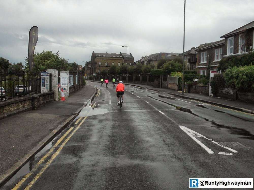
Yes, when things get like this, they need mending.
That is what "roadworks" are. Things aren't changed
while you sleep by the asphalt fairies!
So, this person. From the "other" group. They called our office to start with to complain about the amount of roadworks going on in the area. Yes, I work in a highways office and so it would be reasonable to expect the odd moan about the roads being dug up. In this case, the ire of their issue was a bit of our work and a bit of the power company's work. The call was taken by one of our streetworks officers who is often the person of choice because it is streetworks! The person was very concerned about the amount of roadworks disrupting their journey to work and wanted to know what we were going to do about it.

My colleague explained that in the need to maintain the highway network and utilities, it is inevitable that the roads would be dug up, but that we did coordinate the works within the framework provided by legislation, but from time to time, yes, journeys would be affected. The answer was not satisfactory and the person started adding other non-roadwork traffic issues. My colleague took the details and said someone would call back in due course. Over to me then. Actually, we are in an open plan office and we talk to each other, so I was fully briefed before I made the call.


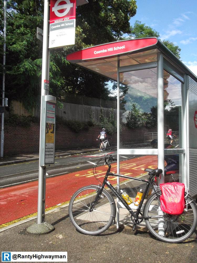
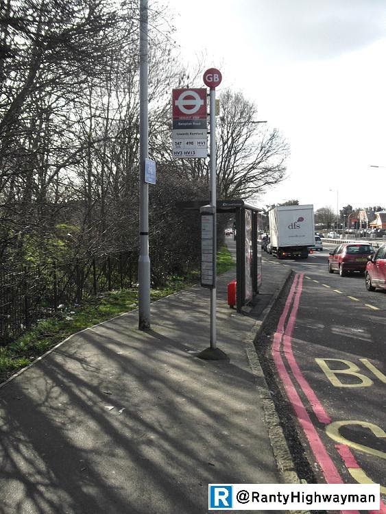
Yes, on the bus at rush hour!
It all started quite politely with the person recapping their concerns about roadworks. The person couldn't understand why "our" job was taking so long and so I tried to explain what was involved (it is a scheme which is completely reconstructing footways and strengthening a carriageway - it take a while you know). The person felt we should be working more quickly because it was affecting their drive to the station. Hang on. Drive to the station? I fired up Google Maps.

They went on to explain that they often used a busy signalised junction, but "it" caused traffic to queue up and that "we" should rephase the lights. The person then went on to say that there was also another junction nearby which was always snarled up and blocked the first junction they mentioned. I gave my traffic signal pie description. You know the one - for any given junction size, there is a corresponding size of pie and we need to give everyone a slice. If we give you, the person concerned about sitting in a traffic jam a bigger slice, then there is less to go round. Need a bigger slice? Well you need a bigger junction which means knocking down some buildings. The person said that they understood, but they hadn't and they were getting frustrated.

I did mention that Transport for London looked after the signals in London and were gradually rolling out SCOOT which (in motorised) traffic terms could optimise the operation of junctions, but of course if traffic grew or switched routes, then it would be a short-lived improvement and it must lead to the inevitable political conclusion that either traffic needs restraining or roads and junctions need to be expanded. I suggested that the later is extremely unlikely in a built up borough where people's homes would be knocked down for the space (although this was done in the 60's and 70's of course).


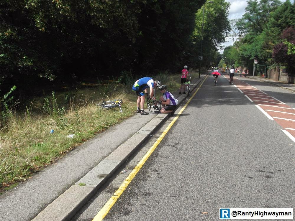
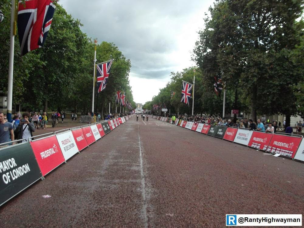
Another lane needed here?
As as I mentioned "politics", my customer the enlightened me about all of the recent poor planning decisions made in the area which had further snarled up their journey to work. A new school and housing developments were a particular issue. I tried to explain that decisions are made at the end of a chain of national, regional and local planning rules and policies and the answer to the complaint was clearly to stop all development in the area. I was then told about the chaos caused by the school run. Actually, I kind of agreed!

I steered the conversion back to the person's main problem and that was driving to the station. I asked if the bus was an option. It wasn't as the buses are stuck in the same traffic jams. I asked if they knew how long the walk would be - they said about 20 to 25 minutes. I said, according to Google, it was 17 minutes and I had found Google journey planning quite good. I was informed in no uncertain terms that walking leaves one sweaty and who wants to get on a train sweaty. I asked if the person was dropping off someone at the station (or being dropped of themselves). This often happens when one person drops off others at the station and drives on to work. Then the bombshell. My customer informed me that they drove to the station and parked nearby (as they had access to a parking space) and then got their train to Central London.

According to Google, the journey is 0.9 miles. 1500 metres of pure horror. Forget the junctions, forget the sweaty walking, forget the developments. This person could not link their congested drive over 1500 metres to the fact that their neighbourhood suffered traffic congestion; that the buses (and all of the passengers) were stuck in traffic because people were choosing to drive stupidly short distances. The conversation ended friendly enough. I was thanked for my time, but because I had no answer to the problem, the person would be taking it further and would be writing to their MP. I wonder if the MP will have any sympathy that this person sits in traffic to drive 0.9 miles or will point out the desperate stupidity at play here. It will probably be the former.


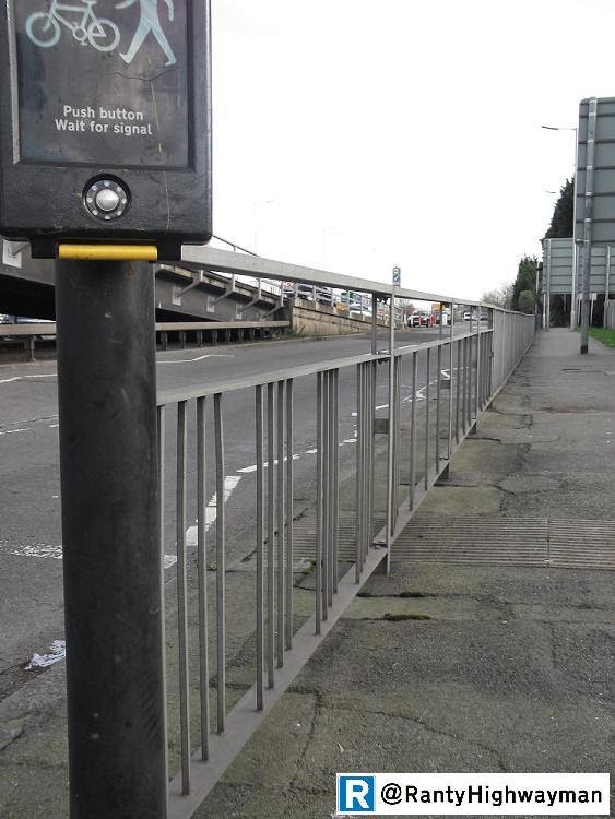
Are we having fun yet?
I cannot totally blame my customer for their attitude. They said that they had commuted into Central London for 25 years and so they will have had experience of how busy our urban areas can be. But, over the same period, we have moved to the point where personal choice is everything, where we have been told and seduced into thinking that private motoring is the ultimate expression of freedom, where the streets have been changed to facilitate easy driving. All of this might be fine out on the trunk roads and motorways, but for short urban trips at peak journey times, driving 0.9 miles is positively antisocial. Of course, we need to be sympathetic to our customers if they have a genuine problem, but in this case, they are the problem.


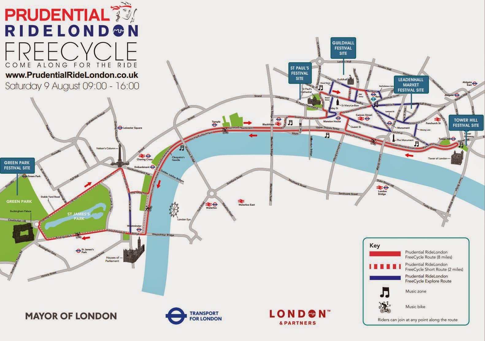
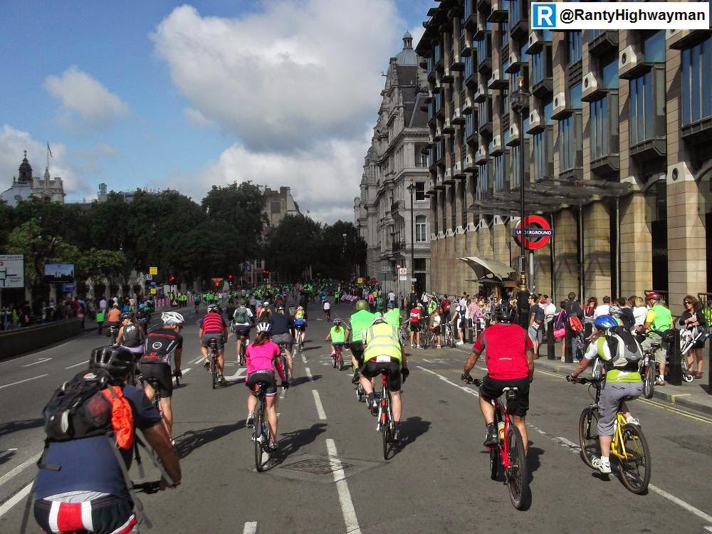
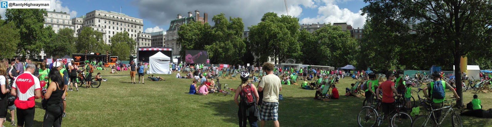
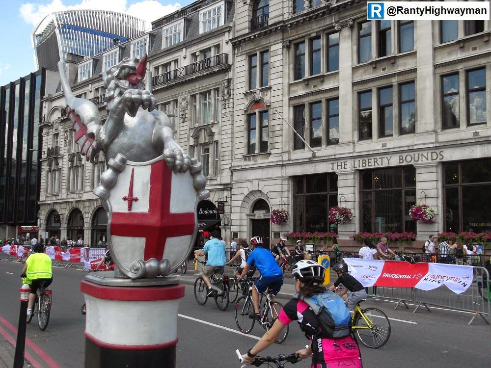
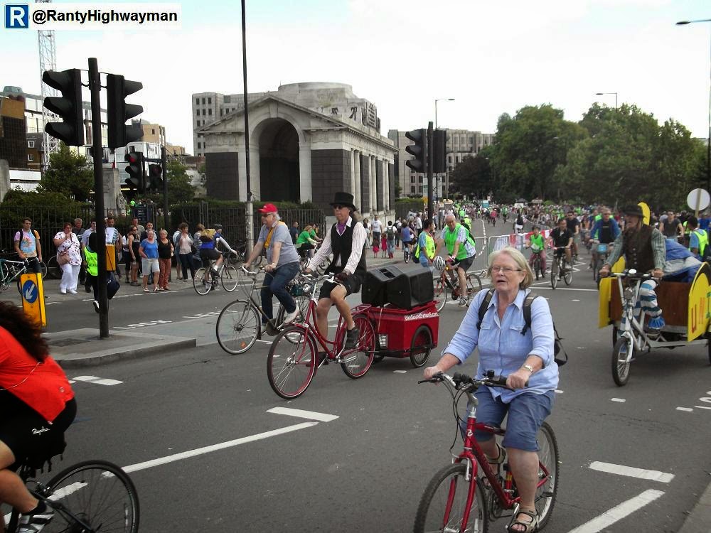
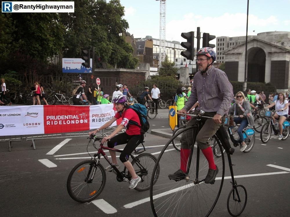
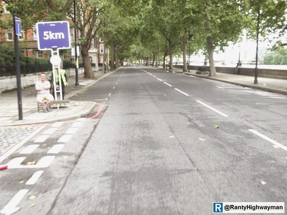
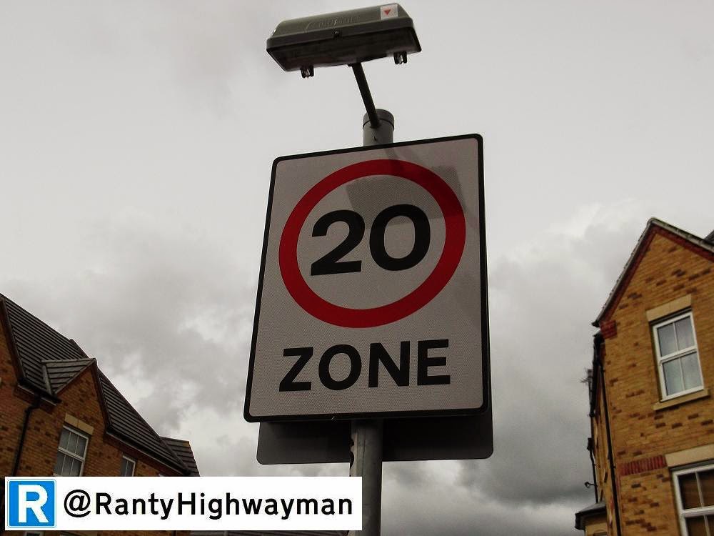
If only there was another way to help people make short journeys.


Boozy Floating Unloading

$
0
0

It turns out that the British Pub & Beer Association is concerned about protected cycle infrastructure because of the effects on HGV deliveries.

In its written evidence to the House of Commons Transport Committee Cycling Safety Report 2014-15 it states (among other things);


Segregated cycle lanes already cause particular issues for pub deliveries. Manual handling of bulk beer containers such as kegs and casks (as specified in current Health & Safety Regulations) ideally requires the delivery vehicle to be sited at the kerb-side outside the premises. Physically segregated lanes prevent this access and in some circumstances, bulk containers must be wheeled across the cycle lane which poses a further risk to both cyclists and delivery drivers.
There are already significant restrictions imposed on delivery vehicles, including the enforcement of permitted delivery times (night time deliveries are not allowed), access routes and parking restrictions. Whereas it may be desirable to separate road users to protect those considered more vulnerable, further restrictions could seriously hinder the ability to deliver to pubs, particularly if this were to prevent deliveries during busy trading periods, i.e. lunchtimes. Imposing such restrictions could also lead to increased, inefficient journey times as all deliveries would be squeezed into a shorter time window. This in itself would lead to wider congestion issues.

First, thanks to Carlton Reid for posting the link on Twitter which got my brain working! Now, people delivering beer are not the only ones to have to shift heavy weights and I am not going to single out the BPBA. I am a beer fan and so I would hate to see the flow of the amber stuff stemmed, so what can be done?

At the time this popped up on Twitter, I posted a couple of sketches. First, we have a layout which is very similar to our (now) old friend the floating bus stop, which I referred to as a "floating loading bay" - remember where you read this term first!

Like the bus stop, the cycle track bends behind an "island" which can be used by the delivery driver to offload goods onto. In my sketch I have thoughtfully provided a reinforced pad onto which a beer barrel can be dropped (onto a portable cushion carried on the lorry. For a pub, this of course only works if the barrels can be rolled into the basement doors.

The thing that makes me smile is that the BPBA is worried about stuff being wheeled across a cycle track - well, with a floating loading bay, those delivering can pause and think before they roll. Presumably, the drivers check for pedestrians before rolling a barrel across the footway into gaping opening in the ground? Of course, everyone else uses a tail lift and delivery cages and of course a floating loading bay would work there too.

What if there is less space available? Well, where there is a narrow kerbed protection strip, the simple answer is a gap and a dropped kerb up onto the footway behind. In fact, there are various permutations of both which will do the job.

So, a physically-segregated cycle track does not prevent deliveries, it all goes back to good design and thought. There is of course the debate to be had about times of day for deliveries, size of vehicles and direct vision lorry cabs. However, in terms of the compatibility of deliveries and protected cycling, it is a red herring and can be designed for. Of course, a traffic lane may have been taken away to provide a cycle track and a loading bay might be an issue at peak times, but loading bays can operate at whatever times we decide.

King Street, Hammersmith. Image from Google Streetview.
I was going to leave it there, but last weekend, I was on a long training ride in a loop around London and lo and behold, I saw something very interesting on King Street, Hammersmith, where my second sketch had been built!

A funny location as the main road has been made one way with a protected contraflow cycle track. But, the principle is there and certainly deals with the problem. So, another excuse ticked off then!

110 Miles, Minus 14 Miles, Hurricane Bertha & The Hybrid Hero

$
0
0

OK, I know I have gone on about it and to be honest, I needed an easy post this week as things have been hectic. So, over the next few days, this post will be updated with a little coverage of the weekend of cycling happening in London.

Those in London on Saturday (tomorrow) will be able to enjoy the Prudential RideLondon FreeCycle which will see a 10 mile traffic free route through the centre of the city. It will be great fun and a wonderful way to see the sights. 

It will be on many roads which normally operate as urban trunk roads and will give many people the only chance they get this year to feel like a first class citizen when it comes to cycling.

There will be commentary about legacy and all of the usual waffle. This event is a fun bit of leisure, not day to day transport and so enjoy it for what it is. This year, it will be me, Ranty Junior and my father who has recently got back on a bike (my folder!) for the first time in decades and I hope he enjoys it - it was good fun last year. I will probably dust off the #space4cycling posters for the bike again for a bit of a protest!

What will be apparent to many is that getting to and from the route will still be on horrible roads. Last year, Ranty Junior and drove to River Road at Barking and came into Town on CS3. Partly because I am riding 100 miles on Sunday and partly because Pater is only recently back in the saddle it will be the train in and back.

And yes, Sunday. Last night (Thursday), I blasted over to the Excel Centre in Docklands to complete my registration for the London Surrey 100 which is quite simply a ride from London to Surrey and back again - more here. When I finally found my way into the place with a fellow lost rider, registration took no time at all. Interestingly, there are some reasonable off road routes in the area, but they seem to be stuck in a 20 year time warp with awful maintenance and variable signage (another post perhaps). Still, looking forward to the ride, even though the forecast isn't too clever and I am a little intimidated about the whole thing!

Makes a change from having trucks flying around!
Saturday 9th August - FreeCycle
The three of us got up to The City by train for a 9am start to try and avoid the crowds. After a chilly start, we got going and then stopped at the Green Park Festival Zone where Ranty Junior had a bit of a race on the British Cycling mountain bike circuit. We then wandered over to the Lea Valley VeloPark tent where he had a go on the Watt Bikes for a sprint (I was saving my legs of course). We then stuck our heads into the London Cycling Campaign tent where there was a track stand competition (1' 30" when we were there - didn't even attempt to beat that!).


Aw, even the smallest got out on two wheels in complete safety.
And then, back onto the route heading along The Mall with its usual congestion to keep Trafalgar Square open and then things got going again for a gentle ride back to The City where we had lunch and watched people go by. Then, we picked our way back to get the train home. 

A great morning out and if I wasn't riding tomorrow, we could have gotten another lap in. I now have a few hours before bed to decide what I am going to take tomorrow as the forecast is interesting to say the least, plus I need to make sure I have enough provisions!


Approaching Westminster Bridge - is the protected cycle track on
its was yet Boris? If not, just leave it like this!

Parliament Square - normally traffic hell. Cycling bliss today.

Ranty Junior takes the flag!

Relaxation in the Green Park Festival Zone.

Rush hour as it should be - The Queen's driveway.

Cycling in The City.

Battle of the sound systems.

Plenty of bikes of different shapes and pretty much every hire bike
could be seen on the route.


At the start.
Sunday 10th August - London Surrey 100

The day of the big ride started with rain and news early in the morning that the remnants of Hurricane Berther were about to hit the UK and specifically the ride. The organisers rightly called before the start, so Box and Leith Hills were out of the route which knocked off 14 miles. I was a little disappointed, but as the day unfolded, not altogether unhappy!

My wave was due to leave at 8.20am and after being dropped off (yes by car) at Stratford Town Centre, I rode with lots of others to the start. After hanging round in the drizzle, we finally rolled up to the start line and I felt a little under dressed sitting on my armchair of a hybrid (Specialized Crossroads if you need to know) as I was surrounded by road bikes (although quite a few of us were not "chiseled whippets").


Hurricane Bertha hitting the crowd at Richmond Park.
And then we were off into a mad hour or so blasting through London. Starting on the wrong side of the A12 we headed south to the river and turned west, taking in the Limehouse Tunnel (which is normally off limits to riding bikes!) We continued off through The City and out west on the A4 before crossing the river and heading into Richmond Park. By now, Bertha was ramping up and with rain stinging our skin, we came to a grinding halt. After some time, we moved off with small rivers running along the road edge.


Floody Hell!
Eventually, we emerged from the park and continued off into Surrey. The weather continued to beat down on us and just when we thought it would clear, down the rain came again. We did miss out the two big hills, but the Surrey Hills still had some summits to beat and yes, I did walk on a couple of occasions (as did people on their road bikes). I tried to make up time on the downhill sections and being sat atop my hybrid with its (relatively) chunky grooved tyres, I would an awful lot more stable than some of the other people I saw - I just had to avoid the cat's eyes and manhole covers otherwise I would have been off. People were cheering us on in pockets as we went through the towns and villages and that was a real boost.


Lots of puddles.
The A24 section saw sunshine and the wind drop (it had felt like a headwind all day so far). The road was newly surfaced and I upped my pace. Towards the end of Surrey (I cannot remember where) I did flag a bit and so after a brief stop for food I felt better and pushed on. I should say that my aim was to keep stops to a minimum as I find my legs seize after to long a stop (the training definitely paid off in terms of how my body works on a long ride). Seeing the signs back to London was a boost and apart from another quick downpour, the sun was out at last.


A quick stop.
Heading back through the towns on the edge of London there were more and more people out on the street watching us pass by giving us plenty of encouragement - it is quite amazing how a crowd can push you along. Many times I had to pull to the side of the road to get a high-five from kids watching and I think the interaction with the riders made their days - it certainly made mine!

Of of a sudden, we were over the half-rebuilt Putney Bridge and there were some of the contractors staff on it (working I guess) and they shouted encouragement (thanks FM Conway). And then CS8 appeared - its blue paint giving a smooth riding surface (and actually nice to use in the absence of traffic). Somewhere along this section, there was a small crowd at a pub watching the ride and one guy shouted encouragement to "The Hero on a Hybrid" - not sure if he was drunk or taking the mickey or both. I gave a wave anyway!


Punctures galore (but not with my tyres - heh!)
At 5km to go, the end was in sight and I pushed on apace. Parliament Square was packed with tourists who didn't seem to understand what the fuss was about and then to Trafalgar Square which was the last turn into The Mall. The riders were really strung out and I couldn't believe the roar they gave each one as we passed. A couple of snaps and then a sprint to the end to collect my medal.

I didn't hang around long afterwards, eager to get home to my family who couldn't get to London, although they followed my progress online (as we had transponders on our bikes triggered every so often at key places). The route back to The City was business as usual through the traffic and on getting back to my home station, the smell of the local curry house was too much and Britain's favourite dish was my reward.


The open road.
Final Thoughts
Build it and they will come. Well, for two days, a huge amount of road closures were "built" and thousands of people got onto their bikes to experience traffic-free riding and make no mistake, there were all type of people on all types of bike. The London - Surrey event was not a taste of everyday cycling, but there was quite a cross-section of the population on the ride and the closed conditions made the event possible.


Nearly there!
But, as I write this, the closures are gone and London (and Surrey!) returns to "normal" life. For travelling, the cars will dominate the routes I rode over the weekend once more and cycling (and walking for that matter) will be back at the margins. It is said every time there are events like this that people want to be out travelling actively - why do the decision makers struggle with this? Perhaps the medals should go to the people travelling by bike every day despite the conditions!


On The Queen's driveway a second time this weekend.


A Bridge Too Far? East London River Crossing Consulation.

$
0
0

Transport for London is currently running a consultation on options for river crossings in East London.

Yes, another London-centric post I am afraid, but it has relevance everywhere of course, as bridges are perhaps the one of the most long-practiced set pieces of civil engineering - long before civil engineering was set as a profession. Those who have been with me since the start of this blog will know that I like a bridge and so what could I object to with TfL's plans?

Whether for trade or military purposes, bridges have always played an important part of city life and even in the modern age where tunneling become possible, some bridges have an air of romance to them, even the most utilitarian. A fixed link between two banks which can be used in (almost) all weathers has seen the demise of ferrymen, but free movement across rivers has always been seen as vital for the economy of a city.

The QEII Bridge (Dartford Crossing).
I have had an on and off relationship with the River Thames during by career, sometimes working near it, sometimes needing to cross it. During my time as a developer, I had the "pleasure" of using the Dartford Crossing twice a day for many years. 

The crossing allowed me to live in one part of London and work in another, although as I drove to work back then, the opportunity would have been denied to me if I didn't have a car - the public transport option would have taken me hours at each end of the day and so my transport choice was essentially take a job where I drove to and from work or don't take the job.

Provision for motor traffic is the fixation for the Mayor's current consultation, pure and simple. There is this concern that growth in the east and south-east boroughs is stifled because of a lack of road crossings of the River Thames. Indeed, between the Woolwich Ferry (connecting Greenwich and Newham), there is nothing until Dartford and the Government is also looking at more (traffic) capacity in that general area too.

TfL is concerned that there is a lack of road capacity across the river in East London because businesses have apparently told them as much and the population is growing. The Blackwall Tunnel also regularly has more traffic using it than its design capacity and so this is why another tunnel at Silvertown is being separately looked at.

The options currently being proposed are:
  • A new ferry at Woolwich
  • A new ferry at Gallions Reach
  • A bridge at Gallions Reach
  • A bridge at Belvedere
The Woolwich Ferry.
As far as the ferries go, I have fond memories being taken on the Woolwich Ferry as a child and I recently took my bike over on a training ride. That would have been the first time in well over ten years with the last crossing made when the whole of East London ground to a halt when there were problems at both Dartford and Blackwall and it took me over 4 hours to drive home for what was usually a 40 minute journey.

The good things about ferries is that they have a relatively low capital cost and they don't need vast approach ramps to clear shipping lanes. The problem with them is that they cost a lot of money to run and maintain and are not always available - this part of the Thames suffers from fog at certain times of the year and the ferry has to be stopped.

The Woolwich Ferry has vessels over 50 years old and so this option would be (larger) replacements which would operate pretty much as now. The consultation suggests that over time the costs of the option would be more than a bridge, but in terms of (motor) traffic impacts, things would be the same because the link is fixed. In my view, larger vessels could mean a slight increase in traffic use, although the traffic queues at some times are off putting and so will not always be a popular driver choice anyway. From a walking and cycling point of view, the ferry is easy to use and there are no steep ramps to deal with.

Next we have a proposal for a Ferry at Gallions Reach (connecting Greenwich and Newham, but closer to Bark & Dagenham and Bexley than the Woolwich Ferry). It has the same pros and cons as Woolwich, but would put more people in reach of the Thamesmead area supporting jobs and housing (apparently). TfL's consultation document shows that this option would perhaps increase (motor) traffic on the A2016 through Thamesmead and also on the A406 North Circular (could any more fit on?). They suggest a decrease might be experienced at Blackwall, Woolwich and Docklands.

An older proposal for the Thames Gateway Bridge.
Then we have a bridge proposed at Gallions Reach. Yes, this is the same as Ken Livingstone's Thames Gateway Bridge which was cancelled by Boris Johnson and the East London River Crossing which was first mooted in the 1960s as the urban motorways proliferated. Indeed, the land needed on either side of the river remains safeguarded to this day and some construction at Beckton took place. A bridge in this location would be very high to clear shipping lanes and for walking and cycling, I am not sure it would be as simple as a ferry in terms of the ramps and being open to wind, fog and rain coming in from the North Sea! 

Traffic-wise, the prediction is for increases through Thamesmead and well out east to the edge of Bexley, the A406 and parts of the A13. Reductions in traffic are expected on the Havering section of the A13, Blackwall, Woolwich and Docklands. The implication is that rather than using the A13, drivers getting to the south would come along the A2016 rather than A13. Doesn't look good for the A406 though! Again, the document cites better access for jobs and homes, but this clearly means better access by car.

Finally, we have a bridge at Belvedere (connecting Bexley with Havering/ Barking & Dagenham). This idea has come out of the blue for me and I don't yet know who has pushed for this behind the scenes. The consultation documents suggest an increase in traffic on the A13 through Havering/ Barking & Dagenham and most of Thamesmead/ Belvedere. Reductions would be expected At Blackwall, Woolwich, the A406 and the western end of the A13. Again (traffic) access to jobs and homes is cited as the advantage. Bexley Council has blown hot and cold over bridges because of traffic fears, but two bridges seems to be favoured to spread the traffic around.

The consultation documents also give some detail various indications of timescales (although who really knows with large projects), costs and (motor) traffic impacts. There is also a suggestion of charging drivers to use the crossings, although the document is silent on Blackwall. There is also commentary on environmental impacts in terms natural habitats, pollution and so on.

In my view, the consultation is flawed. If you fill in the online form, you are asked which schemes you do or do not support and at the end which you think should be taken forward. There are no other options, although you can stick comments in as you go. My own view is that any increase in cross river motor traffic capacity will undoubtedly lead to traffic congestion on the main routes either side and more seriously, the associated local streets. I do think that links are needed for public transport and for walking/ cycling, but not necessarily over the Thames.

For crossings over the Thames, clearly the ferries are best for walking as they don't need one to walk the distance of a bridge and for many people, they are part of a longer journey using buses. Cycling across the Thames might be an option for some people, but it won't be at all attractive unless the cycle routes are fully enclosed from the weather and they connect to proper cycle tracks either side rather than the free for all dual carriageways there are now.

A quiet route over Rotherhithe New Road.
Actually, I think the funding (which is by no means certain) would be better spent on many small bridges. There are plenty of local places where there are significant barriers to walking and cycling which could be overcome with relatively modest bridges. I have been looking at some potential Quietway routes recently and every time there is a railway, major road or river, busy roads converge on often narrow bridges and there is no space for protected cycling.

Other cities spend money on these kinds of bridges, but here, it only seems a worthy investment if it for traffic. Cleverly located bridges can make walking and cycling direct and safe and from the point of view of city and population growth, could negate the perceived need to keep building more roads as these Thames crossings actually are. So, please respond to the TfL consultation and point this out and if you have a missing link which would benefit from a modest bridge for walking and cycling, let me know as these are interesting little projects in their own right.

The Relevance Of Road Safety Audit

$
0
0

I am sure many of you will have at least heard the term "Road Safety Audit", even if you haven't the faintest idea what it is (although the clue is in the name!)

You may have even heard people referring to schemes as either "passing" or "failing" a Road Safety Audit (RSA) - well put that straight out of your mind, there is no such thing. A RSA does not approve or reject a scheme, that is the job and the responsibility of the highway authority and those making the decisions. Put simply, a Road Safety Audit (or RSA) is an independent assessment of the road safety impacts of a highway scheme on all users, including those maintaining the asset and is a useful independent check on the safety implications of a scheme.

Introduction
As is often the case, the standards (and guidance) stems from the Design Manual for Roads and Bridges (DMRB) and is covered in HD19/03. The DMRB is mandatory on Highways Agency operated trunk roads and motorways and as such does not always translate well to local roads. As far as RSA goes, many authorities have their own versions and procedures in place such as Transport for London (linked to without endorsement or judgement); but the principles remain the same. If you are really interested in the detailed mechanics of RSA, I recommend reading HD19/03 as it is full of the definitions and structure of the audit process - far more detail than I will be boring you with here!

I also recommend you visit the Road Safety Audit interactive website developed by CIHT, TMS, Lancashire CC and DfT. The site has pretty comprehensive checklists of things for auditors to consider. I have to praise TMS here - they are a consultant which aside from many things, has undertaken over 11,000 RSAs. They are also skilled at auditing highway schemes from the point of view of vulnerable users. I have read many of their audits and they are always thorough.

Competency of AuditorsI am not a road safety auditor. To call myself one, I would need to be able to demonstrate a track record of safety auditing, have a relevant set continuing professional development (CPD) activities and experience in road safety engineering. I do maintain my CPD as a matter of course and could demonstrate the background required, but as I don't undertake RSA myself, I cannot call myself an auditor - I know what to look for in terms of auditor competency and content of a RSA; and in my day job, I do review quite a lot put forward by developers.

The requirement for auditors to be competent comes from Article 9 of EU Directive 2008/96/EC which is concerned about the safety of the Trans-European Road Network (TERN), itself part of a wider set of transport networks. For the UK, this trickles down to a fair bit of our motorway and trunk road network. For RSA, this Directive meant that by and after December 2011, those undertaking audits must have relevant training and hold a certificate of competence - of course, only mandatory for those working on the Trans-European road network and therefore motorways and trunk roads (mandatory under HD19/03 as mentioned above). The TERN is very much for long-distance road transport and this probably shines through the DMRB in terms of the priority afforded to walking and cycling in the design standards.

The UK Government was pretty useless in sorting out auditor standards and so in practice, the industry reacted to make sure people were (and are) qualified, whether or not local procedures are in place to vary the policy or details of the RSA process  The Chartered Institution of Highways & Transportation (CIHT), through its Society of Road Safety Auditors (SoRSA) seeks to coordinate and disseminate best practice and for those meeting various training and experience requirements, they issue professional qualifications and a Certificate of Competency for practitioners. For example, I am an Associate Member of SoRSA which shows I have the basic training and road safety engineering background. A full Member would be able to show more detailed training and a track record of performing RSAs. A Fellow would be a leading specialist in RSA. The Institute of Highway Engineers (IHE) also runs a similar arrangement for its members.

The other interesting thing to note is the more wider experience of an auditor. There is such a wide range of layouts and design options on the road network, it is simply not possible to be an expert in all of them. Like me, many highway engineers are generalists and so for certain schemes, the advice of experts might be needed when a design is being developed. It is no different for safety auditors. For example, while an auditor will have a working knowledge of traffic signal operation, for a complicated junction, additional advice will be required from a signals engineer. For issues affecting blind and partially-sighted people, the auditor may wish to discuss a scheme with a local support organisation.

Of course, this does start to lead us down the debate as to whether auditors need to have had specific training or at least demonstrable experience in cycling, walking and disabled user issues - in my view yes. In fact, auditors will need to have had experience in design to be able to understand how things fit together. My argument could extend to driving of course, but from any user point of view, it is important that the auditor understands the issues without necessarily being a "driver" or "cyclist" or "pedestrian". Actually, auditors should also have an appreciation of issues for powered two-wheelers.  Yes, I have spent a bit of time on the competency of safety auditors, but my general point is that they should understand the design process and the issues facing all road users - they need to be rounded and experienced engineers foremost.

The Audit ProcessAudits are rarely undertaken by an individual (expect for simple Stage 1 audits) and would normally be two people for most audits, with more as required. The team would comprise of a "Audit Team Leader" who should be very experienced, "Audit Team Members" and sometimes "Audit Team Observers" who are essentially auditors gaining experience and who are expected to contribute to the process. We also have "Specialist Advisors" as required (such as the signals example given above). Another important thing to note is that those involved in audit must be completely separate from those involved in design because of the clear conflict of interest. It doesn't necessarily mean people must be from different organisations, just that things are separated to maintain objectivity.

There are 4 general stages to the RSA process, unsurprisingly, Stages 1 to 4. A Stage 1 RSA is at initial design stage, really before much of the detail is worked up. It can help the designer to get another view from a pure road safety point of view before too much detailed (and costly) work is undertaken. Generally speaking for most highway authorities, the larger schemes only will be subject to Stage 1 along with developers submitting a planning application. With developers, some see RSA as one item on a long list of things to do when making a planning application, but that is no bad thing.

Stage 2 is at detailed design stage and for smaller schemes, Stages 1 and 2 are often combined. For example, if a RSA was being done on a stand along zebra crossing, a combined Stage 1/2 might be done as the difference between initial and detailed design is often quite small. It doesn't stop a crossing location being subjected to Stage 1 based on a quick plan, but this doesn't happen much in practice (of course it would on a Highways Agency scheme where RSA is mandatory).

Stage 3 is at completion of construction and ideally before the road is opened. In practice, where the scheme is an addition to a live road, a Stage 3 cannot be done before "opening" and so HD19/03 requires within 1 month of "opening". Individual highway authorities may have their own process. 

Stage 4 is not always used, especially where developers are concerned as it deals with monitoring which is pretty much the job of the local highway authority anyway. HD19/03 suggests monitoring during the first year of operation and then a formal accident review at 1 and 3 years after opening. In my experience, not often done. (accident is used throughout the standard - I prefer collision).

As mentioned above, the RSA is a process where the safety aspects of a highway scheme are assessed. It is not a check on design standards, it is not an opportunity for an auditor to redesign a scheme (more on that later) and it is certainly not a process to endorse or condemn a scheme. It is also not the role of the auditor to redesign the scheme or to make design changes - apart from taking on design responsibility (which is another whole area of legislation and liability), designers are employed to design the scheme. I would suggest, however, that training designers in road safety audit is very valuable as they will often spot things and make changes which designers not trained in RSA will miss.

The RSA (at whichever stage) is a formal process which ends in a report set out in a standard way which seems a little strained to the casual observer, but is designed to be a consistent approach. Before the RSA takes place, it is vital for the correct brief to be provided to the audit team. For me, this is probably as important as having competent auditors as if the brief is crap, the audit will be crap and of little value.

The audit brief will provide the audit team the scope of the scheme to be audited along with full details and relevant supporting information. I have seen audit reports submitted where the scantest information has been provided to the auditor - little more than a plan in many cases and no wonder the audit team struggle. At Stage 1, it might just be a sketch on a plan, but it would greatly help if information such as traffic flow and speeds could be provided. Perhaps for my zebra crossing example, a map of the area showing schools or shops might help.

Despite what some consultants working for developers would have you believe, the whole audit team should visit the site. Yes, it is obvious, but some try and get away with sending one person, especially at Stage 1, to try and save a few quid on site visits. This is not right as how can one comment on the issues without visiting the site - that is almost as bad as me commenting on sites I haven't been to (oh, wait!). You cannot design without visiting the site and you certainly cannot audit without visiting either. At Stage 3, the standard requires a night visit (to look for any issues not apparent during the day) and again, some people try and skip that because of the cost (worse hanging around for dark in the summer of course).

So, to the audit report. The format will broadly be as follows (from the standard):


  • A brief description of the proposed scheme;
  • Identification of the audit stage and team membership as well as the names of others contributing;
  • Details of who was present at the site visit, when it was undertaken and what the site
  • conditions were on the day of the visit (weather, traffic congestion, etc.);
  • The specific road safety problems identified, supported with the background reasoning;
  • Recommendations for action to mitigate or remove the problems;
  • A3 or A4 location map, marked up and referenced to problems and, if available, photographs of the problems identified;
  • A statement, signed by the Audit Team Leader in the format given at Annex D [of the standard]; and
  • A list of documents and drawings considered for the audit.

The road safety problems which are identified should also be presented individually with a recommendation. The standard has a series of checklists for Stages 1, 2 and 3 which try and make all audits consistent. The report would also consider previous audits (if undertaken) and any recommendations or changes made. Each problem will be set out with its location, a summary (including the type of collisions which could occur) and a recommendation. It is bad practice for an auditor to recommend "monitoring" unless the issue is really minor - he or she needs to get off the fence.


London Road roundabout, Clacton-on-Sea.
Image adapted from Google Maps.
So, let's have an example. The image here is of a roundabout junction on the A133 as it enters Clacton-on-Sea in Essex. I have circled a staggered zebra crossing and so let's just assume the proposal is to change an existing uncontrolled pedestrian crossing to this one with the zebra crossings to make things safer for pedestrians.

The A133 as it approaches the area is a wide single carriageway road subject to the National speed limit which steps down to 30mph around 100 metres before the roundabout. As the road approaches the roundabout, it opens up from one lane to two lanes for about 25 metres before the give way point on the roundabout. The design is for a staggered zebra crossing (i.e. people cross two, distinctly separate crossings) and although there may well be lots to mention in the RSA for the roundabout as a whole, I will concentrate on this one arm for this example.

So, in the format of the RSA (normally section 3 of a report) and assuming a Stage 1 RSA, here are a couple of problems which could be identified:


3.1 PEDESTRIAN FACILITIES

3.1.1 PROBLEM

Location
North-western arm, approaching roundabout.

Summary
Excessive traffic speeds approaching crossing/ roundabout. Site observations suggest speeds above 30mph speed limit which could result in vehicles overshooting zebra crossing when being used by pedestrians.

RECOMMENDATION
Provide measures to ensure approach speeds to ensure they are low enough for drivers to be able to stop when the crossing is being used.


3.1.2 PROBLEM

Location
North-western arm, approaching roundabout.

Summary
Visibility of pedestrians crossing. The two lane approach to the crossing could create conditions whereby one lane is free flowing and one with queues. The queueing lane could mask pedestrians crossing from the free flowing lane putting them at risk of being hit by a vehicle in the free-flowing lane.

RECOMMENDATION
Consider suitability of multi-lane approach to zebra crossing or consider alternative method of control.


OK, I could go on and do a whole report, but this is a long enough post as it is. You will note that although the process is laborious, it is designed to be logical and consistent which allows the issues raised to be considered logically. The auditor does not add any weight to an issue, does not rank the issues or undertake any design work. With the first problem, it would now be up to the designer to consider the approach speeds and decide whether to make changes. It could be that as this is a Stage 1 RSA, no traffic data has been gathered and when speeds are checked, they are appropriate for the provision of a zebra crossing.

The second issue is harder for the designer to deal with as the auditor has highlighted a pretty fundamental potential issue with multi-lane approaches to zebra crossings. On further thought, the designer may decide that the layout is acceptable (as traffic data shows queueing unlikely) or might decide that a traffic signal controlled option is better. In real life, there is a cycle track around this roundabout and perhaps a Toucan crossing which can be used by cyclists might be more appropriate? A Toucan crossing would also have traffic speed detection which could deal with the first problem (if it is a problem).

At Stage 1, it should be relatively simple to make changes to a scheme. It might be that a layout or part of it might not be appropriate and the recommendation is to change it as above. But what if the zebra crossing remains the favoured design and the scheme is subjected to a Stage 2 RSA with no changes? The auditor is not there to design the scheme and can only raise safety issues at this stage which makes life tricky for the auditor if the issues are still fundamental.

The difficulty at Stage 2 is that the design has crystallised after a lot of effort and the danger is that the designer and indeed the scheme promoter have a "pride of authorship" or perhaps have their heads stuck in the sand - a fair bit of money might have been spent by this stage. A good auditor will need hold their nerve and remain objective. In my example, the same issues should be restated unless evidence has been provided to deal with the issues.

So, what happens at Stage 3? In my example, let's assume the zebra crossings went in as designed and the concerns raised in the audit where not dealt with. It may be that no problems ever materialise and the audit is accused (perhaps not openly) of being over cautious. Having at least two people auditing gives some quality control as they are expected to debate the issues and only include them if they are real road safety issues. It might happen, but I would rather be cautious than cavalier.

When the site is reviewed at Stage 3, it may be that approach speeds are still too high. It would still be possible to recommend speed reduction measures as they could be installed (it might cost of course). If the pedestrian masking is still a problem, it is probably not helpful for the audit to recommend a different type of crossing and so it is hard to make useful recommendations in many cases when things have been built. Often, an audit will recommend warning signs in a situation like this which is a bit of a cop out, but one caused by the designer/ scheme promoter.

Once an audit has been completed an the report issued to the project sponsor (i.e. the person responsible for the project, not the designer), then it is usual practice for the designer/ design team to formally respond to the issues raised (known as a designer's response), although the person with overall responsibility for the project is the one to ultimately decide if the issues raised by the audit are significant. Any items not considered significant should be formally recorded as such (and with reasons) in an exception report - although it is ultimately the decision of the highway authority what gets built.

Limitations & Issues
The process to HD19/03 is more extensive and detailed than I have set out and is predicated on a decent level of resource for schemes, including staff. For a small highway authority working on small schemes, they are unlikely to have the resources of the Highways Agency or a large county council and it means that the person responsible for the scheme might be the highway authority representative and the designer - in this situation, people need to be open and record their thoughts and decisions as it is the only way to remain objective.

It might also mean that many schemes don't get subjected to a safety audit on cost grounds. For example, a straight-forward zebra crossing might cost £20k and a three stage RSA might cost another 15% of that budget. I am not suggesting this is right or wrong, just a reality of budgets.

What of innovative, dare I suggest radical schemes? There should be no difference to the process. It might be the auditor is not familiar wit the concepts involved and they need to be properly explained in the audit brief - perhaps with a statement provided by the designer on how the scheme is intended to work. 

Take this image of a bus stop bypass on Lewes Road, Brighton. I can imagine an audit raising safety problems with people crossing away from the dropped kerbs, on the far side of the bus shelter and not being seen by cyclists. Yes, this is a valid safety issue, but could an auditor recommend anything sensible to deal with the issue - guard rail on the far side of the shelter perhaps? 

Actually, this kind of "problem" would be a sign that the audit team perhaps didn't understand the scheme or might be over-cautious. The dropped kerbs are provided for people with reduced vision or mobility. There is nothing "wrong" with people crossing elsewhere - they have the cues around them of needing to step down into the cycle track. Had the dropped kerbs not been provided, then that might be raised as a problem. This goes back to the designer(s) explaining the scheme at the audit brief stage and perhaps (in my opinion) the auditor needing to have had experience of this kind of design or consulting with someone who does.

Another example. Bromells Road at Clapham, which has the footway of the main road ("The Pavement") continuing across the junction. The point of the scheme is to give reinforced priority to pedestrians over traffic leaving the side road. This would need to be explained in the audit brief otherwise the auditors might be concerned about blind and partially sighted people not knowing where the extents of the carriageway are (there are none, it is all footway which vehicles have to cross).

The other pitfall is where different layouts are subjected to a RSA and this is used by scheme promoters to pick the "safest" one. This is very bad practice because of the lack of weight given by the auditors. In my example, a Toucan crossing and a zebra crossing might throw up different issues and so suggest one is safer than the other is wrong - it depends on so many variables, it wouldn't be comparing like with like.

There are other audits which can be used to complement RSA such as a Quality Audit (see 3.7 of Manual for Streets). Other people being involved in reviewing schemes from the point of view of various users or from an architectural point of view can add value to a scheme, but as with the RSA, the responsibility for the scheme remains with the designer(s) and those making the decisions. Beware of any highway authority (or indeed developer) who suggests that a scheme is fine because it "passed its safety audit" or "the safety audit didn't raise that issue" - the auditor might have missed something or wasn't given the full details.

Final Thoughts
Returning back to my starting point. I have often heard people say "how did that scheme pass a safety audit". Well, assuming it was subjected to a RSA, it is not a pass or fail and I hope that this post has given you some insight as to why. What people examine is how the design process was progressed and how the decision was made. If a RSA was undertaken, what was picked up by it? What was the designer's response? What weight did the person responsible for the scheme give the issues? Did the decision maker know all of the issues? Sometimes, there might be potential safety issues with a scheme, but in the final analysis, the decision is taken to build it. 

Road Safety Audit is just one of the tools highway engineers can use to help them design a scheme. It is not the auditor's job to design the scheme, merely point out potential road safety issues. If you are reading a RSA as a campaigner, it won't be enough. You need to be reading it in conjunction with the audit brief, a designer response and an exception report to get the full picture.

Guide Dogs Cycle Eyes Campaign: Barking Up The Wrong Tree?

$
0
0

One of the things which gives me a buzz as an engineer is seeing a highway scheme I have had a hand in being used. What is even better is seeing people who could not have used that piece of highway before, now being able to use it.

As many people will know, a large infrastructure scheme is something which people like to associate themselves with whether it is as clever designers, the project sponsor or the politician cutting the ribbon. Me? I remain a fan of the small scheme - the ones which can make a real difference to people's day to day travelling.

I am a veteran of bus stop design. By that, I mean I have traipsed around the streets looking at flags, shelters and bins, scribbled away in AutoCAD, run countless public consultations, written endless committee reports and spent hours in the council chamber attempting to explain and advise councillors that making bus stops accessible is a good thing to do, despite the opposition from people who don't want a bus stop near their premises. 

Access for all should be our objective.
The grief and the hard work is totally forgotten when I see someone getting on my bus who couldn't have done so easily or at all before. If a the highway environment can be changed to meet the needs of the person finding access most difficult, then it will make everyone else's life a doddle.

But, this is not a post about bus stops. The point of mentioning them is two-fold: first, I have a social responsibility as a professional engineer to make the world a better place. I know it sounds a bit hugs and peace, but when I get a letter of thanks from someone who can now use the bus because their local stop is accessible, it is the best possible outcome from an often hard-won process. Second, I am often asked by people objecting to bus stop works just who is asking for the improvements and the answer is usually "nobody". People put up with an awful lot and get on with their lives, but when it comes to travel, there are often tremendous barriers and so making the highway accessible to all is clearly the right thing to do.

Built for wheelchair users, but life is even easier for everyone else.
This holds for walking and cycling, where changing the highway environment so it is accessible to all pays an awful lot more dividends than we might imagine in terms of personal independence, inclusively and indeed dignity (many people don't want to be seen asking for help). The motivation for a pair of dropped kerbs across a junction may come from wanting to help wheelchair and mobility scooter users cross the road, but it means that people pushing buggies have an easier life, people using sticks to walk don't have to step into and out of the road and actually, life is made a tiny bit easier for everyone else.

As well as people like me trying to do the right thing (it is my job you know), there are many organisations and charities with aims which are actually pretty similar in terms of improving people's mobility. They are interested in improving the lives of the people they represent (whether generally or by membership) and so it is always a shame to see campaigns which on the face of it pitch people with common aims against each other.

So, it was with dismay that I learnt about Guide Dogs'"Cycle Eyes" campaign. It essentially asks "cyclists" to watch out for people who can't watch out for them. On the surface, who wouldn't agree that people riding bikes shouldn't be looking out for people who would struggle seeing them when crossing the road, or walking next to a cycle track or so on? Forget about one's chosen mode of transport, isn't it the moral duty for people to be aware of others full stop (yes, many don't!).

They give 5 points to think about;
  • Pay attention – look to see if the guide dog and owner, or person with a cane are waiting to cross. Remember that they can’t always see or hear you.
  • If you see the guide dog and owner or person with a cane waiting to cross, use your bell or call out to let them know you’re there.
  • If the guide dog and owner or cane user are already crossing the road, please stop and wait until they've reached the other side.
  • Do not cycle up behind or around the guide dog and owner, no matter how much space you think you’ve given them. The dog may be startled and get confused.
  • If you need to use the pavement for any reason, please dismount. Bumping off the kerb onto the road can scare and confuse the guide dog.
It is not just "cyclists" who are a danger to people walking on our
streets you know!
OK, it all seems reasonable and perhaps things that many people might not have come across (at least in detail) before. The campaign was started because of "a noted increase in guide dogs and their owners being hit by a bike or having a near miss." Really? This not something I was switched on to and doing he job I do, I like to think I have a rough idea of what is going on in terms of conflicts, collisions and the like. 

It turns out that Guide Dogs have been a bit naughty. The "noted increase" comes from the following data;

There are just over 320 guide dog owners in London. We know not every guide dog owner reports these incidents, and whilst we have had an increase in phone calls from Guide Dog Owners reporting incidents, through social media we invited blind and partially sighted to fill in a Survey Monkey. 33 of those who responded were guide dog owners from London, 42% of those have been involved in a collision with a cyclist 76% have had a near miss (defined as where they have narrowly avoided a collision).

This tweet was doing the rounds at the end of June;


So, it would appear (and I would welcome some detailed clarification if I am wide of the mark) that Guide Dogs has created (either on purpose or by mistake) a survey (now closed) with responses from people with "strong views on cyclists in London". I doubt very much if the strong views presented were mainly positive and certainly the "data" bears me out. I mentioned at the start of this that the people interested in making bus stops accessible are those who don't want the bus stops near their premises - like Guide Dogs' survey - classic self reporting which can skew the real picture.

Looking at the data, we have 320 guide dog owners in London and 33 (10%) filled in the survey. Of those, 42% have been involved in a collision with a cyclist (14) and 76% have had a near miss (25). What we don't know is what were the circumstances of those incidents were or over which period they occurred (3 years? 30 years?). I would not for a minute wish to devalue the impact that these incidents must have had on the individuals involved, but the survey really does suggest that it was a vehicle (if you excuse the term) to set up guide dog users as being under attack from this dangerous, group of people known as cyclists. I will state it again - I am not a cyclist, just somebody who chooses to travel by bicycle.

Reading further into the article on Guide Dogs' website, we learn that "Cycle Eyes" is supported by Transport for London and quotes TfL's Leon Daniels;

"It is vital on London's busy road network that we all understand and respect the needs and welfare of our fellow road users. We support the Guide Dogs' campaign to remind cyclists and other road users to watch out for and give extra care to visually impaired and other vulnerable pedestrians. This, together with the work being done to make pedestrian crossings more accessible with tactile paving and audible signals, will make London's roads safer for all."

Perhaps this should be the focus of a campaign?
Well, the campaign is aimed at "cyclists" (not other road users) - it would be very interesting to see a survey undertaken by Guide Dogs on how many collisions and near misses occurred involving motorised traffic. It would be very interesting to see a survey from Guide Dogs on whether or not users are happy with the level of provision at crossings as there are a heck of a lot on borough and TfL roads which have no provision at all. No tactile paving, no green men. Squat. What about footway parking making life so difficult for people to walk along a street? What about advert boards left in the middle of footways? What about the often poor state of footways. What about parked cars preventing people from crossing the road at junctions? I think Guide Dogs are barking up the wrong tree!

Perhaps you need to remind Mr Daniels about just how bad the
pedestrian experience can be on "his" road network.
(A12, Barley Lane - from Google)
Guide Dogs' also state;

"We work incredibly hard to get blind or partially sighted people out of their homes and mobile, so to hear that vision impaired people are anxious and in some cases fearful about going out in London because of irresponsible cyclists is very worrying. With the Mayor committing nearly £913 million to a 'cycling revolution' we need to make sure that cyclists are more aware of blind and partially sighted pedestrians."

So, they seem to suggest that with £913 million being spent on "cyclists", they had better shape up - seems like classic blaming of that "cyclist" out group to me. The London Cycling Campaign supports Guide Dogs in this initiative if you read the Guide Dogs' web page, although it seems a little less clear on the LCC's website and indeed, there is clarification being provided in the comments;

"One reason for LCC to support the guide dog users was to point out a real problem (however big) and lay the basis for working together to get better infrastructure. If we propose safe space for cycling on London Streets that seriously inconveniences blind people we will get nowhere. All the blind people I spoke with this morning recognised the need to improve conditions for cyclists.

To me, that is absolutely fair, but Guide Dogs have not echoed the need for good infrastructure, just had a pop at cyclists. LCC also stated;

"Another reason to support them is to make the point that many cyclists are inconsiderate of pedestrians, whether they are sighted or not. If you cycle on urban streets in London you should be expecting pedestrians to walk out without paying attention and moderate your riding style so that it doesn't create a problem for them, or for you."

I bet this is a common issue for Guide Dogs and LCC!
Oh nice. So LCC is now repeating the "cyclists" as an out group mantra. Where is the proof that "many cyclists are inconsiderate of pedestrians" then LCC - can you back this self-blaming with facts? I would suggest that as far as LCC members go (and I am one), this campaign is preaching to the converted. Many members of LCC may not be aware of the detail of why bikes can be an issue for guide dogs and their owners, but they will have an appreciation of the rounder issues. Going to the effort of joining an organisation does rather suggest (at least to me) that one already has an interest in the issues the organisation is interested in.

Guide Dogs have also made a helpful film which does indeed show "cyclists" going through red lights when people (including a person with their dog) are trying to cross on a green man. No, those people should not be doing that, but the behaviour is not because they are on bikes, it is because they are determined to make progress and sod everyone else. No different from people driving badly - it is people. The funny thing is that although the film shows how hard it is to hear bikes passing, there is no comment on the intimidating traffic. There is no comment on how difficult it is for people and their dogs trying to negotiate the multi-stage pedestrian crossings shown in the film.

So yes, Guide Dogs, there are some people who happen to ride bikes badly and without consideration to those more vulnerable than them, but lumping us all into this group called "cyclists" is not the right thing to do and should do know better. LCC, yes, I am irritated that you have aligned "us" with this campaign and indeed have repeated the many "cyclists" are bad mantra.

As an engineer, as someone who walks and rides a bike, I agree that our highway network can be pretty intimidating and downright impossible to use for some (unless driving). The trouble is that campaigns can backfire and to many people, it seems that there are these little interest groups squabbling, when actually, we all (broadly) want the same thing and that is a safe and fully accessible highway network for walking and cycling. If I were a cartoonist, I would draw an ivory tower with a ministerial type figure sitting at the top of it sniggering while little protest groups have an argument at the bottom (yes, this is a cue for someone to draw this please!)

This kind of thing is simply reinforcing the view held by some people that "cyclists" are irresponsible. It gives column inches in the media which are dedicated to having a pop at me because of my transport choice. It makes some people who are driving think it OK to have a go at someone, purely because they happen to be on a bike. If I singled out a person who relies on their guide dog in this way, I would be pilloried. Please rethink this as I think the aims have the best of intentions, it is just you have picked the wrong target.

My Personal Cycle To Work Day

$
0
0

Today was "Cycle To Work Day", an event aimed at getting people onto two wheels for at least one day this year. For me, it was my normal cycle to work, but I thought it would be a bit of fun to run through my journey.

There is more information on the Cycle To Work Day website and while a single day of publicity is not going to change anything overnight, at least it might be a way of showing the conditions that many of us put up with already and get people thinking what would happen if the right infrastructure was provided.

So, here follows a set of photos with some comments, and I will round up with some thoughts at the end;

The bike is ready to go. Coming to the end of my 4th year as a
bicycle commuter, I have the best bike I have ever had. 7 gears
(including a super low gear), twist shift, luggage rack, proper
mudguards, nice and upright, a comfy saddle and a smart bag which
converts from messenger to pannier. A happy rider indeed!

Round the corner from home, I am on a shared-use, unsegregated
cycle track. A bit uneven in places, it is far better than the amazingly
empty 50mph trunk road on the right. I don't normally see pedestrians,
but, this would be ripe for a proper separate footway and track.

Further down, our old friend, the multi-lane flare appears on the
approach to a large junction which means the track gets really narrow.
I often have to give and take with people walking or by the bus stop
in the background and if you think this hedge is bad now, you should
have seen it last month - virtually impossible.

Still on the cycle track, things are a bit better again, but the nice wide
verge separating riders and walkers has gone.

As I near the half-way point, the track goes all shared-use, segregated.
The trouble is that it is all paint, too narrow and often occupied by
pedestrians who for some reason, don't fancy walking next to the
50mph dual-carriageway!

So, well into the on-carriageway section of my commute and it is
advisory cycle lanes all the way. Normally, this road is stuffed and I
am able to glide past the traffic queues (watching for left hook at the
junctions of course). This morning, some plonker parked, and from
the fog on the windows, this person has been there for some time.
It would be a doddle to build a cycle track between the white line
and the edge of that concrete strip. Sigh.

Nearing the end of my journey, I have just ridden around a large
roundabout and now I just have a section of urban dual-carriageway
to contend with. I am not sure what is more fun, the bus stop to my
left, the sunken gullies in the cycle lane, or the vehicles to my right.

A quick nip over an area of single surface shared-space (which
kind of works as it goes nowhere for traffic) and my goal is in sight
(not work, but where I pick up some rolls for lunch!)

The bike gets tied up in the secure compound by the staff entrance
to my building.

And so to work with the obligatory cup of tea (strong, one sugar please)
and a sneaky pain au chocolate to get me started.

The first job of the day - setting up a new project file.
No money announced as yet, but I am going to put some base
drawings together as I live in hope. This project is staying with me!
(if we ever get some cash!)

I guess the photos are a fair reflection of many people's bicycle commute. On the first part of my journey, the photos show there is tons of space, but while all of the attention is in Central London (and please do read the blog post by Cyclists in the City), it is very easy to feel forgotten.

Sadly, the second part of my journey is on my patch and I don't have people queueing up to ask for it to be made wonderful (they are queueing up to sit in traffic) and so I doubt it is even on the political radar (with a small, and very objective and not at all critical 'p'). There is very little money floating around for cycling in my neck of the woods, despite the almost constant announcements.

I do live in hope and that Quietways folder is absolutely genuine - I am going to find the time here and there to get some base plans drawn up so the schemes exist. Once a scheme exists, even on a shelf, there is at least a chance it will be built. It is something to talk about and it is more than a scheme name on someones wish list.

Petrol Promotions, Prioritising Parking & Poor Passengers

$
0
0

As those who have followed this blog a while will know, I do have a car, but it sits (off street) most of the time. It does get filled up every so often and at the moment, I get to benefit from a "pennies" off per litre promotion my local (big, national) supermarket is running.

Actually, we don't tend to shop in our local (big national) supermarket very often and so on the infrequent occasion we need to fill up, it is only about a £2 saving on a 50 litre tank. The reason we don't need to fill up very often is we try and use the shops in our local area as much as possible and although for groceries it is still a national chain, it is a smaller shop which is within walking and cycling distance of home (and it is at the more "cooperative" end of the scale if you catch my drift).

The big store is designed for cars. It has almost direct access from a trunk road with a huge car park (although people always queue to get close to the door). The access to the trunk road also serves a 1980s residential development and as a result vehicles are prioritised over those walking and cycling - it has a staggered Toucan crossing to contend with which is arranged to not affect traffic.

At the store, walking and bike access is squeezed down the side of the building, although at least it connects to the cycle track which runs along the trunk road. The bike parking is at the far end of the store (away from the entrance) as trolley parking is prioritised. There is a bus route which goes into the store (no use to me, though), but it dumps people at one end of the car park, rather than stopping right outside and so passengers have to lug their bags through the car park to go home. The store sells everything and so it is not a place to go for fun.

Although the big store is actually on my way to and from work, I never go into it (unless getting petrol or using the car for a big shop), I prefer to make a slight diversion to use the local shops. I can park my bike right outside the door of the local supermarket and I also have access to the other shops. There is car parking outside (pay and display) and so there is still the option of the car for a bigger shop or the bus (which stops at the shops and within 2 minutes of where we live).

The more local shop has been running for years and I hope it continues to do well as it means we don't have to do a weekly shop at the big store; just pick up what we need as we go (and we have the other shops too). The trouble is, the big store is cheaper and so as well as being able to entice people there with a petrol discount, they can undercut the local shops. The flip side is that if walking or cycling, you tend only to buy what you really need rather being enticed to fill up the boot of your car.

The big supermarket is a classic business model. You can get anything you want under the one roof, there is plenty of free parking and as a result, the local streets are arranged to get traffic into and out of the site. This arrangement can be found at countless locations up and down the country and has us stuck into a loop with the supermarket business. I know there is the other model of large convenience stores, but they seem to be aimed at knocking out the smaller independents. At least with the local supermarket, there are still two independent newsagents in the same parade.

The big store's business model pays no regard to people who are not arriving by car and of course, there is no offer of a bus ticket refund, or loyalty card points for walking or riding to do your shopping - you are only valued if your mode has an engine. There are other examples of this difference in valuing people for their mode. Larger shopping centres often charge for parking (and unlike paid-for council parking, we don't hear that fool Pickles moaning about parking profits for private operators!), but one can often get money back for using the supermarket "anchor" store or perhaps the cinema. Again, no discounts or refunds for those arriving by public transport, foot or bike.

These sites are again arranged to stuff the traffic in and those trying to walk or ride (or live) around them be damned. It is of course easy to take a car park ticket from a shopper and stick it in a computer for a discount - it is a little harder to prove that you walked to the cinema! But, whole swathes of the purchasing population are treated differently because of their modal choice. In the public sector, it is the same. Zelo Street recently blogged about the hollow "victory" the newspapers had over hospital car parking in England. I recommend reading David Hembrow's post on free parking because as ever, there is a lesson to be learned from across the North Sea about providing real alternatives.

A few months back, Mrs RH spent some time in hospital (she is fine now, by the way, although she brought a small person home with her!) I was fortunate to be able to bike over to the (edge of town) hospital for frequent visits as I knew how expensive the parking was. When came to taking the kids visiting in the evenings, it was just not practical to use the bus (we were time poor between me getting home from work, getting the visit in and then home in good time for bed) and so we used the car. There are arrangements to help some patients and their families with parking charges at many hospitals (hence the hollow victory), but there is no campaign to help people pay for bus travel to hospital - especially as the fashion is now to have large, edge of town hospitals - again, all designed for motor car access.

Being an edge of town site, the hospital sits within a roads system designed for cars. In common with many places in the UK, it is a PFI monster which has centralised loads of services alongside other hospitals and smaller units having been flogged off as housing sites. If you live near a bus route which serves the site, then you are reasonably OK (although many routes end up literally going round the houses which is the outer-London arrangement). Live a few miles away from the site, or out of borough, then it will be multiple buses to get there. Train-wise, it is just over a 1km walk, but many pedestrian crossings and horrible subways.

I don't know if the parking charges cover the cost of running the car parks at the hospital, but it is expensive and I can totally understand why people get upset paying when the alternatives are so poor. If you are ill or visiting someone with a long stay in hospital, the last thing you should worry about is transport.

We never seem to learn from past mistakes. Our approach to transport seems always skewed to the car, never recognising that there are huge numbers of people who either don't or choose not to drive everywhere. Big stores and regional hospitals are a good example of the illusion of the freedom of choice. If the local shops go out of business, then it is the big stores who corner the market and immediately, the non car-using people are immediately at a disadvantage as they have lost their choice. Those already using the big stores have given up their choice in reality as their lives now include infrequent, but large shops with the car. With hospitals, we are promised the choice of where we are treated. For many, it is a struggle to get to their nearest hospital, let alone travel to the next town. There is no real choice for many.

As someone who is a small cog in the transport sphere, it is frustrating that many of the decision-makers and influencers don't see need to change how we travel and most importantly, give people real choice.

Clutter Buster

$
0
0

Brace yourselves, I agree with eric pickles on something. yes both you and I are now feeling sick. actually, we agree on a very narrow area of life and that is street clutter.

Blue paint, unnecessary pedestrian guardrail and an advert board.
Three bits of clutter. Not sure the lights hanging above the road do
much for the street scene either.
It has taken us decades in many cases, but we have managed to stuff our streets are full of clutter. It is a combination of "official" stuff such as signs, guard rails, bins, bollards, road markings and dare I state it, blue paint (at least in London). This could also include advertising boards and hoardings where planning permission was granted. Then we have the unofficial stuff like the shop advertising boards, bin bags left on the footway or cars parked everywhere (Eric and I probably part ways at that point).

Of course (and as usual), Pickles was out to criticise local authorities. It is his hobby and I doubt he has ever taken the time to try and understand why some of the things get put in our our streets. If we are really going back to the basics, then we could do a lot worse than always asking ourselves the following question when planning elements of a scheme or reviewing an existing layout:

"does it perform a useful job?"

If the answer is no, then you probably need to remove it. Let's think about some examples. Pedestrian guard rail (PGR) is the obvious one. Nominally installed to keep pedestrians safe, PGR has covered our streets and may things more dangerous in many cases. If people are safely penned in, then they cannot wander into the path of traffic. On the flip side, drivers get used to pedestrians not crossing the road and so begin to ignore the fact that they are there.

OK, see through PGR has been provided, but I
wonder if it was really needed at all?
PGR can be useful in some limited circumstances. I have used it right outside school gates on busy roads not to keep the kids from running into the road (is there any actual evidence of this lemmingesque behaviour?), but to stop people accidentally stepping into the road during the crowding one can get at the school gate. Of course, this use of PGR does not deal with the busy road or the lack of capacity on the footway but we sometimes we do have to just deal with the symptom. I am not happy about it, but it is life - especially in skint local government.

I have covered desire lines before and really that should be the starting point which means PGR is not needed. Where people crossing a road are made to come off their line, PGR might be useful within a high speed environment, although if people can easily walk round it then it is a waste of time. The problem is that it can also be a trap for people on bikes. Oh and it is not designed to prevent vehicle impacts despite the amount of times I am ask to put it in to protect someone's garden wall.

Traffic signs (and I include road markings) are over designed and over used. Much of the problem is the complexity of the rules governing their use which leads to over specification as many designers do not understand how it all works. There are some signs we do need such as for speed limits, parking controls, banned turns, no entries and the like - actually signs which regulate are required because they give effect to Traffic Regulation Orders (Traffic Management Orders in London). I would also add that signs are relatively cheap and nobody likes a sign more than a local councillor who wants to see to be doing something!

Chapter 4 of the Traffic Signs Manual - what a read!
Warning signs are so overused I wonder if they have much effect any more. Some are useful such as "traffic signals ahead" on a high speed road where visibility is not quite perfect and indeed at traffic speeds above 50mph they are (almost) mandatory (the guidance states they should be used rather than must be used). In a normal 30mph urban situation they really do not need to be used.

The "zebra crossing ahead" sign seems to be put in as a matter of routine by many people without any reference to guidance. Again, it should only be used when there is a specific visibility issue - possibly the crossing is over a hill. Of course is this a sensible place for the crossing? It might be on the desire line and to improve visibility by moving it might mean people don't use it. The other thing is that the sign does not look like a zebra crossing and many people are not actually sure what it means.

On the entrance to a side road, speed limit signs don't need to be lit.
Sometimes traffic signs need to be lit. Normally, if the road is an A-road and is lit, the signs will be lit to help them stand out from the generally levels of illumination (if that make sense). Apart from some regulatory signs in most other situations, signs don't need to be lit but some designers just specify lighting without checking. Speed limit signs are a good example. If the limit changes part way along a lit road, then the speed limit signs need to be lit. If the speed limit changes at the entrance to a side road, they don't need to be lit, but it is amazing how often side road signs are lit.

Apart from the energy and maintenance costs associated with signs which don't need lighting, there is the extra clutter created by the lighting units and the wide-based posts which take the power supply - simply not needed.

My point with signs and indeed road markings is to always start with nothing and only put in what is needed. If this was the approach, streets would look so much better. The big problem with all of this is managing parking. The UK takes the approach that one may park where one likes unless there is a restriction and to restrict parking, we need more traffic signs and road markings, only we don't.

The Traffic Signs (Amendment) (No.2) Regulations and General Directions 2011 made some changes which can help reduce sign and line clutter in both town centres and residential areas.

Although around for a while with permission from the Department for Transport on a case by case basis, we are now fully able to use Restricted Parking Zones. Done properly, the entry points to the zone has a sign giving the restrictions and repeater signs replace the yellow lines. 

Parking or loading bays can be "marked" with paving designs or bollards, although the parking bay signs are still required. The large sign on the left is an image of a RPZ entry sign which basically tells drivers that parking and loading is banned in all places except in signed bays. The yellow sign is the repeater sign which replaces the double yellow lines and kerb blips for the loading ban. 

Although the signs are needed, the visual impact of the road markings is removed totally. The image (from Google) is Chester City centre which has a RPZ in force which has indeed done away with road markings. At the end of the zone, a "zone ends" sign is needed, but that can go on the back of the entry sign.

For self-contained areas operating permits, we can get rid of all of the parking bay markings. The two signs on the right of the above image are the entrance/ exit signs which are used. Again repeater signs are used in the permit area (they would have been needed for the bays anyway) and if there are places where no parking is allowed, then sections of double yellow lines are needed. I have been involved with one scheme like this which restricted 4 roads which were accessed from a single point. So easy.

The bus flag did not need planning permission, but
when combined with the shelter and lamp column, it
is all rather crap for pedestrians and bike riders on
this shared-use track
OK, what about non-local authority clutter? On-street advertising is something I really detest. Whether it is an advert board (A-board) put out on the footway by a shop (often without permission or licence) or a permanent advert stuck in the middle of a shopping centre, they not only create visual clutter, they block the free flow of people walking. Many adverts require planning consent and this is one area Mr Pickles does have oversight with.

There is guidance available and I suggest campaigners read it and challenge their local councils on their enforcement and licencing policies. Briefly (and subject to various rules) there are things which don't need planning consent such as bus stop timetables, for sale signs and A-boards on private forecourts for example; everything else does.

A strange middle ground exists with some poster sites known as "4-sheet" which is the size of bus shelter adverts (which you see on the end panel). They mustn't be lit and mustn't be larger than 2.16 square metres. They must be on a purpose designed structure for the poster panel and have permission from the highway authority (S115E of the Highways Act 1980). Of course once the poster is lit, then it requires consent.

OK, my ramblings are a little cluttered, but I think you get the gist - things need to earn their place on the streets and I haven't even commented on how rows of parked vehicles create clutter! I will leave you with a story on how a traffic sign did solve a clutter problem.

As a vestige of privatisation, British Telecom has a "Universal Service Obligation" to provide telephone call boxes for social and community reasons. The other telecoms operators are not saddled with this (apart from Kingston Communications by a historical quirk) and so poor old BT lose money on the call boxes because of falling demand, cost of maintenance etc.

Before - the old phone box
So, to offset the cost of providing call boxes, they have been working with advertising companies to sell the space available on them. With a normal call box, a non-illuminated post of less than 2.16 square metres can of course be put up without planning consent.

But this is not big enough for the advertisers and so BT is working with the advertising industry to provide large, lit poster panels which have a telephone attached. The argument is that the structure does not need planning permission as it is for the telephone and as BT has powers to install a call box, it does need highways permission to install it. They only need planning consent for the lit advert.

After - the advert panel aimed at drivers
(the phone is on the other side)
There has been debate in planning and legal circles whether this is within the law, but I don't know if it has been challenged - if you know, please do let me know. 

In my example, we had a call box which was replaced with one of these poster-phone combinations. The problem was that not only did is substantially reduce the footway width it ruined the visibility at a T-junction just behind it. Pulling out of the side road, one had no view of traffic on the main road.

I met the advertiser to explain the concern and it was like water off a duck's back on the basis that there was nothing we could do - you have to understand, planning permission for the poster itself was very hard to refuse - technically it was the structure that was the issue and that was lawfully installed using BT's powers.

There is more than one way to skin a cat.
I dealt with numerous resident and councillor complaints which just sucked in time. The planning and legal departments ummed and aahed and so eventually I concocted a plan. The advert panel is hinged at the top and so opens up for the advert to be changed. What I did was to arrange a traffic sign to warn people on the main road that there was a side road ahead and to replace the obscured cycle route warning sign.

Using highway authority powers, the sign was installed right in front of the advertising panel so that it couldn't be opened to change adverts and coincidentally, the sign completely blocked the view of the advert. The advertiser was not happy and threatened us with action. My answer was that as highway authority, we had the power to install the sign and we only did so because of the junction visibility being blocked. Eventually the advert was removed and we took out the sign. Sadly, there is no call box at all now, but the point was made - I do question the conscience of advertisers placing things to attract driver's attention, but that is a post for another day.

London's Proposed North-South / East-West Cycle Superhighways: Deeper Benefits

$
0
0

For those interested in cycling matters in London and perhaps further afield, you will of course know about Transport for London's proposals by now.

The consultations are running now for the North-South and East-West routes and you have until 19th October to make your views known. I am not going to blog about the proposals in detail, plenty of other people already have and there is nothing I really want to add on the technical side at this stage. I would say that this is the golden opportunity to deploy simultaneous greens, free left turns and the like.

There may be concerns about some of the details of the layouts, concerns about how they can be delivered, that they might get watered down and of course that the usual suspects have come out against the schemes. These were going to be issues anyway and now is the time to challenge the dogma head on and consign the opinions of those people looking to the past to plan our cities for the future, well, to the past.

For me, the plans are vital because it would mean that we would have highway space specifically allocated for cycling (without taking it away from pedestrians), giving space to those wanting to take up riding as a form of transport in its own right. More important than that, it will help show that a proper and coordinated approach on direct routes can be made to work and most importantly (for me at least), it will be a demonstration to highway and traffic engineers, planners and politicians; and the general population that it can be done.

The layout at Bow in East-London is safe-ish (don't write in please),
but bikes always have to stop and pedestrians have bugger all to help
them, but things are shuddering in the right direction.
We don't have all of the tools yet, but as the emerging London Cycling Design Standards suggest, adaptability will be an important consideration for London cycling infrastructure going forward.

We may end up with some "always stop" junctions, but we can now use low level signals. We don't yet have mini-zebra crossings (without Belisha beacons) for cycle tracks to give pedestrians priority where needed (IHE - you have the DfT's ear on this,have a word please), but we can muddle on for now - we will be able to adapt as time goes on and the rules and regulations catch us up to keep on improving and to make the next scheme better.

These routes have to be the proving grounds for our engineers. We technical types need to ride the layouts to understand them. We need to share the experiences, and we need to take the good aspects away and push them into our own schemes. Although I know full well how far we are behind other cities across the world, London (and the rest of the country) needs to find its own way to some extent and develop layouts which work for us - that is not to suggest for a minute, we shouldn't push for regulatory change.

These two schemes will only happen if people get behind them. The London Cycling Campaign has made it easy to respond and so please take a couple of minutes to visit their website. There is also the new Cycling Works website where you can get help in getting your employer to support the proposals.

For those readers who are professional engineers, architects, planners, public health experts, academics and the like, lobby your professional and educational institutions to respond in support of the proposals. I have membership of three engineering institutions, all based in London. The Institution of Civil Engineers has the East-West route running past the front door of One Great George Street for goodness sake! The Chartered Institution of Highways & Transportation and the Institution of Highway Engineers have their HQs within a mile and a half of both of the routes. I have tweeted all three asking for support (as is the modern way) and I hope colleagues will follow suit and make contact too - they have powerful voices.

It is worth those three institutions realising that these are proper civil engineering projects in their own right, but have many other linkages to areas of life such as public health and transport poverty which I know are topics important to many within the institutions and the wider membership. Also, don't forget that our members will also be involved in the design and construction of these schemes and frankly, it will also keep people like us in work for years to come.

We have been here before. Until this point, we have always made the wrong choice. We have always tried to maintain business as usual for motor traffic and time and again, it has been proved (with evidence) that we got it wrong. I really hope these schemes go ahead and as I hope I have suggested, the benefits are far deeper than they first appear. Above all, I hope they shake up our design culture and change it for the better. Only then will we see the benefits ripple out beyond the boundaries of the Capital.

Weekend Download

$
0
0

OK, I know my recent posts have gone increasingly away from the technical and into the wistful. This week is no exception, take it as a bit of therapy for me, it has been a long week. The technical will return soon...

This week has been very "planning" oriented. I am not a planner by training - I am a kerbs and tarmac person, but I have picked up an awful lot over the years (and a lot of awful things no doubt). What has been a help to me dealing with the highways planning side of things is the fact that I used to work for a developer (exposed to the planning process from the other end) and so it is very much poacher turned gamekeeper from that perspective.

1.5m cycle lanes with a bridge pier on one side
and flimsy traffic wands on the other. Slightly
better than now, but the right answer involves
either traffic lane removal of structural works to
the bridge. Good Streetview here. Image is an

extract from the TfL consultation on CS2.
The start of the week was fun. I sat down with a transport planner and we worked up some (very) rough Quietways concepts in anticipation of a funding announcement later this year. We aren't actually holding our breath, but there is enough useful stuff in what we have looked at to come up with some good little schemes which might help at a more local level and we are eager to get things "on the shelf". It was nice to get back into some engineering as all too often my day gets bogged down in stuff which has nothing to with being an engineer.

It did show that there are some major issues which need serious money spent to make cycling a safe reality - an issue which seems to be gradually popping up all over London as a few projects get going. Even the CS2 revamp has plenty of compromise to avoid spending the real money needed for a proper job. As usual, we will have to think if we are going to do most of the job as well as possible, only to live the big problems on the too hard pile, rather than deal with that pile first.

Much of the rest of the week was either spent in meetings with planners and developers or reviewing planning applications from a highway authority perspective. I won't go into the details of course, but at least one developer brought an architect to the meeting who seemed really up for making walking and cycling the heart of their new estate layout and working vehicle access around people - a first for me and I have been involved in this side of the business for a long time. Another meeting led to a chance discussion with a colleague from the Housing Department which has turned into an idea to improve an existing (and short) walking and cycling link. Not sure where it will end up, but hopefully, there will be photos in due course! One of my meetings also included a discussion on solar farms and whether they are appropriate in the Green Belt. Opinion was divided, but I was compelled to point out that motorways seem perfectly acceptable in the Green Belt!

Because maximum parking standards apply, I am forced, kicking
and screaming to park my works van on the cycle track. But don't
worry bus driver, I have used my hi-vis vest to stop you crashing into
the metal tube on my roof rack, but you won't be able to get into the
bus stop properly, so anyone who has trouble with stepping into the
road and then up onto the bus is screwed.
Other meetings and many planning applications had me wrestling with parking standards - both local and London Plan. The situation is that we have maximum standards these days, although the London Plan has lower maximums than you might find is the norm in Outer-London. The conundrum is that maximum standards (as in private, off street parking) seek to limit car ownership, but where development is in existing areas with low public transport provision, how do we stop people arriving with more cars, filling up their private parking and then over-spilling onto the streets and invariably onto the footways, round corners and so on?

Developers come with different views. Some want to maximise the number of units on a site and as parking is dead land for this purpose, they go for low provision. Some see parking spaces as a selling point and so we end up with new front gardens mainly parking spaces or parking courts which perhaps should be gardens. Please take a minute to read John Dales' views on the current proposals by Eric Pickles MP to take local decisions away from local authorities. Localism - when it suits him (Eric, not John). I digress. I don't have the answers, other than an idea that "car storage" is an issue in many local streets. Coupled with loads of parking at destinations and no alternatives, it is no wonder we are in this mess.

"Hello. Is that the 1970's? About this footbridge you sold me. I am
standing on it now, but the traffic is still screwed and people are still
dashing across the road at street level."
I spent a fair bit of time catching up with correspondence which was the usual mixed bag of moans about lack of parking, congestion and requests for schemes we don't have funding for. The magic pill for most of the problems is of course to prioritise walking, cycling and public transport. The enquiry of the week was from a disgruntled driver who felt we should build a footbridge over a road so that they were not held up by people using a pelican crossing. The road in question is a relatively narrow "high street" type affair which is tidally stuffed at peak times. Putting pedestrians on a bridge at this location would mean that drivers get to the back of the queue further up. Oh, and the idea was so bloody stupid, impractical and discriminatory, I wouldn't even know where to start with an answer. Still, the person remained anonymous and so although no reply could be sent, I (and colleagues in our contact centre) still had to log and close the pointless rant.

Peppered around the week (and away from work), Mrs RH and I have been trawling secondary schools with Ranty Junior in anticipation of him moving up to Year 7 next September (have I got it right? I went back to being a 1st Year!). I am hoping it is the local secondary school (he really likes it) as he will be able to walk (and cycle perhaps). Some of the other schools were good, but needed walks at each end of one or even two bus journeys to get to. Mrs RH and Ranty Junior did the journey for real and I met them either on my bike, or with the car (after going home to drop off the bike - we had the baby in tow as well and yes, it was just easier). It said a lot about how local and national planning policy over 40 years had rendered our area so hostile to kids getting to school.

As the week came to an end (and I was stuck in the office far too late for a Friday) I had a look at my final planning application of the pile (the pile that always replenishes itself!). It was for a new house in a more rural part of the patch. Actually, it was to demolish an existing big house and build an even bigger one. 6 bedrooms, cinema, 10 metre swimming pool (in the house of course), triple garage large enough for two cars and a horse box. OK, reviewing planning applications brings out the nosiness in me. I don't begrudge the person wanting to build this house - I am not there to judge (other than on highway impacts!), but it seems as far away from normality as one could get in my area.

Fun With Numbers

$
0
0

Well, it has been a few weeks of rambling, so I am back with the technical this week with little bit of insider knowledge which you might find useful.

The Department for Transport collects traffic flow data on every junction to junction link on the A-road and motorway network in the country. A link is a street between two junctions with other A-roads (often called "nodes" in the business). The data is published and the home page is linked here. In order to find you place of interest, they also have an interactive map which can be found here. The map has a menu which allows you to select the local authority area you are interested in.

A screenshot for Westminster Bridge.
You can zoom in on the area of interest (or you can manually select the count point), not forgetting you need to change authority area if you move the map around. 

Let's look at Westminster Bridge (A302) in London as an example. Click on the icon which points to the link of interest and a speech bubble appears with some information. Then click on the "count point id" and you are taken to a table of links - you need to look for the count point ID here. If you then click "download" in the right of the screen, the data for that count point will download as a spreadsheet .CSV file. 

The surveys are snapshots; simply annual traffic counts which show what happened in the the face of prevailing conditions, policies in force etc. I am not suggesting for a minute that this data should be used as a forecasting tool, but it can show trends over time. If you download the .CSV file it will give you the year on the far left hand side (back to 2000 in many cases) and various columns including location and technical stuff, plus traffic flow broken down by type. Pedal cycles, motorcycles, cars/taxis, buses/ coaches, light good vehicles and the full range of HGVs; the last column being total traffic.

There is a health warning with this data. It is based on an "average" day's traffic - traffic over a full 24 hours, so you cannot pick out the peaks (the Annual Average Daily Flow - AADF) and so for any given day or time things could be busier or quieter. The data is also for both directions of traffic added together (unless a one-way road of course). The data does not drill down into more local roads and so is intended for use at a higher level. Nonetheless, it is interesting and opens opportunities to challenge assumptions which are often made.

Looking at Westminster Bridge, I have considered bike use as a percentage of all motor traffic (which is easy to play with having a spreadsheet). I have simply added bike and traffic flows and then calculated the percentage of bikes. 

From this snapshot, the trend has been for all traffic to decline to a point where in 2013, it was less than half than it was in 2000. Over the same period bike flows peaked in 2010/11 which was also the highest percentage of total flow. By 2013, bike flow as a percentage of all traffic had dropped and, with traffic flows dropping as well, it is not surprising that bike use dropped off in the way it did.

I have no answers as to why things have changed as they have - that is one for the academics and those that know the area. My guess is that the motorised traffic falls is a long term trend and the cycling figures are rather volatile - perhaps a better parallel route opened for bikes in 2012, perhaps the high was just a blip - answers on a postcard (or the comments) please!

Here is another set of data, this time for the Dartford River Crossing (A282). Don't be too shocked about bike use - they are stuck on 4x4s and carried over and getting to the crossing points involves using some very unpleasant roads! I have highlighted the period where junctions 27 to 30 were being widened and so it is possible that flows dropped because of the lower speed limit in force at the time, although 2013 saw another slight dip.

For comparison, here is the data for the link between junctions 29 and 30. Again, a bit of a dip during the road works, although despite now having 4 lanes in direction (rather than 3), traffic flows were a little lower than in 2000 - did we need to spend all of that money? 

Well, look at the data in 5 years time to see if more traffic is using this section of motorway, but there doesn't seem to have been the traffic growth which the Government is so worried about tackling on this stretch of motorway. Where was the justification in widening? I leave that comment hanging as I know full well that the area is far busier during the day time!

OK, let's look at what has been happening at one more place, the A118 Stratford High Street. This link is where the extension to Cycle Superhighway 2 was completed towards the end of 2013 please correct me if I am wrong).

So, "peak traffic" was in 2008 and by 2011, traffic was less than it was ten years before. I don't know if any tweaks were made because of the Olympics in 2012 (it should still be representative), but the drop was dramatic. In 2013 traffic stayed at this new lower level. Again, the information over the next few years will be interesting. 

Cycling was relatively popular leading up to 2007, but dropped of in 2008 (did politics shift or something?). It has been on the increase since, but only time will tell if 2012 was the peak or if CS2X is making a difference. One generalisation I might make is that with general traffic dropping, there was "slack" to reallocate the road space to cycling. What might have been seen as a bold scheme in building CS2X, could well have had some science behind it (I bet it did) as all of the howls of chaos before it was built don't seem to have materialised (again, correct me if I am wrong).

I have only considered a few locations, but the point is that the data exists and we pay for it to be collected. So, why not realise your investment and have a play with the figures yourself? I have most recently used the data to show the potential impacts of a relatively modest development where vehicles accessing the development is a tiny fraction of overall traffic in the area, but HGV movements increase by a fifth which is locally significant. Do beware. The numbers just benignly sit there doing nothing, it is how they are interpreted which counts. As I have said before with statistics, they can be used for good or evil!

Sunny Sunday Southend & Shoeburyness Safari & Shameful Shared Space

$
0
0

Last Sunday, Ranty Junior and I went for a ride along the seafront at Southend-on-Sea in Essex between Chalkwell and Shoeburyness.

It was a ride we had been thinking about doing for a while as I had been told there was a pretty good cycle track we could use. Before I go any further, please take time out to read David Hembrow's take on Southend which deals with the town at a strategic level - I am sticking to the the engineering of kerbs and tarmac, as there are positive things which can be taken away.

As I have done before with a photo-heavy blog post, I will simply add comments to a set of images and round up with more general comments at the end. Before I start, some background. I have been going to Southend for years, since I was small in fact. It was the place for a day by the sea for many people from East-London. I was a regular as a teenager, taking the train there to hit the arcades and this continued when I learnt to drive, although my friends and I tended to drive there. The trip last weekend was the first time I had ever taken a bike.

Sadly, our trip started on four wheels - it is just too expensive by train and so we stuck the bikes in the car (Ranty Junior on his usual bike, me on the fold-up Tern). We parked at Chalkwell which is west of the main town centre and the ideas was to head east, through the pier area and out to Shoeburyness to the east (6 miles away). After an ice-cream, we would then retrace our tracks. We arrived at Chalkwell, parking was £1 per hour and so we stuck in £4. It was a wonderful sunny day and so we were raring to go, although we were going to detour to the main shopping centre for some lunch. So, to the photos:

At the Chalkwell end (west) of our safari we were presented with
a cycle track which was 2.5 metres wide and bi-directional.
A bit of a sod to get on if heading east though.

The track has a normal but lowish kerb upstand above the
carriageway, is surfaced green (more on than in a bit) and has
a low, but vertical upstand to the footway. So it is a hybrid track.
The upstand to the footway looked like the original carriageway
kerb and so this is a retrofit scheme, but that upstand is not
forgiving to 2-wheels, so best keep away!

Heading east and our first interaction with pedestrians. On this
cycle track, cyclists are meant to give way to pedestrians (which is
fine with me) but it is quite clumsily done because of the lack
of space between the zebra and "give way" area. Messy if lots of
people are on the tactile area too. On a bike, you also have to dodge
the Belisha beacon.

This track was machine-laid and so would have been very smooth.
However, it had been coated in green thermoplastic surface dressing
which gave it a "rumbling" quality. Would have been far better done
in red machine laid asphalt rather than with surface dressing. Red
asphalt would have probably been cheaper than black plus the
green surface dressing.

The kerb on the seaward side has changed to a kerb drain. You will
still want to keep away from it (not forgiving), but gives a good level
of surface drainage. Note the tiny drainage gaps which would normally
be twice as deep which shows that the track would bolted on and
levels lifted to make the crossfall acceptable.

Approaching another zebra crossing. The white line on the right
seems pointless, but I guess some use at night.


Getting closer to the pier and in this area, the road becomes a bit of
a dual carriageway affair with basically a car park in the middle.
Welcome to the Western Esplanade. 2.5m starts to feel too narrow
for a bi-directional track when people are coming towards you and you
need to avoid going into the carriageway or hitting the kerb (for the
oncoming rider).

Door zone dealt with (ish). We didn't have any problems and people
opening doors would have a better chance to see you, but a bit
tight really.

What the hell? We are invited to join a shared-use, unsegregated
cycle track just as we approach the pier which is probably one
of the busiest areas for pedestrians. Yes, that is 2 traffic lanes and
a parking lane you can see. Why the track didn't keep going, I have no
idea.

See, sign says share. Imagine the crowds in August.

"Welcome to City Beach - Share Space" - how would I get from this
side to that side, even if I fancied sharing? If it is a shared space, why
the heck is there a staggered Puffin crossing? Mind you, there is an
average speed camera (yellow on top of the black post) to enforce the
20mph speed limit which I only realised when I put this post together!

There is a highway pinch point under the pier, but there is space for
driving lanes, cycle tracks and footways. Besides, we are *meant* to
be sharing this space - probably wouldn't work if we had decided to
cycle towards traffic to keep on this side where the shared-us track was.

OK, we want to turn left now to go up the hill to the shopping centre.
Shall we bounce down the kerb from the shared-use cycle track into
the shared space carriageway? No, too much traffic, so we will backtrack
and use that Puffin crossing in the shared space area in the previous
photograph and then jump back into the road then. Yes, we were
ready for a spot of lunch!

After lunch in the shopping centre (where bike parking was a rare
species indeed) we came back down the steep Pier Hill expecting
to somehow rejoin the route on the shared-use cycle track. Except
we didn't. We turned onto the carriageway in the shared space.

With me as a rolling road block, we continued east on Marine Parade.
This area used to be a dual carriageway with staggered
pelican crossings and a wide central reservation. It was popular with
drivers of hot-hatches and there were often cruises and sometimes
the odd drag race. There is no denying that this new layout is so
much better, but why wasn't the through traffic sent around the long
way on the nearby A127 leaving this area for people and access?

Kerb Nerd Klaxon! This was pretty cool. In a few areas, there were
loading bays built onto the widened footway which was not an issue
at all for occasional use - businesses need servicing. The kerb
upstands in the shared space were 50mm and the kerbs were 300mm
wide. Where the loading bays were placed, the kerbs were chamfered.
This gives a slope of about 1 in 5 which was really comfortable to
cycle up and down, but less useful for people with reduced mobility
who would need a maximum slope of 1 in 12 (1 in 20 is better).


This is just getting stupid. The area behind the planting is vast, so why
this is all getting so squeezed is beyond me. You will share the space!

This is the junction with Hartington Road which is an access to the
large Seaway car park (yes where Radio 1 used to pitch up for its
summer Roadshow - remember Smiley Miley?). The kerbs are gone
and we are into "single surface" territory, you know, like Exhibition Road
in that there London. Why here? I guess for all the people walking back to
their cars at the Seaway.

And with the dome of the exotically-named Grade II listed Kursaal, we
have a "courtesy crossing" (otherwise known by its proper term as a
uncontrolled pedestrian crossing). At least that driver was being courteous.

Actually, this bit was superb.

So after a bit of stop/ start through the shared space for me to take
photos, we were unceremoniously dumped at the Eastern Esplanade.
I don't think we should have been cycling here, but there was no help
for us, so we slowly carried on and turned right at the Sealife Centre.
(the blue building)

Here, we were on the seafront proper, no idea if we were allowed to
cycle, but we did for a little while.

Then we found the cycle track again - yay!

This track is much older than the one to the west, perhaps 1990s?

It is machine laid in red asphalt (nice) which is faded, but on the
whole in a very good condition. The track was 2 metres in width and
with very unforgiving full-height kerbs on both sides as we now had
a buffer between us and the carriageway. 

We then worked out what we should have done at the Kursaal. We
should have swung across the shared space onto the northern side of
the road and then cycle through a busy junction and then used this
jug handle to access the refuge to join the cycle track on the southern
(seaward) side of the street. Actually, this has been here years, it is
the shared-space designer who didn't think about cycling continuity.
It was kind of OK, but a bit tight and with a trailer, forget it.

The western (green) track only had a couple of side roads on the
opposite side of the street, but no access to and from the cycle
track is provided. On the eastern track, there are lots of (tight) little
junctions so that people can feed into it from side roads.

Looky here, a floating bus stop! It is accessible with a high kerb to
meet a low floor bus. The bus stop island is a bit narrow and the
fencing makes for an over-engineered layout. But ahead of its time.

Less good for pedestrians here. Cross the track onto a refuge in the
buffer area, cross onto the narrow refuge in the carriageway and then
finish crossing. A mobility scooter user or someone with a pushchair
needs a 1.8m wide waiting area.

Interesting. At each bus stop, there is a little cycle parking area.
Was this a Dutch idea brought over so that people could park their
bike and catch a bus? Not sure, but the track doesn't seem to go
far enough and there is no wider network to feed into it to make one of
these park and ride sites much use (at least from what I could see).

Zebra crossing of the carriageway and then a stagger to give two
crossing points over the cycle track. Again, over-engineering to try
and deal with pedestrian/ bike conflicts.

At last, a bit of greenery in an otherwise harsh street scene.

The track got a touch wider in places, but remained very smooth indeed.

Pedestrians benefit from a big buffer from traffic.

Another floating bus stop...

...and its cycle parking. We are about to bypass a roundabout too.

Ranty Junior cycling in perfect safety and at the pace he chooses.

Oh dear. This is just an access to a slipway. No need at all for a
give way here.

Further east, the track is still separated from pedestrians, but with a
grass verge on both sides, the kerbs change to basic edgings.
Basic edgings are not a patch on larger kerbs which do a much
better job at supporting the structure of a machine-laid track. Edgings
are much more likely to move.

The eastern track surface is red AC6 (asphalt concrete with a 6mm
nominal stone size - previously known as 6mm DBM). These days
I would specify AC10 or 55/10 HRA (hot rolled asphalt with 55%
10mm stone) as both are more durable.

I think the track was routed onto the green. Still machine-laid and
with the verge rather than a high kerb, the full width could be used.

So, the track has just bent away from the road at the access to
Thorpe Bay, which is a car park, a cafe, some loos and beach huts.
It could have been designed to carry the track straight through the
access.

Another access to a slipway, with a handful of parking spaces. The
track and footway should have carried on through. 

This is Ness Road which bends in away from the sea, but at least
we still have a separate track and footway. The track doesn't feel
as smooth which might be the affects of tree routes.

Now we are off the cycle track onto a 3m wide path. No idea if we
are meant to cycle, but a few people were. There is new housing
being built on the background.

Passing an old fort - I assume Second World War.

Just before we had a rest before turning round, we are back by the sea.

Heading back west, bike traffic increased and it was hard to overtake
with the kerbs on either side.

Ranty Junior gave up and went round!

So, at the western end of the eastern (red) cycle track, we rejoined
the carriageway as we were supposed to and it wasn't particularly
pleasant.

Transition between the chamfer kerb and the full height (50mm) kerb.
This looks like the perfect way to keep a cycle track level and allow
vehicles over to private drives and small estate roads. Pity this was
for access to a loading bay rather than a cycle track :(

A slightly weird panoramic shot of the shared space for what it's worth.

Traffic was at a standstill, so we stuck to the shared footway/
cycle track area.

Just too narrow.

Back on the western (green) track and having to keep right of the
low but vertical kerb.

This line of palm trees looked in-keeping given the sunshine!
From a designer point of view, a good way of giving some informal
buffering space between bike handlebars and pedestrians.

Yes, the zebra crossings were kind of working.

So, what did I learn from this safari? Well, it continued to reinforce the fact that I enjoy being segregated from busy traffic, that should be a no-brainer by now. The western (green) cycle track was wider and felt nicer in terms of space and ability to overtake, but with Old Shoreham Road in Brighton being between 1.8m and 2.5m on each side of the road (uni-directional) it did feel mean. There was space to get to at least 3m which would have been good.

The eastern (red) cycle track was quite old, but the surfacing was superior. The 2m width and high kerbs made it feel tight and overtaking was a pain, but I preferred it in the round because of the buffer from traffic. A minimum of 3m with a buffer and chamfered kerbs would be pretty good in my books. The floating bus stops and pedestrian crossings on the eastern track were over-engineered. On the western track, bus stops were ignored and the crossings squeezed in.

I will write a blog post about shared space in the next few months and so I won't talk much about it here, but Southend's was basically useless for cycling and it did not tie the two cycle tracks together. Southend could have had a connected the pair and got nearly 6 miles of continuous cycling. I did like the loading bay kerbs and could see them being used for vehicle crossings of cycle tracks and footways - that is how they do it in Copenhagen and elsewhere.

Of course, because of a lack of network, the seafront tracks will only be of use for people who live and work in close proximity to them as beyond that, they are really just something for leisure. Although there are flaws with the two tracks, they are far better than the conditions on my daily commute and most importantly, they were being used by a wide demographic. I think we can learn some engineering from Southend's sea front, both what to do and what not to do. The challenge will be making things wide enough (so complete new layouts rather than bolt ons) and then building them into networks. After all, having the sea on one side means no junctions to worry about!

Highway Maintenance: Do It Yourself

$
0
0

You might have caught the news story about Devon County Council's plans to have volunteers filling in potholes on their road network, but of course, there is a proper story behind the headlines.

This week's post was nearly another one about being on strike (for a cost of living pay rise after years of freezes) which was called for yesterday for many of us in the public sector and in my case, working for a council. As it turned out, the strike was suspended to consider a new offer and so perhaps more on that in the near future. There is a link with the Devon story of course!

So, the headline with all of this is that Devon County Council is looking at making substantial funding cuts, including £3.4 million from its 2015/16 highway maintenance budget. I would state that Devon CC talks about "savings" - let's call them what they are - cuts. These cuts are being forced on highway authorities because of the wider programme of local government cuts being imposed by the Government.

Highway maintenance has traditionally been a service which is at the front line of being cut and you can track the decline over decades, it is just the most recent rounds have been especially harsh since the current mob took power in 2010. Devon CC is reckoned by the Western Morning News as having the largest highway network of any UK authority costing £1 billion a year to maintain and certainly the asset list is impressive for a relatively sparsely populated county (and hence relative lack of council tax payers!).

Funding for highway maintenance is complicated, but in essence, local councils get about 75% (and falling) of their funding from Central Government and the rest is made up with council tax. Capital works are a different kettle of fish which I won't deal with here. The vast majority of this maintenance funding is not ring fenced (other than the politically motivated pothole fund) and so if central funding is cut (as it has been since 2010), then highway authorities have some choices;
  • Cut services
  • Raise income levels through charges
  • Increase council tax
Of course, raising council tax is a vote loser and the Government has connived to make this difficult by bribing councils with extra cash for freezing it and requiring a local referendum to raise it above 2% (which of course costs to set up!). Besides which, who wants to vote to pay more tax? There are lots of ways income can be raised, essentially by charging for services (where permissible in legislation) which includes little things like charging developers for formal planning advice before a planning application is made and the headline grabbing parking debate (no, I am not getting into that again - yet).

So, in common with councils up and down the country, Devon CC is undertaking a consultation on its proposed service cuts framed in its "tough choices" slogan (doublespeak if I have ever heard it). Highways has its own consultation which you may wish to respond to of course. Areas of the highway services identified for cuts are as follows;
  • Cuts to the winter service (gritting, snow clearance etc) fleet and gritting/ snow clearing routes - local grit bins no longer used, but local groups could pay to restock them;
  • Sale of the county's 4 picnic sites;
  • Grass cutting to be reduced to just safety critical areas (visibility and so on);
  • Weed killing of noxious weeds to end;
  • Reduction of Lengthsmen service (a traditional highway service which keeps drainage grips clear and does minor things as they are picked up - good old fashioned and cost-effective preventative work);
  • Reduce front-line area staffing by a fifth - these people act as liaison with local people, parish/ town councils and councillors etc

There isn't actually a mention of people filling in their own potholes in the consultation, but there are discussions about community wardens (unpaid volunteers) picking up some of the slack in a similar way to an existing system of volunteers who help with snow clearance in the county. For a very rural county the snow warden scheme makes sense and as with other parts of the country with similar arrangements (which have been in place for decades) it keeps isolated communities accessible. This story has also been picked up with a cycling spin on Road.cc and by the Chartered Institution of Highways & Transportation (CIHT).

The thing about this is that highway authorities have a legal duty to maintain their highway network, although there is nothing to stop them using volunteers (my own employer has a small network of volunteers who act as extra ears and eyes and that is no bad thing). However, volunteers need to be organised, trained and managed. In order to to be able to defend against claims an authority needs to keep records of works (to show they have acted reasonably) and so as a bare minimum, someone being paid to do a job at least has some basic financial motivation to so their job.

Where it is a local person simply phoning in faults, the only organisation needed is to make sure they have the right phone number and the fault gets logged. When we get into people potentially undertaking works, then it is a whole different matter. Roadworkers (paid people) whether contractors or direct highways staff have to be trained in techniques, tools and health & safety to be either deemed competent or to comply with basic law. Volunteers doing work need the same and that takes resources and someone employed to manage them. That is not intended to be disparaging about volunteers at all.

Once we are into pothole repairs, we are into people working on live carriageways - potentially in a lone working situation. Repairing a pothole could involved bunging a bag of deferred (cold) set asphalt into a hole (subject to the person having been trained in manual handling and the correct risk assessments being in place), but a proper job will invariably involved cutting out the road and doing a proper job with hot materials and machinery - that is not something a resident could do.

No, in my view, this is just a headline which might translate into a little extra being done by motivated residents, but with similar arrangements to the snow warden scheme. The news stories out there do talk about the cuts, but actually, the scale of the cuts should be the headline and this is being repeated up and down the country. Staggeringly, we are being told by David Cameron that if the Conservatives are elected in 2015, they will cut taxes. From a highway maintenance point of view, this is despite a backlog of at least £12 billion.

For those of us involved, it is a very depressing time (as it is for people in child services, education, libraries and all of the other services provided by councils). Devon is a microcosm of the wider cuts agenda and with highway maintenance, they appear to be targeting the "easier" areas for cuts. But, ignore the basics like dealing with weeds and keeping drainage grips clear and problems are magnified in the future. The Asphalt Industry Alliance suggests that reactive maintenance costs 20 times more per square metre than preventative work.

So, the choice is yours. Either have a properly trained and motivated highways workforce which you have to pay for, or do it yourself. Perhaps while you are at it, you could also do a bit of policing and if you really have time, warm up by volunteering in your local library to keep it open.

Calling London's Professional Institutions: Support Proper Space For Cycling

$
0
0

I am probably repeating myself to some extent, but this post is essentially an open letter to my professional institutions who are based in London, asking for their support the North-South and East-West Cycle Superhighways.

I posted abut the deeper benefits to developing these schemes last month and since then I have tweeted requests to my London-based professional institutions asking them to support the proposals. The targets of my tweeting have been the Chartered Institution of Highways & Transportation, the Institution of Civil Engineers and the Institute of Highway Engineers. I have had a response from CIHT, but not of the others, so here is my open letter. If you are a member of a professional institution in London, please badger them for support too!

The east-west route passed right outside ICE HQ!
(Image adapted from TfL consultation drawings)


Colleagues,

After years of stop/start funding, debate, tinkering and disjointed approaches to design across London, the Mayor of London is consulting on two new cycle superhighways, one running east-west and one running north-south. We have often struggled to provide decent protected cycling infrastructure in the UK, but this is a golden opportunity to show what can be done, especially against the backdrop of a growing city with falling car use - colleagues on our various technical panels can demonstrate this as fact.

I am not asking for you to comment on the details of every junction and cycle track, but to support the concept of providing safe and direct protected space for cycling on London's streets. I know that CIHT are very supportive of cycling and even this week announced new guidance (although I haven't chased down a copy to read just yet!) and I know you are reviewing the Mayor's proposals in a more general sense. 

I know that ICE has a cycling and walking policy and these schemes fit right in with these aspirations. It was just about a year ago when 250 of us joined a panel of experts to debate how infrastructure will power the cycling revolution.

IHE - you are the industry experts on traffic signs and traffic signals. You understand the technical and legal issues of getting things changed to give designers tools which will help us design new layouts which feel safe. You also award professional certificates in traffic signals, traffic signs, cycling infrastructure and indeed maintenance - all vital areas of work which will contribute to providing proper protection for people riding bikes.

The institution HQs are all within a mile and a half of both schemes and for the ICE, the east-west route runs right past the front door of One Great George Street! You employ lots of staff who need to travel and they will benefit from these schemes. You host meetings, training and seminars all of which could be made more accessible if you support these schemes.

So please respond to the consultations at least in principle, the links are in the first paragraph and as employers, add your voices to dozens of diverse companies and organisations who have already come out in support

More than ever, London is at a transport crossroads. Do we keep providing for cars which are not being used as much as they were even a decade ago, or do we sign up to changing this city for its people - whether they live here or work here. Your powerful and influential support is vital and will help London's transport compete at every level with every other world city. 

You have until 9th November to respond.

Your loyal member,

The Ranty Highwayman

100th Post

$
0
0

This is my 100th post on this blog which I started nearly 2-years ago. I suppose the 2nd anniversary would have been a good time to reflect, but 100 is a round number and round numbers are satisfying!

Another round number popped up last week when the blog hit 100,000 visits - I have no idea how it works (are they genuine visits, robots, I don't know!) but a nice number nonetheless. I think I have managed a post per week and according to a website word counter, I have written over 275,000 words - perhaps I should have put as much effort into studying as I do blogging! (yes, I still doing my highway maintenance distance learning course). 


Copenhagen - year round transport by bike!
I started the blog partly out of frustration with how we have prioritised private car-based transport and partly as a way to explore how walking and cycling can make our urban areas more liveable - after all, other countries seem to manage it. I am just amazed that people have been reading my ramblings! Over the last 100 posts, I have tried to cover a range of topics which cover some of my highway engineering interests such as my most popular post on the humble kerb, my love-hate relationship with road humps as well as my vaguely occasional series on traffic signals. I have also had the odd rant about how much I despise footway parking and all but one thing that Eric Pickles has spouted over the last couple of years.

Royal College Street - not everyone's cup of tea, but it seems to be
working reasonably well - even with bus stop layouts which can be
found in Copenhagen!
I have been "out in the field" on 2-wheels and 2-feet to experience infrastructure first hand (as a designer how could I not?) and even when I was meant to be training for that long, wet ride, I still managed to find some interesting things! Sometimes my son has been out with me (yes, he has cycled along Royal College Street in London). Sometimes I have been out with others - this summer's Cycling Embassy of Great Britain's AGM and gathering gave me enough material for 3 blog posts and at last September's London Cycling Campaign's "Space for Cycling" ride I met up with an old university friend who I hadn't seen for years (such is the power of 2-wheels I guess). 


Mmmm flush kerb = happy baby
Perhaps the most enjoyable thing about the last 100 posts has been the people I have met at the various events and rides I have attended - I have been inspired by so many of them. I should also mention those I haven't met in person yet, but by the power of Twitter (which I really do spend too much time on) I have been able debate ideas with so many interesting people. I do need to mention Mrs Ranty Highwayman who has to listen to me going on about cycling and dropped kerbs all the time - although she appreciates a properly dropped kerb as much as I do now we are using a buggy again. I also need to thank Highways Magazine for giving me another audience for my ramblings - thanks guys!

The UK has huge challenges in shifting to sustainable and active transport modes. I do not underestimate the political will required for change and the need for professionals and their institutions to advocate change. But, I remain positive (I have to) that things can and do change. Look at the support among business for the cycle superhighway proposals in London - unheard of even a year or so ago.

Civil Engineering always has been an interesting and varied profession and at the moment, the highways and transport sector is very exciting. I hope I can continue to bring you what I find interesting and exciting over the next 100 posts!

Traffic Signal Pie: A Midnight Feast (For Some)

$
0
0

Richard Tracey of the GLA Conservative Group has recently released a paper proposing to switch off traffic signals in London at night in order to save London's motorists £40m.

Tracey, the GLA Conservatives spokesman for transport, states;

“Every year Londoners waste over 170 million hours sitting in traffic, costing London’s economy £4bn. Many of these journeys in our city are unavoidable. But rather than hurting motorists with ridiculous charges and taxes, we should look at innovative ways to cut congestion and make traffic flow more smoothly. 

Turning off traffic lights at night, like they do in parts of Europe and North America, is one measure which would boost the economy and help the environment. A common sense approach in the right places would cut idling and therefore vehicle emissions, motorists would save cash as less fuel is wasted, and journey times would be slashed meaning deliveries are completed quicker and cabbies are able to take on more jobs. Even if lights were turned off for just six hours overnight, accounting for non-suitable junctions, drivers could save £40m over four years in saved time and fuel alone.”

Obviously, my "common sense" and "smoothing traffic" klaxons went off together and I thought it might be interesting to explore the paper and offer some other views. Let's start with the statement above. 170 million hours wasted in traffic sounds like a huge number (and I will come to the source shortly), but if London has about 8 million residents then this means that each person spends (on average) 21.25 hours a year stuck in traffic. Or 3.5 minutes a day. Doesn't seem that bad to me.

The source of this data is a 2006 report which is based on data from 2003 which in my book might make for some interesting historical reading, but is so out of date as to be irrelevant. The 170 million hours is derived from the report's suggestion that there is an annual delay of 10,250 million minutes (Table 2) and this figure is arrived at through some complex calculations;


But, hang on, the people for whom Tracey is so concerned are sitting in traffic for 170 million hours between 7am and 7pm, so what on earth has this got to do with switching off traffic signals at night? I can answer that, it has nothing to do with it. This is pure, populist politics. The data is not derived based on people sitting at traffic signals (although this might be one of many reasons for congestion - more on that in a bit). But, let's stick with it.

The paper suggests that this is costing London's economy some £4 billion a year, although the 2006 report suggests £1.6 billion (paragraph 5.2). Sadly, Tracey's reference isn't hyperlinked and doesn't show up in searches. There is reference to the £4 billion in the Roads Task Force Technical Note 11, which seems to have come from the same source which was for 2008/09, published in 2010. Certainly, the 2006 report uses the Department for Transport's COBA Manual (Table 1/1) figure of 930 pence per hour for the "average" vehicle (an average for drivers, passengers, buses, commuting, non commuting etc). I assume that there will be annual uplifts for the figures to get us to the £4 billion (which is quoted at £17 per hour). Of course, these "costs" do not factor in those accrued by pedestrians trying to cross busy roads or any costs to those riding bikes being delayed.

The RTF Technical Note 11 references the US Federal Highway Administration (FHWA) factors for congestion and network reliability (with a bit of London spin!):

Category 1 – Traffic-Influencing Events

1. Traffic Incidents – disruption to the normal flow of traffic usually by physical impedance.

2. Road Works – activities that result in temporary physical changes in road capacity.

3. Weather – certain conditions can lead to changes in driver behaviour that affect traffic flow.

Category 2 – Traffic Demand

4. Fluctuations in Normal Traffic – Day-to-day variability in demand leads to some days with higher traffic volumes than others. If the capacity of the network is fixed this can lead to variable travel times without any Category 1 events occurring.

5. Special Events – Are a special case of demand fluctuations where traffic flow in the vicinity of the event will be radically different from “typical” patterns.

Category 3 – Physical Highway Features

6. Traffic Control Devices – Intermittent disruption of traffic flow by control devices such as poorly timed signals can contribute to congestion and travel time variability.

7. Physical Bottlenecks (“Capacity”) - the maximum amount of traffic capable of being handled by a given highway section. Typical bottlenecks in London are caused by fixed bridge and tunnel capacity. Other factors that impact traffic capacity include bus lanes and cycle lanes.


For interest, I reproduce the FWHA's suggested causes of congestion (which is in the US of course). It is interesting as it shows that the causes of congestion are many and the FWHA's report admits that the matter is complicated and congestion can vary at location and day.

The London spin of course cannot resist mentioning bus lanes and cycle lanes as an impact on traffic capacity which of course completely disregards the efficient movement of people - a bus lane only "takes" capacity for other drivers when it is built, but it must be offset by passengers who have a more efficient journey. Cycle lanes would only take capacity if from existing traffic lanes when a new facility is built which cannot be used by motorists (i.e. mandatory lanes or cycle tracks). 

The three categories are related, but if we strip out unplanned things like weather, planned capacity reductions such as roadworks and special events, we are left with demand and capacity. Where demand exceeds capacity, we get congestion and journey reliability gets worse. Perhaps if Tracey had explored some of these issues, the paper might have come across as being a little more authoritative.


The RTF Technical Note 11 also gives an interesting little bit of information which was some modelling done on Victoria Embankment in preparation for the Olympic Route Network signal timing review. Essentially, the modelling looked at the relationship (if any) between the degree of saturation (DoS - there is more detail in that link) and journey time reliability. It showed that with a DoS above 80%, journey time reliability decreases.


If 100% is the theoretical capacity, then running at 80% will mean the flow is smooth (laminar to extend a water flowing through a pipe analogy). At 100%, there is "friction" (people pulling into and out of side roads, people braking and people behind them following suit, people crossing the road when invited etc). The DoS for a road link will vary because of the impacts on it, but the point is that 100% is not the most efficient flow. Of course, there has been a reducing traffic trend in London for a while now (although current road building policies seem determined to reverse this) and so if this continues, then congestion would reduce and hence the economic cost for those driving during the daytime which Tracey uses as a prop for the argument of people being stuck in traffic because of traffic signals in use at night.

The third reference in the paper is from 2010 where it is stated that London has 6,000 sets of traffic signals (up from about 4,800 in the year 2000). It is no secret that the Mayor of London is pro-car and has had a policy of "smoothing traffic flow" which includes removing traffic signals. In his 2008 paper "Way To Go!" the Mayor stated:

"It is incredible that we have successfully deterred tens of thousands of vehicles from entering the Congestion Charge zone, and yet congestion – and frustration – have continued to rise.

We are now in the process of reviewing all of London’s 6,000 traffic lights, and already we have shaved seconds off red on about 150 of them. A couple of extra seconds on green can cumulatively make a huge difference to traffic flow, and where it is possible to make a difference without prejudicing the rights of pedestrians, we will do so.

We are reviewing 1,000 lights per year, and in many cases we will be asking what the lights are doing there in the first place. Why were they put there? What risk were they addressing? Can we address that in any other way, without bringing traffic to a standstill?"


So, let's be honest, Tracey is just repeating the company line. Don't get me wrong, there is nothing intrinsically wrong with reviewing traffic signals and as well as timing reviews (because traffic patterns can change on a local or network level over time) there may be justification for removals (for example a bypass might render a set of signals in the bypassed area redundant). 

According to the guys at work who have been around a while, before TfL came into existence, traffic signals in London were run by the TCSU (Traffic Control Systems Unit) and it was the case that new signals were funded by the TCSU (the "civils" works were paid for by the borough promoting the scheme). At least in my area, I know of stand alone pelican crossings which were put in because it was cheaper to do so than zebra crossings as someone else funded the signals kit (at least at the point of use - the costs were paid through precepts). TfL now expects that boroughs fund new signals as part of their schemes and with budgets being the way they are, people tend to use them more sparingly these days (and of course there are annual maintenance charges). But, I digress (as usual).

Why do we use traffic signals? According to Tracey's paper;

"There are three reasons why traffic lights are used. The first of these is safety. There are some junctions where traffic signals play an important role in reducing the chance of accidents or injuries.

The second is amenity. Traffic signals can be useful in providing a safe route to a school or reducing the effect of a major road segregating a community. 


The third reason – and the one that has been the key driver in the growth of traffic lights over the last decade – is to help implement wider transport policies, such as bus and cycle priority."

Safety is a loaded point. There are layouts which could be redesigned so that traffic signals could be removed and with any given set of signals (junction or crossings) statistically, there will be collisions occurring as a consequence of how people behave with them. For example, people jump red signals when other people have priority or people stop when they should and get shunted for their trouble. If someone walking or riding a bike is involved, the outcome can be serious or fatal. In 2012, nearly 5000 people were hurt in collisions at traffic signal-controlled junctions (Table 5.2). Statistically, a signalised crossing could attract a higher rate of collisions than it did pre-signalisation.

Compared with situations where there are no signals, it can be difficult for people to get out of side roads or cross roads and so signals help and so there may be suppressed demand anyway - the introduction of signals therefore allow people to move through junctions or across roads where it might have been difficult or dangerous to do so without and this in part could lead to an increase in collisions. Signals are a tool which can enable people, especially those walking and cycling and particularly the elderly and the young. It kind of links to the second point, but this is of course far from "amenity" (what a curious word to use) for many people signals are vital.

The third reason is absolutely fair and what it tells me at least, is that in order to provide for cycling (and indeed walking), we are going to need to use an awful lot more traffic signals to make things feel safe for people on many roads (using or crossing) and this links back to the first point anyway. Of course, this cannot possibly square with the Mayor's policy for removing traffic signals - but they are a vital traffic management tool and so we should be prepared to pay for them to be used.

The paper also quotes a Greater London Authority paper - "Economic Impact of Traffic Signals" to justify turning signals off at night. The paper uses modelling of 5 London junctions to compare a "do minimum" (essentially tweak the signals for efficiency) and remove the signal control. There was a big assumption;

"In modelling traffic movements some assumptions are needed as to how traffic will react without signals. When the traffic signals are removed traffic is assumed to give-way to the right as normal on roundabouts, to give-way to traffic on  the right on 4-arm junctions and to revert to major-minor road status for 3-arm junctions."

It would be interesting to see how a 4-arm junction would be laid out with signals turned off as the modelling assumes that people would give way to the right which is not a UK convention in the event of a traffic signal failure. For a 3-arm junction, reverting to major/ minor would mean that people entering/ exiting the minor arm may well be disadvantaged. As for signals on roundabouts, aside from the ability to incorporate stages for walking and cycling, signal control is often used at intersections of big roads to stop them locking each other up - I am thinking of places such as Bow, Redbridge and Hanger Lane.

In terms of impacts on pedestrians, the GLA report does not cover benefits and disbenefits and for road safety, the commentary suggests that where traffic signals fail this could equate to around 9 PIAs per year (personal injury accidents) compared to 2.4 PIAs per year normally. Failed signals is not a proxy for turning them off, but interesting background nonetheless.

When we finally get to the proposal to switch off traffic signals at night (where congestion is least and journey reliability highest), the GLA report considered modelling of the study junctions at various times of the day and this included an "off peak" between 22:00 and 01:00. The study looked at the economics of removing the signals, but stresses that this is for the study junctions rather than something applicable to the whole of London - each case on its merits then, which is what good engineering advice is about. There is a slight economic benefit in all 5 cases for no signals during the off peak (22:00 to 01:00) period which I have to assume is the thrust of Tracey's point.

You should read the full conclusions of the GLA report, but like any good research, more work is needed;

"In the UK legislation does not allow for the use of switching all signals at a junction to flashing amber at less busy times, a measure which is commonplace in a number of European countries. We recommend discussions should take place with the appropriate European traffic authorities to obtain evidence and ascertain their views on the impact that such traffic control methods have on safety, vehicle and pedestrian movement."

Of course, other European countries also have vehicles turning right on red (giving way to pedestrians and bikes going ahead), arrow-based red signals (for lane control) and where flashing amber signals are used, pedestrians can have priority as the crossings revert to zebra crossing equivalents (please correct me or add in the comments as I don't know enough about international set-ups). I have to conclude that even if a flashing amber was used (in lieu of a complete switch-off) then we need to change our regulations and given that the Department for Transport is killing off the Pelican crossing in the proposed changes to the Traffic Signs Regulations & General Directions, we will have no flashing amber signals at all!

In the economic part of the paper, Tracey argues that £10m per year could be saved across London by turning traffic signals off at night (i.e. £40m over 4 years). The saving is accrued by drivers of course and does not add in disbenefits to pedestrians. TfL is currently rolling out SCOOT which allows junctions to adapt (within parameters) to changing traffic patterns. At night, this translates to more efficient detection and cycle times and probably renders switching off signals as irrelevant now. Of course, Tracey's calculation makes no assessment as to what the costs in terms of new collisions could be - I would lay odds that would more than £10m a year.

If I put human cost to one side, the current economic costs of collisions are as follows;


Essentially, if a programme of turning signals off at night went ahead and there were 5 fatal collisions (I prefer that term rather than "accidents"), then that wipes out the "savings" made by drivers - seriously, is it worth even trying this on pure economic grounds. I don't think so. Is it worth doing to save a few people a few seconds on their night time journeys even if others get hurt or killed? Of course it's not.

Fancy coming back at night for a bit of cross-traffic chicken?
On the TfL trunk road network, the main roads are often set with 40mph and 50mph speed limits and the traffic signals rest on green on these routes anyway. Side road traffic triggers a demand and the high-speed arms get a red to allow side road traffic to access or cross. Certainly, when there is a traffic signal failure on these junctions, TfL's normal protocol is to close any right turns off the trunk roads and to prevent traffic crossing the trunk roads (in essence you can turn left on or off the trunk road). I find it hard to imagine TfL being happy turning signals off at night on high speed roads.

What about in Central London? Lots of areas are busy well into the night with traffic, bikes and pedestrians (I am thinking the West End for example) and so I cannot see those junctions being suitable for switching off. Where does Tracey suggest we turn signals off? Well, he gives some recommendations;

1. Where it is deemed safe, TfL and London’s Boroughs should turn off London’s traffic lights between midnight and 6am.

2. TfL should, as a pilot, turn off traffic lights at 100 junctions during daytime off-peak hours. London’s Boroughs should look for opportunities to do the same.

3. TfL should perform regular wide scale reassessments of their current traffic lights to see if any are redundant under their current standards.

In response to the first point, I have given a couple of types of location where it wouldn't be safe to switch off signals at night. I have also thought about my own area and I would not wish to put my name to any report or decision to switch signals off - good luck with that one.

On the second point. Oh, hang on, the paper was about switching off signals at night and now Tracey fancies some during the day too - how on earth are people going to be able to cross the road under those conditions? Yes, nothing wrong with the third point as things change over time and actually signals may no longer be needed and other things could be looked at (such as roundabouts with zebra crossings on all arms).

At the end of the day, Tracey has (like me of course) picked on snippets of information and used them to justify a political position which is chiefly to turn off traffic signals at night. He has mixed up various studies and papers to get the result he desires and as far as I am concerned, I simply do not think it holds up to scrutiny and I am sure the modelling experts and academics can pick a few more holes in the ideas too. To be fair to Tracey, a politician's job is to question the status quo and to ask searching questions about accepted wisdom or even why is something done a certain way - yes, we should review how traffic (in the widest sense to include all highway users) operates in our city, but Tracey comes at it from the put down motorist's point of view;

"rather than hurting motorists with ridiculous charges and taxes, we should look at innovative ways to cut congestion and make traffic flow more smoothly."

That is where I take issue on all of this. Tracey's congestion is that experienced by the private motorist. His traffic is the private motorist. Congestion (and indeed journey reliability) is complex and the solutions can be complex, but it always comes down to the point where demand exceeds capacity. The ideas in the paper are tweaks to improve night-time capacity, but this is when congestion is not an issue anyway and so makes this a political dogma - similar to that of people wanting to drive faster on motorways at night, or ignore 20mph limits outside of school times.

All in all, the paper is an extension of the Mayor's car-centric side and is in direct opposition to making London a more walkable and bikeable (indeed liveable) place. The position also has to be anti-bus, as technology is used to give buses priority through junctions. It also hints of a disregard for road safety in the widest sense - all to save £10m a year in a city of 8m people. If only there were other ways of moving lots of people around efficiently.

A Sunny Southern Seaside Safari Part 2: Smart Streets & Compromised Confluence

$
0
0

A couple of weekends ago was the Annual General Meeting & gathering of the Cycling Embassy of Great Britain. We did some riding as well as talking!

In the second of three posts, I want to cover some of the other interesting things we saw cycling around Brighton & Hove. In the cliché of countless travelogues, it was a land of contrasts, but actually, there are all sorts of different road layouts which kind of show experimentation over several decades. So, in no particular order, here is some of what we rode.

Gardner Street
North Laine
This is the area roughly south of Brighton Station (and I apologise if I get it wrong). It is a strange mish mash of tatty old streets and sleek redevelopment. The main thing is many streets are narrow and many are one-way with the area being in a 20mph zone, so there are various bits of traffic calming around.

We saw plenty of contra-flow cycling in the one-ways, even in places which felt quite narrow with oncoming cars, but it was OK and much of the back street traffic was only there for access.

Gardner Street is worthy of mention, not because it has been particularly designed for cycling, but that it seemed a reasonable place to cycle. During the day it is a pedestrian zone which bans motorised vehicles (so cycling is allowed) and out of hours, it can be accessed for deliveries and general driving (although it does seem to be an access street). During the day, pedestrians dominated and with the mix of shops it was buzzing.


Jubilee Street
Next up we have Jubilee Street which has two-way cycling (which a contraflow one-way) and is restricted to access only for motor traffic. It is a little smarter than Gardner Street, but seemed to have little going on. Still, nice to cycle along, even if there are delivery vans to dodge!

Then we have perhaps the nicest street we saw in the area which was New Road. This street is a single-surface shared-space. By single-surface, I mean that the highway is paved at the same level across the whole street and without kerbs. Shared-space means that pedestrians, cyclists and drivers all share the area - and this does not always mean a single-surface.

There is often a debate about this kind of scheme and views are often polarised. On the one hand, the hard-core urban designers and architect types enthuse endlessly about them. At the other, access groups worry about the impact on pedestrians, especially blind and partially-sighted people.


The lovely New Road
As is very often the case, it is all about context. Any shared space scheme where motorised traffic is able and allowed to dominate will never be successful. Pedestrians and cyclists cannot ever share the road on equal terms with traffic and so controls and limits are needed. In fact, unless there are controls and limits, it is not shared space - it might be very pretty, but it is flawed.

New Road does shared space well. Traffic can access the street from one end and really, the local road layout means that drivers entering the street are only doing so for loading or to access blue badge parking. Pedestrians dominate the whole space and drivers have to move through on pedestrian's terms. Cycling is allowed both ways and again, share the space on pedestrian's terms.


New Road is also pretty. The surface is laid out in various grey-shade granite blocks. There are some benches, street lighting and a couple of signs and that is it. It is a restricted parking zone (RPZ) which means no yellow lines anywhere. My criticism of the street is that it is only one within an entire city centre and will have cost a fortune (not to mention having some rock-star designers on the project!). It was part of a larger strategy to be fair, but the challenge is to do the same in "normal" materials


As it was (image from Google)
Seven Dials
The Seven Dials is a junction of 7 streets just north-west of Brighton Station. It used to be a tiny roundabout in a sea of tarmac. Pedestrian guardrail was everywhere to push pedestrians to the various pelican crossings in the side roads. Brighton & Hove City Council wanted to transform the area for several reasons and work was undertaken last year. 

We were riding round the city looking at cycling infrastructure and I am afraid the first impressions were not good because traffic still dominates the space. But, compared to how it was before, it is so much better for walking and for cycling I guess there are views either way. As someone used to cycling in pretty grotty places, it wasn't too bad, but not a layout to use as an example to show someone who would like to take up cycling for transport.


The central island of the roundabout has been replaced with a much bigger area, which is more of a long oval. Footways on the edges have also been widened and the arrangement now squeezes traffic and will certainly have reduced speeds through the junction. The guardrail has gone and the crossings on the side roads are now zebras, which are much more flexible than pelicans in use for both pedestrians and drivers.

The central island area also has an over-run strip around it which has been designed to accommodate occasional large vehicles while keeping cars to the main carriageway. The strip has a kerb with a small chamfered edge as not to damage tyres, although I wouldn't want to catch my bike wheel on it.

I did notice some kerb movement in the over-run strip which is often a construction detailing issue which is often found where vehicles are able to drive over paving - tricky to get right.

Over-run area to the left of a kerb with a slight chamfer
It is a nice tidy job by and large, but not successful in traffic volume reduction, although it must be slower - I did jump onto the island to get some snaps and had to dash rather than walk. I did have the weird thought that there needed to be a couple of zebra crossings on each of the long sides of the roundabout to let people cross through the middle.

Kings Road/ Kingsway
These two roads form part of the A259 which runs east-west along the sea front and connects Folkestone with Chichester, although some parts are bypassed at other south coast towns. As for Brighton & Hove, it is not a place for comfortable cycling or crossing the road as much is dual-carriageway with staggered crossings and busy junctions. There is a section of cycle track on the seaward side of the road which has been there for many years. It is better than the road, but not really wide enough. There is no height separation and so pedestrians wander in and out without realising and so intimidating to some on foot.

Grand Avenue/ The Drive
Running away from Kingsway, Grand Avenue is another dual carriageway, but with only one lane in each direction. I assume that years ago there would have been more lanes, but lots of space has been given over to parking bays. In addition, some of the space has been made into an island-protected cycle track (basically a long, skinny traffic island to protect cyclists from traffic).

The parking is on the outside of the cycle track and so it feels really safe. Passengers in cars can also open their doors without swinging them in front of bikes. Although I would have preferred 45 degree chamfered kerbs, the kerb heights either side of the track are low and so not too much risk of catching pedals.

Look mum! No lycra!
Bus stops are treated well with the track going behind them and a gentle ramp bringing the track up to footway level where passengers cross back to the main footways. For people wanting to cross the road on foot, they can, but it means crossing the track, the road and parking bays. Anyone who needs a flush crossing point are at a major disadvantage and they are forced to use crossings at the signalised junctions along the street.

There are gaps in the protection island at accesses and on the approaches to the signalised junctions, the protect goes and we are back to painted cycle lanes (albeit mandatory), and staggered pedestrian crossings. The worst thing at the junctions is that cyclists are placed to the left of left hand turn lanes and so left hook is a big issue (some of our group experienced it first hand). The further north one goes on the route, the more patchy the protection which disappears into a mandatory lane at the junction with Old Shoreham Road - and that will be the subject of next week's post.

The Road To Where?

$
0
0

I know it must come across as slightly perverse, that as a highway engineer and (sometime) driver I often speak out against road building. But, like many people my views have been shaped by experience.

A am a civil engineer by training and a highway engineer by specialism and so I could understand any confusion. I am not anti-car or anti-driver, I just want our highway networks to be arranged so that people have genuine choice and I am afraid that yet again, the Conservative/ Liberal Democrat Coalition leave me utterly cold with the Prime Minister's promised £15bn splurge on road building.

Of course, he was speaking at the Confederation of British Industry (CBI) conference today which is a pro-roads audience. I cannot quite work out if this is £15bn of new money, or a reannouncement, but Cameron and his mate Osborne have form. Labour has had a pop, but reading between the lines, it seems that they are unhappy with road schemes cancelled by the ConDems - frankly, I cannot tell the difference any more.

The road-building is within England's Strategic Road Network which is comprises motorways and Highways Agency operated trunk roads (Wales and Scotland have their own arrangements). Highlights include;
  • Legislating to secure long-term funding certainty. 
  • Delivering a huge programme of investment in our road infrastructure.  
  • Transforming the Highways Agency into a legally separate company. 
  • Introducing a roads investment strategy – backed by legislation. 
Making the Highways Agency (HA) a company is interesting. It will be government owned and be subject to a regulator and watchdog (Office of the Rail Regulatory and Passenger Focus). The cynic in me wonders if this is a set up for future privatisation or to keep stuff off the government's accounts. I have yet to read anything which convinces me that it is a good idea. Linked with the changes to the HA is apparent certainty of funding backed by legislation. Of course, legislation and funding can be changed.

Many of the road-building schemes are to deal with "pinch points" as well as increasing capacity. I think most people with a passing interest in this blog understand that predict and provide for roads has been discredited and that those forecasting traffic have got it totally wrong on the national scale. It is about a policy which assumes road building stimulates economic growth and that is why the CBI was interested.

I remember the M25 being built out in the east as when I went on a school trip to Hobbs Cross Farm (which is close to the junction with the M11) the road was still under construction (must have been at the start of the 1980s). Since it being fully opened in 1986, it has had capacity added to it and in 2012, the eastern section went from 3 lanes to 4 (with lane gain/ drop in places). I used the Dartford Crossing daily from 1998 to 2004 and my memories and experience bear out that every time capacity is added, it fills up. 

My 6-year stint was at a job (which was great by the way) which was pretty much impossible to by public transport - which is the often given as the reason for driving. Of course, had the M25 not been there, then it would be highly unlikely that I would have applied for the job in the first place - access to labour markets/ work is often cited as a reason for the Strategic Road Network (and freight as well). Of course, look at how public transport in London has and continues to provide access to labour and work!

I don't envy anyone who uses a congested motorway or trunk road, but you have to wonder where it will all stop. It is all very well adding capacity to these roads, but there are further knock-on effects in the areas around motorway and trunk road junctions which bear the brunt of traffic when there is a problem. There is also the issue of what to do when these big roads fizzle out as they hit towns and cities - the traffic has to go somewhere.

We get rumblings about road pricing from time to time as a way of managing demand, but I am not convinced. While it will encourage some people to change their journey times (if their jobs allow it), many people will be stuck with the choice of paying more of their income on travel or getting another job. Like the railways, peak times on the roads (when most people go to work) will be for those who can pay. Everyone else will be priced off and if still driving, the areas which the trunk roads and motorways bypass will become the new bypasses for those who can't, or won't pay. The problems associated with traffic on local and residential streets will also get worse.

The 2013-14 spend for the UK Government was forecast to be £720bn. £15bn is 2% of that sum, earmarked for 100 roads projects. Imagine what could be done for active travel if that was spent in the UK's top 15 towns and cities?

The National Funeral For The Unknown Victim Of Traffic Violence

$
0
0

Today I joined all sorts of people in a walk through the West End of London.

Organised by Stop Killing Cyclists, the walk was in protest to highlight the toll on Britain's streets caused by motor traffic. Here are some photos, you don't need opinions from me.


Viewing all 510 articles
Browse latest View live